Good Saturday, folks. It’s a hot and humid weekend across the Commonwealth as we get ready to change up the pattern in the week ahead. Rounds of showers and thunderstorms look to bring heavy rain in here for the week ahead.
Let’s kick this Saturday off with the weekend breakdown:
TODAY
- Highs reach the mid 90s for much of central and eastern Kentucky.
- The west makes a run at 100 degrees.
- Heat index values are firmly into the danger category across the west with a heat index of 110 or so for some. It’s a little cooler east.
- There’s a better chance for a few storms going up and we have to watch for a complex of storms making a run at us from the northwest.
- If that complex of storms does fire up, temps will be down a bit.
- Here are your radars to track whatever fires up out there today…

SUNDAY
- Temps are similar to the Saturday numbers but may come down just a touch.
- The heat index is still in the danger category.
- Some showers and storms fire up late in the day.
The setup after this turns stormy as a front slides into the state and slows down. This brings rounds of storms to the entire region…
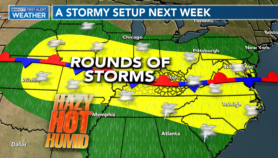
You can see this well on the EURO animation from Sunday night through Friday…

Some of the storms may be strong or severe and put down enough rain to cause flash flooding. Check out the Monday-Friday totals from the EURO…
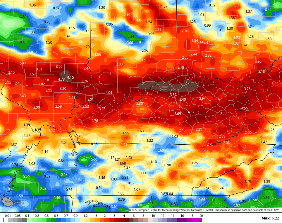
Exact placement and totals will, obviously, vary because of thunderstorms. But, the potential for flash flooding is there!
The models are hinting at that front pushing through later Friday with another front trying to show up as we close out July and begin August…

The GFS wants to bring some cooler air in for that first week of August…
We shall see about that. The GFS is pretty horrific with temps right now.
Have a sensational Saturday and take care.

I hope the rain occurs.
If not at least the overcast skies will keep temps down.
Yep – My house has no shade…I welcome clouds when it’s hot.
August and Sept around here can go either way….be really really dry and boring OR lots of rain/storms… I’ve noticed lots of tropical activity in the Atlantic can just pause all weather systems..
Despite the invasion of Saharan dust in the Tropical Atlantic and the Caribbean, NOAA is sill holding on to their prediction for above average Tropical development later in the season ?
I have’t any trees to shade my home either. The 2009 Ice Storm is responsible for that.
This Heat Wave across most of the country seems to get worse as we go forward towards Autumn. I am praying and hoping for that predicted rain next week ?
The longer this heat goes on, the more it becomes entrenched. “Heat Islands” that are normally restricted to urban areas are expanding, as dried out fields begin to act like macadam, and all of that hot air rising causes a “capped” condition, choking off condensation. We’re to the point now where a cold front won’t be sufficient to break the drought, especially in South-Central Kentucky. We need a tropical system to come through, but that comes with its own set of issues, most notably those tropical cloudbursts will be essentially hitting hard pan, raising the risk of flash flooding.
Seems like Murphy is working overtime!
I agree the drought will worsen. It’s been going on too long now and I now expect it to be part of our Autumn Season. In my local forecast the best chance for rain/ showers is Tuesday or Wednesday ?
Strong thunderstorms with torrential rainfall blasted through the Chicago area just after sunrise and continued for much of the morning. Numerous Severe Thunderstorm Warnings and flood advisories were issued and even a couple of Tornado Warnings went out for possible tornadoes in the SW Suburbs.
Very unusual for organized severe weather to develop so early in the day here, and there could be more tonight.
Mike, be glad your area escaped this awful heat and drought.
Don’t get me wrong it’s hot when it’s 94 , but the models forecast of extreme heat near or be at 100 that was forecast today won’t come close to that. I live here far western ky. and plus we been have a good breeze today that helps keep the humidity down from what they was forecasting. In my opinion July 15th has been the most miserable day so far this summer.