Good Thursday, folks. Major flash flooding continues across many areas of the state with more storms to come today. This will bring more heavy rain that can cause additional flash flooding for parts of the state. I’m also looking at another possible flash flood setup Sunday into Monday.
Let’s begin with today’s weather before we fast-forward to the weekend.
Life-threatening flash flooding starts the day in numerous counties of southeastern Kentucky. Rainfall of more than 6″ have been recorded in some spots. I don’t have the words to describe the destruction we will see in these areas. More storms are moving through today with torrential rains and additional flooding concerns.
A few of the storms may also be strong or locally severe. Once again, the Storm Prediction Center has us in a low-end risk for severe weather…

A cold front finally starts to push through here on Friday. It will continue to have rounds of showers and storms along and ahead of it with the southern half of the state back into the greatest risk for flash flooding.
There’s another low-end severe threat for parts of the region…

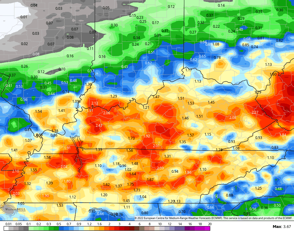
Rainfall totals today into Friday should average 1″-3″ for many with locally higher amounts. Here are the EURO numbers through Friday…
This front sags to our south and that sets up a decent Saturday. Temps are pleasant with a mix of sun and clouds hanging tough. There’s still the threat for a shower or storm in the far south as our front slows down and gets ready to return back to the north on Sunday. That brings more in the way of heavy rain producing showers and storms…
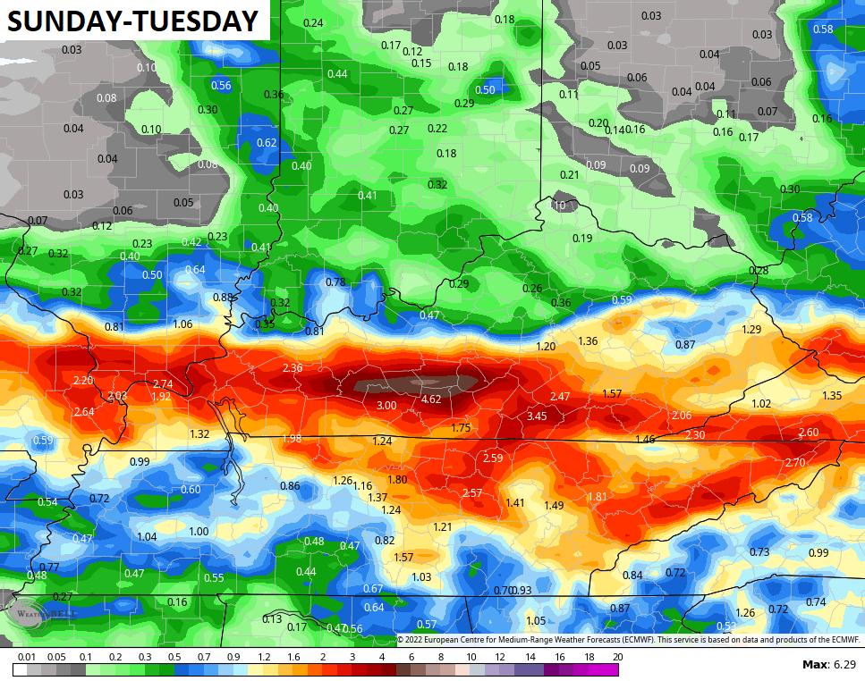
Check out the EURO rainfall totals from Sunday through Tuesday…
That could bring a renewed threat for flooding to the region.
More typical August weather then takes over by the end of next week.
As always, I leave you with your storm tracking tools…

Current watches

Possible Watch Areas

Make it a terrific Thursday and take care.

Prayers to all that are effected by the tremendous flooding and prayers to those that are still dealing with the drought especially those that Farm for a living. It seems like anymore these weather events are more severe in some areas and tame in other areas. It didn’t use to be this way if memory serves.
In the past 48 hours we have received over an inch of much needed rain which included loud thunder and vivid lightning. More rain is in my local forecast for today and part of tomorrow. I am praying and hoping for a more pleasant weekend for everyone.
This weeks rainfall has been dysfunctional.
What I mean is that some areas have had too much water and some other areas have not had barely a sip.