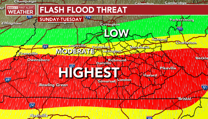
Good Friday, everyone. Devastating flooding hit the areas of the Commonwealth over the past few days and we are still on guard for additional flooding. That’s the case for today then again from Saturday night through Tuesday.
Folks, I’ve been studying Kentucky weather since I was a kid and as a professional for nearly 25 years and I’ve never seen anything like what happened to southeastern Kentucky this week. This was one of the worst flash flood events in Kentucky’s history.
The rainfall amounts from late Monday through Thursday morning were the highest I’ve personally witnessed in Kentucky…
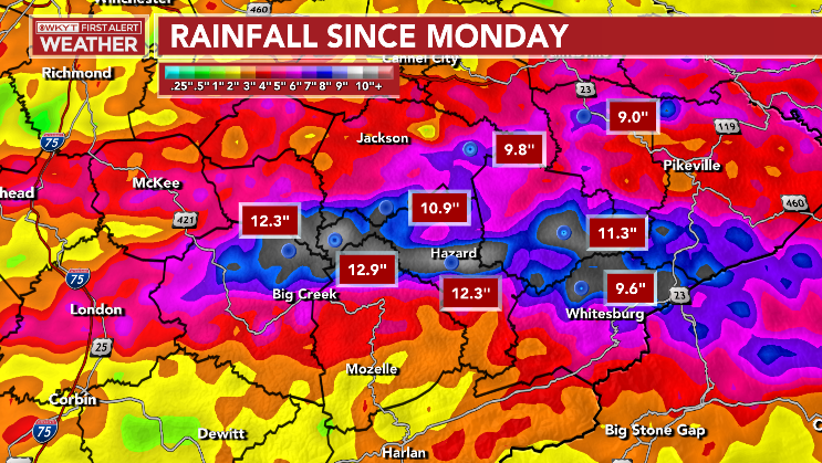
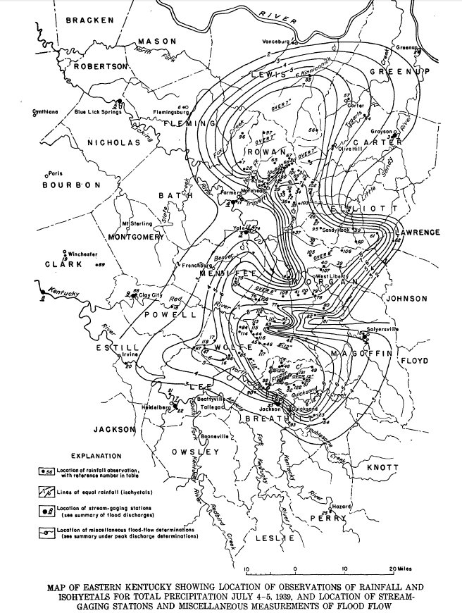
Much of that actually feel Wednesday night. Normally, you only get such a devastating flash flood on a local scale, but this was widespread over several counties. The only true comparison I can think of for this event was the “Frozen” flood of 1939. The name comes from a community in Breathitt County that experienced the worst of the flooding. 79 people died in this widespread flash flood that was centered farther north than this one. Check out the rain map from July 4th and 5th, 1939…
Again, very similar events that both happened in the late evening through overnight hours of a July night.
Additional showers and storms will rumble across the state today with the greatest threat for flash flooding across the south and southeast…
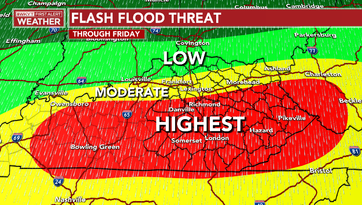
There’s also the potential for a few strong to severe storms in some of these same areas…

Our front slides to the south on Saturday, it takes much of the rain with it. I can’t rule out a few showers and storms still on the Kentucky and Virginia border counties.
That front lifts back to the north on Sunday, bringing showers and storms with it. Those rounds of showers and storms hang through early next week and will bring another flash flood threat to the area. Once again, the same areas appear to be most at risk…
I leave you with your full array of Friday storm tracking tools…

Current watches

Possible Watch Areas

Have a great Friday and take care.

Over the past 36 hours, my PWS near Bowling Green recorded 3.81″ of rain. 1.51″ fell yesterday afternoon and 2.30″ this evening. At one point this evening, the rain was falling at a rate of 3.5 inches per hour.
I am happy to see you finally received some needed rain.
We had about a weeks worth of rain since the event started.