Good Saturday, everyone. We are enjoying a much needed break from the rain today, but that’s not going to last long. Additional rounds of showers and storms move in later tonight and Sunday, bringing another flood and flash flood threat through early next week.
I will start with the good news because we really, REALLY, need it, and that’s today’s weather. Humidity levels are way down with highs generally in the low 80s for many. A mix of sun and clouds will be noted as a mainly dry sky takes over. There’s still the chance for a shower or storm across the far south or southeast. If it’s out there, it’s going to show up on your radars…

That front then lifts back to the north later tonight into Sunday as showers and storms return to the state. The boundary slows down on top of us with additional rounds of showers and storms through Monday and early Tuesday. That sets the stage for another flash flood threat. I continue to highlight the areas along and south of Interstate 64 for the greatest potential…
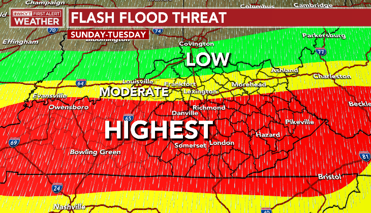
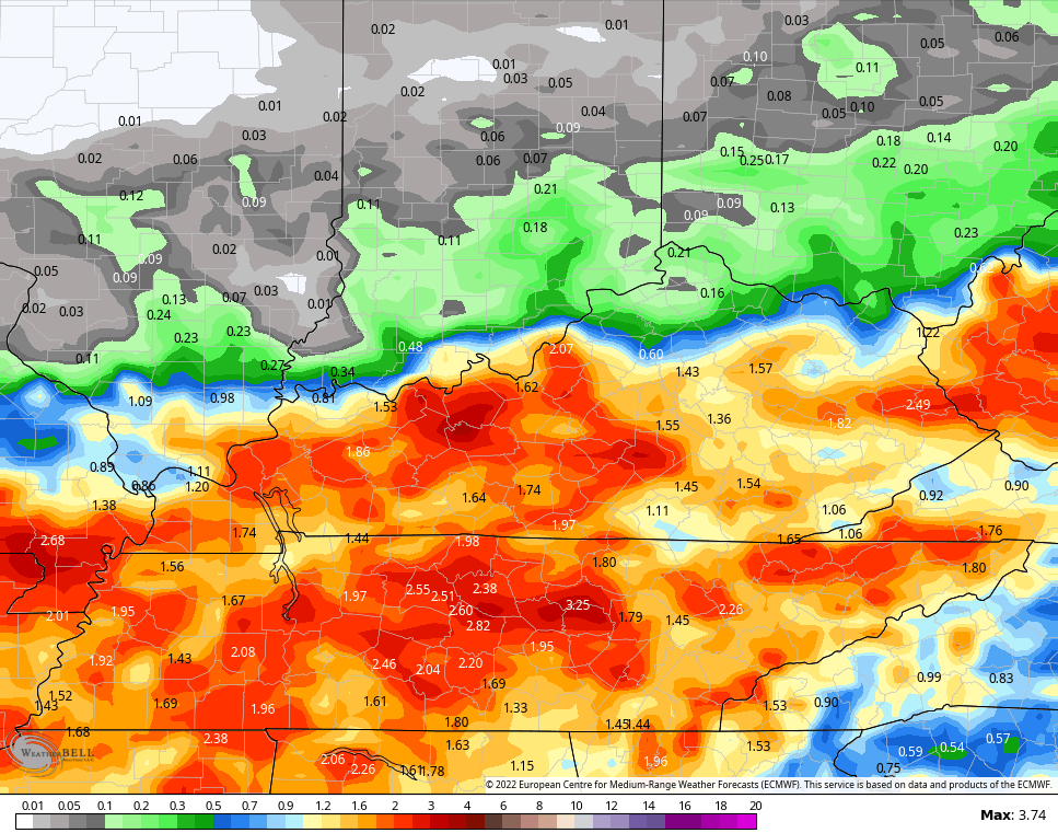
Another 1″-3″ of rain is possible for many, with locally higher amounts in thunderstorms. The EURO performed well with the flooding rains of the past week and it’s matching up well with my map…
Temps increase for the middle and end of next week, but the super wet ground is going to really tame that. It’s going to become VERY muggy and tropical feeling, instead. This may also spawn scattered storms with a greater storm threat by next weekend…
Have a great Saturday and take care.
