Good Monday, everyone. We continue to track the potential for strong to severe storms across the Commonwealth as we begin the month of August. This week can’t even compare to last week in terms of the amount of rain, but we are still tracking a pattern skewing above normal for rainfall.
Let’s begin with today then roll forward.
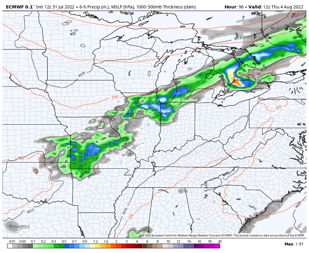
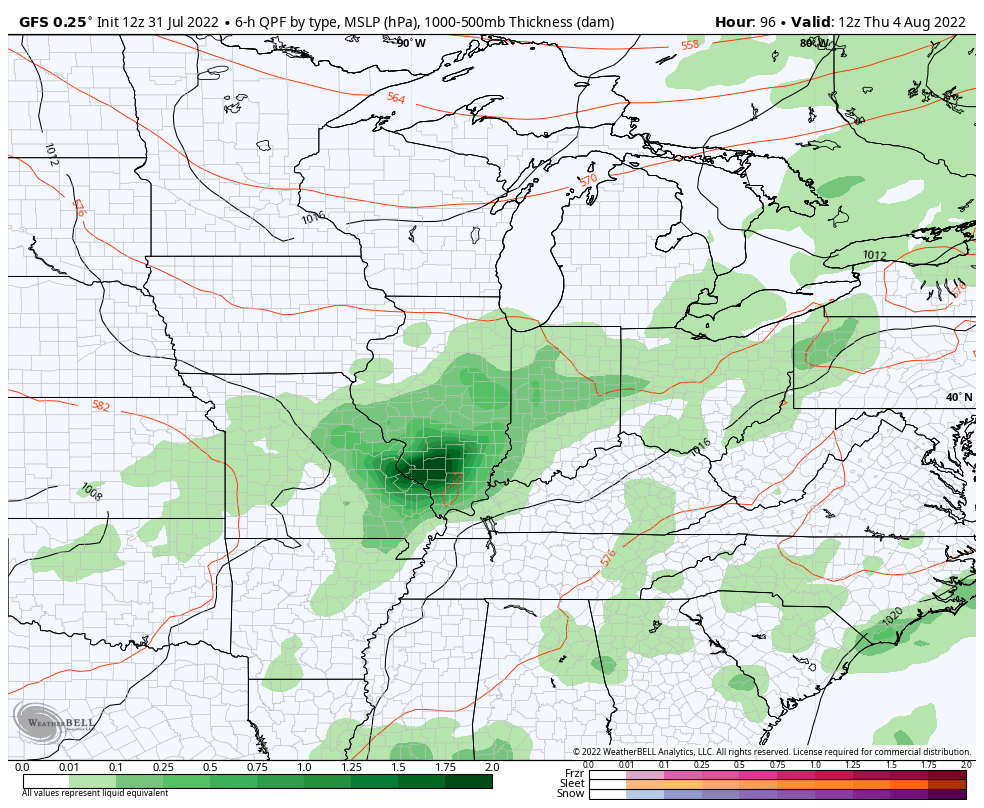
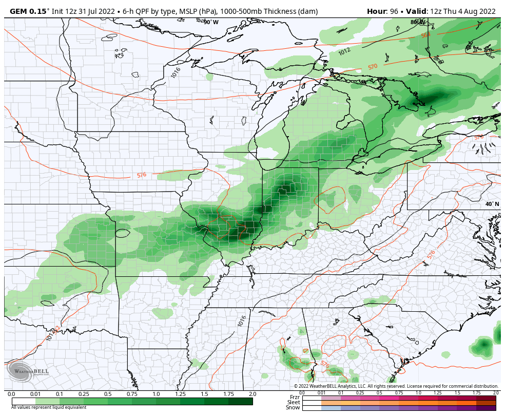
Scattered showers and storms will be noted during the day, but our focus turns toward a complex of storms developing and working in from the northwest late today. This may turn into a damaging wind maker for some and the Storm Prediction Center has the area outlined in a Marginal to Slight risk for severe weather…

We will also have to keep a close eye on these storms as they can put down a lot of rain in a short amount of time. Needless to say, much of our region can’t hold another drop so the local flash flood threat continues.
We will also need to watch later tonight into Tuesday for some additional clusters of storms to rumble across western and parts of central Kentucky. There’s a chance for some storms to train from northwest to southeast somewhere in these areas.
Wednesday looks like a steam bath of a day with temps in the west reaching 90-95. The wet ground across the rest of the state will hold temps down, but that humidity will be off the charts.
The threat for thunderstorms will then return starting later Thursday and this takes us into the upcoming weekend…
EURO
GFS
CANADIAN
Looking farther down the weather road, we are seeing signs of a different overall pattern shaping up across the country. The August 9-16 average 500mb heights show a trough trying to set up across the east…
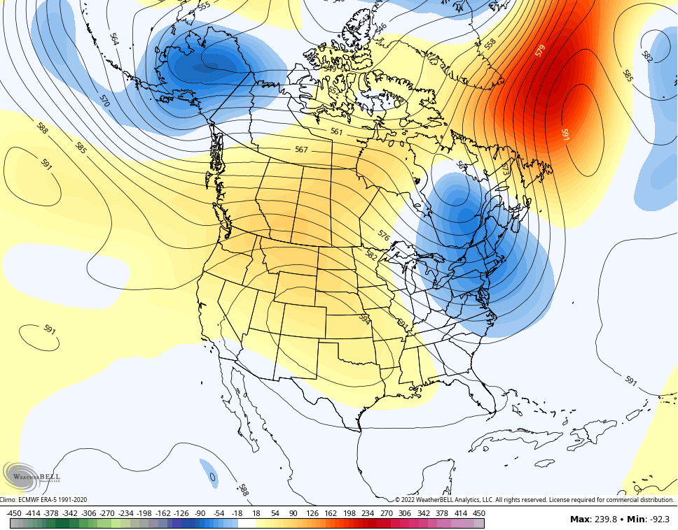
Below normal temps show up with that setup…

We shall see.
I will drop by with any updates as needed later today and have the very latest on WKYT-TV starting at 4pm. As always, I leave you with your storm tracking tools…

Current watches

Possible Watch Areas

Have a great Monday and take care.

One more humidified month to go, before more pleasant weather returns.