Good Tuesday, folks. Rounds of strong to severe storms continue to rumble across the state today, bringing the potential for more high water issues for some. In the overall scheme of things, we are locked into a wetter than normal pattern for the next few weeks, at least.
Clusters of strong to severe storms are working across the state today from northwest to southeast. Damaging winds will be likely with these clusters of storms and the SPC continues with the threat through the area…

The flood and flash flood threat continues and I’m concerned that some training of storms may show up across the state. Exactly where that sets up is still in question, but it could bring a flash flood threat to areas outside of the devastated areas. We never wish ill will on anyone, but we want these storms to stay away from the southeast at all cost.
Wednesday is a steamy day with just isolated showers or storms around. Heat index values will be up there, especially in the west.
The threat for renewed flash flooding will be with us later Thursday through the upcoming weekend as more storms fire up. These storms will have ample amounts of moisture to work with…

From there, we find a cold front trying to work in here early next week. That will also fire up storms…

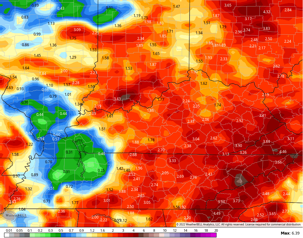
The models are spitting out some hefty totals over the next week or so…
EURO

GFS
Nothing good can come from this setup, folks.
I will drop by with any updates as needed later today and have the very latest on WKYT-TV starting at 4pm. As always, I leave you with your storm tracking tools…

Current watches

Possible Watch Areas

Have a great Tuesday and take care.

The state of Alaska as well as the Gulf of Alaska is recording well below normal temperature readings. Until this changes we will continue to have the weather we have been experiencing the last three years.
At this time we can only pray and hope that these hit and miss rain events cease and we return to our usual late Summer weather pattern which is drier with normal temperatures.
Since the Flood occurred in Southeast Kentucky, I’ve tune into Chris’s twitter feed, and I must say it has upset me to no end. The photos of destruction were unreal and decided not to look anymore. I just pray and hope these wonderful people of Southeast Kentucky are receiving the care and love we need to give them.
MAY GOD BLESS TO ALL.
Thank you for what you do. I live in Benton, Kentucky and you are my go-to guy for weather. =)