Good Wednesday, folks. High humidity is leading to a super stuffy day across the Commonwealth as we get set for another stormy setup. Clusters of storms kick back in later Thursday and hang tough through the weekend, potentially bringing more issues to the region.
Temps today are upper 80s to near 90 for most of central and eastern Kentucky, but the humidity makes it feel 95-100. The numbers in western Kentucky will be higher, of course.
There’s the small chance for a stray shower or storm to go up. Your radars are once again on duty…

Rounds of showers and storms will then kick back in later Thursday as we go back into a wet pattern. This is likely to stay with us through the weekend and into the first half of next week, and is likely to cause more high water concerns.
Watch how the EURO shows these rounds of storms…

The EURO did very well with the recent historic rain event setup so we have to give it the respect it’s earned. Here’s what it’s showing over the next week and change…
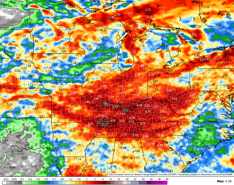
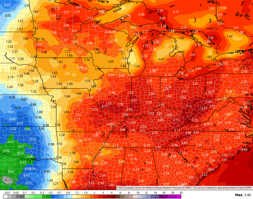
That’s backed up by the average of the 51 member EURO Ensembles…
The control run of the EURO Ensembles…
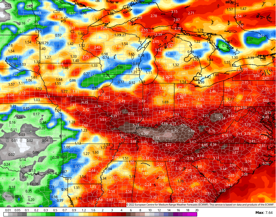
This isn’t a good setup at all and one we really need to keep a close eye on.
Have a good Wednesday and take care.

Thanks Chris, We really need to ” break out ” of this current Weather Pattern but, La Nina says different.
I hope there are some changes soon.
Tropical Pacific remains the same and Tropical Atlantic remains inactive.
I hope the tropics remained tame.
We only have one more month of heat & humidity.
Rain is no longer a problem.
So I am find with the weather pattern, there is no need to change the dynamics. We don’t need more massive destruction in the country.
Schroeder, i have read that the pattern maybe coming later next weekend we shall see.
patter change that is. sorry