Good Thursday, folks. We continue to track an increase in showers and storms out there today. This action may be on the strong side as we kick off another stormy setup that can bring heavy rainfall back into the Bluegrass State.
Let’s begin with today and roll forward. A cold front drops toward the region from the northwest and slows down. Yes, that’s a familiar setup that can get us into s0me trouble again.
A few rounds of showers and storms go up out there today and a few could be on the strong or severe side. This doesn’t look widespread, but the Storm Prediction Center has our region in a low-end risk for a few severe storms with damaging winds…

Additional waves of showers and storms kick in for Friday and Saturday, producing heavy rain that can cause local flash flooding issues.
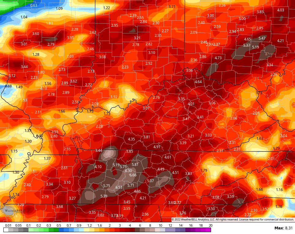
This continues through the weekend and into early next week. That’s when another front drops in and tries to push our heavy rain corridor farther south. The models are still trying to get a grasp on the rainfall totals for the next week. The GFS and EURO traded places with the GFS now having the higher totals…
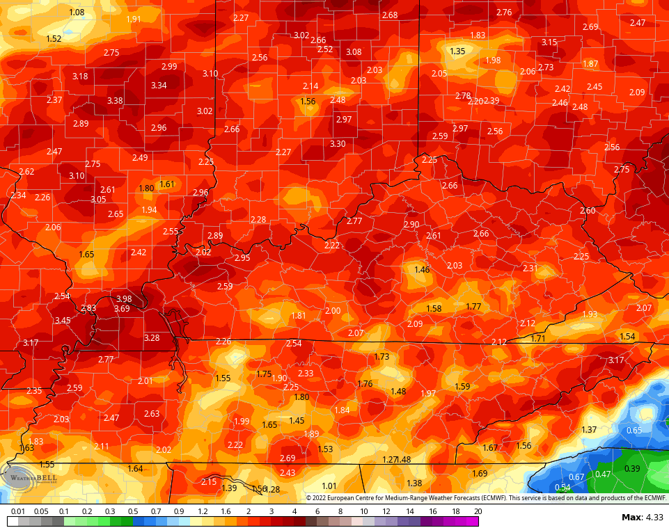
Here’s the EURO…
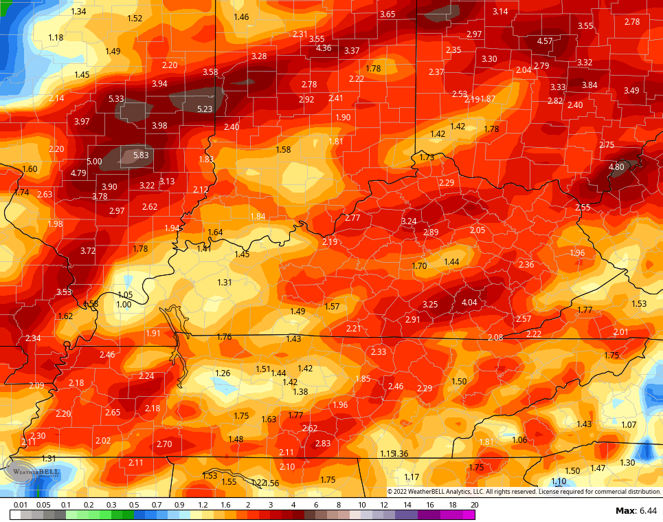
For what it’s worth, here’s the Canadian…
Looking longer range, the EURO Weeklies continue the above normal rainfall look through the middle of Sepetmber…
The control run of the EURO Ensembles is even wetter…

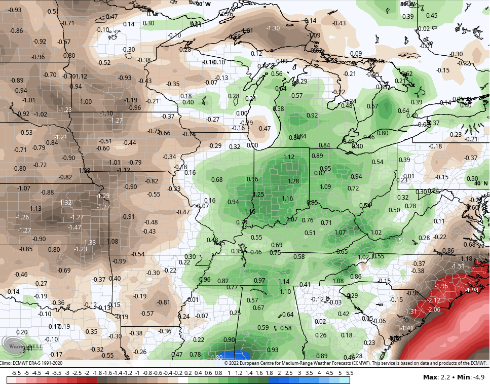
The temp trend is very close to normal across Kentucky with the core of the heat back to the west and north of us…

As always, I leave you with your storm tracking tools…

Current watches

Possible Watch Areas

Have a great Thursday and take care.

Those various weather models presented this morning with the predicted rainfall totals may turn out correct but, let’s HOPE NOT !!!
A little too early to predict how our Autumn may turn out ? Right now, it’s just a wish and a hope for drier, cooler and maybe frosty weather with lots of colorful foliage ?
Those strong storms can just rumble their way out or better yet not form at all !!!
Only one more month of extreme humidity to go.
Glass is half full.
Test