Good evening, folks. I wanted to drop by for an update on the strong storms rolling in here later Tuesday and Tuesday night. We don’t really want the strong side of the storms, but we do need the rain and many get a nice drink of water.
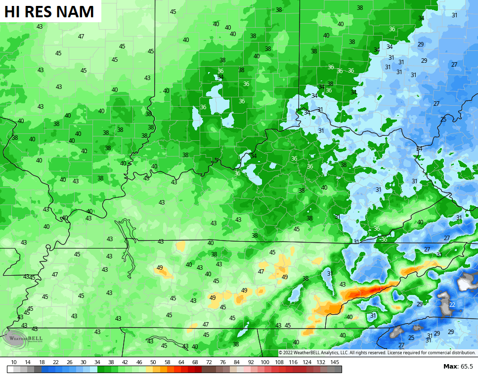
Showers and storms move in from southwest to northeast as low pressure works through the region. This future radar from the Hi Res NAM starts Tuesday morning and goes through Wednesday morning…

The chance is there for some of the storms to go severe and the Storm Prediction Center has much of the state in the low-end risk…

Damaging wind will be the primary threat for storms that go up. With our without storms, winds are a player through Tuesday night. Check out the peak wind gusts from the models…


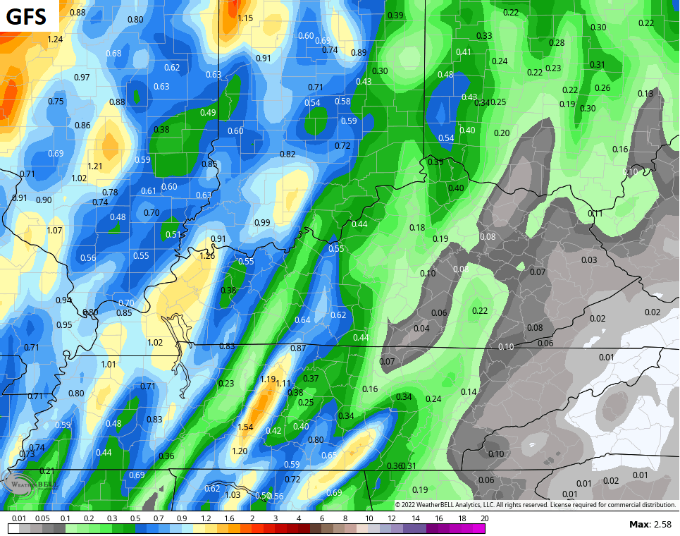
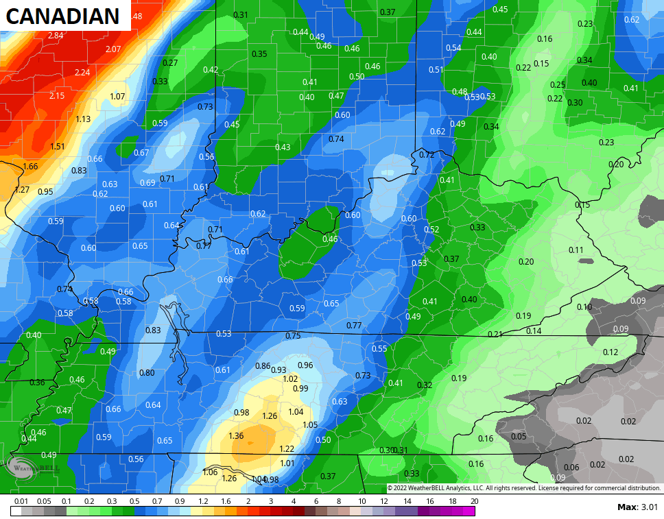
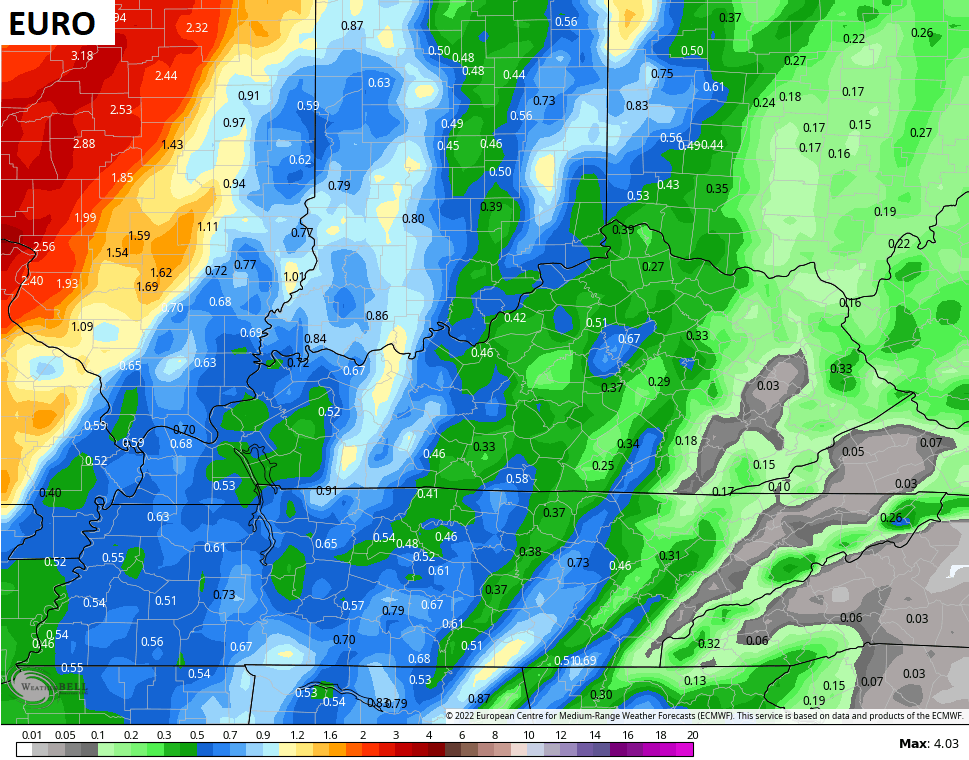
Rainfall totals will vary widely from place to place, but areas of western and central Kentucky look to pick up on the highest totals…


The Halloween Weekend system continues to look fairly stout with wind, rain and a few storms…

Another deep trough looks to make a run at us later next week into the following weekend…
GFS

EURO

I look at that and wonder if that’s a situation where you have severe weather ahead of it and some winter behind it. Hmmm.
Enjoy the rest of the day and take care.

Appears that I am forecast to pickup a little more than a1/2”. I will take it.
It’s looking like the GFS (ducks) is picking up on a tropical system over Cuba to close out the month too…