Good Tuesday, everyone. It’s Election Day in America so don’t forget to get out and vote. As far as the weather is concerned, it’s nice and will stay nice for the next few days. Once into the weekend, a major pattern takes us into a wintertime looking and feeling setup.
Temps today range from the upper 50s northeast to the upper 60s southwest. A mix of sun and clouds will be noted.
Highs reach 70-75 degrees for both Wednesday and Thursday and you should enjoy it because of the temp plunge by the weekend.
To make things even more extreme, we are likely to have Hurricane Nicole moving into Florida Wednesday night. This system is a tropical storm right now, but you can see how it’s starting to develop more…

Here’s the latest intensity and track forecast from the National Hurricane Center…

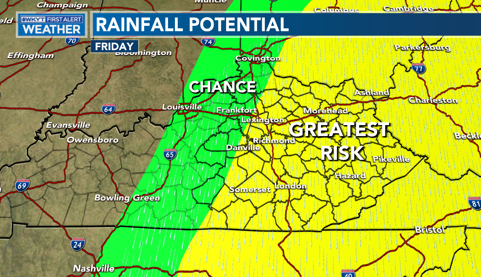
The turn to the north and northeast comes as a strong cold front works through here on Friday and moves that system along. Offshoot moisture is likely to surge out ahead of this and into areas of central and eastern Kentucky Thursday night and Friday. That brings an increasing chance for decent rains. Here’s the area I’m currently highlighting for the best rain potential…
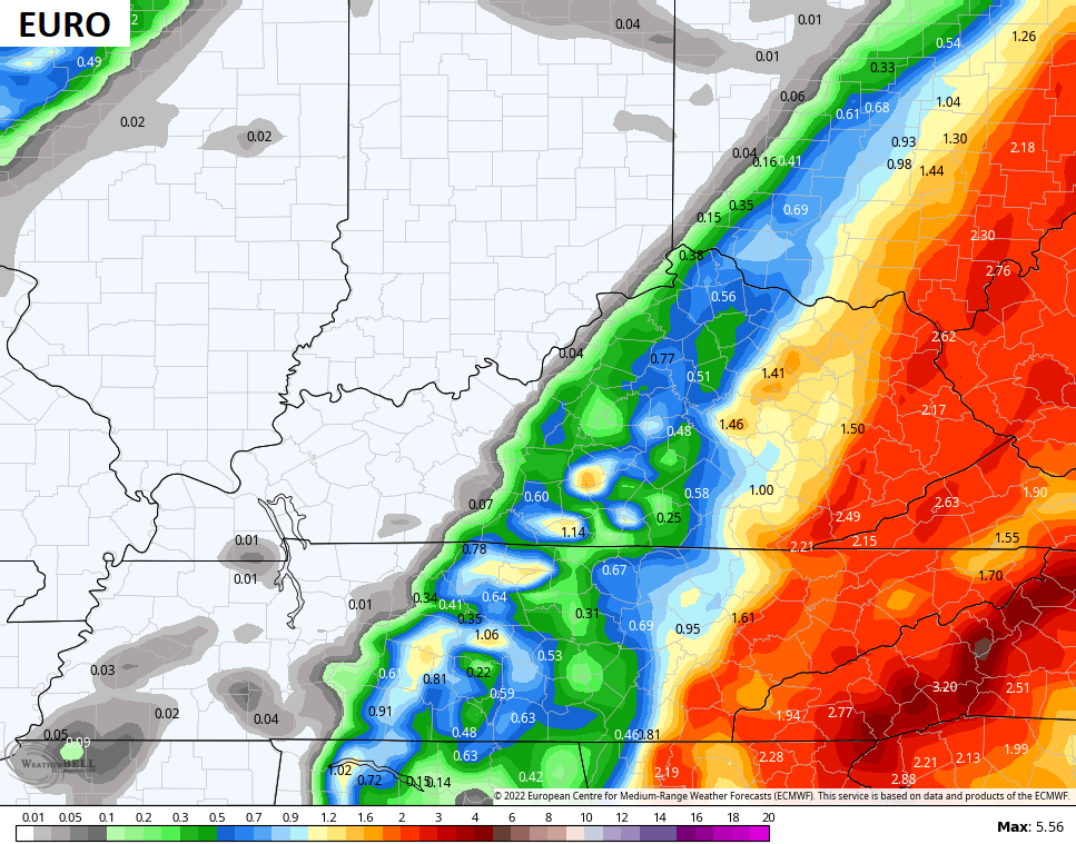
There’s a chance that gets expanded farther west as we get closer. I don’t think too many folks would complain because we need the rain. Here’s what the models are seeing in terms of rain from this setup and the totals are really increasing…
![]()
![]()
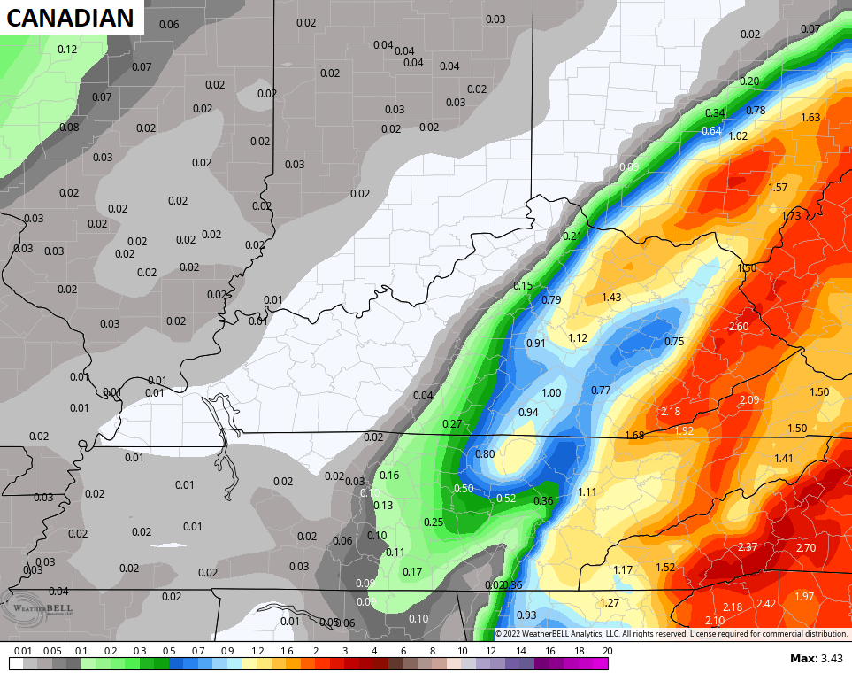

The GFS went from having zero rain to throwing down more than 3″. Why the change? The model has an east bias with storm systems across the eastern part of the country. The model will almost always trend west and it will likely come farther west in time.
The comes the cold… And it’s really cold!
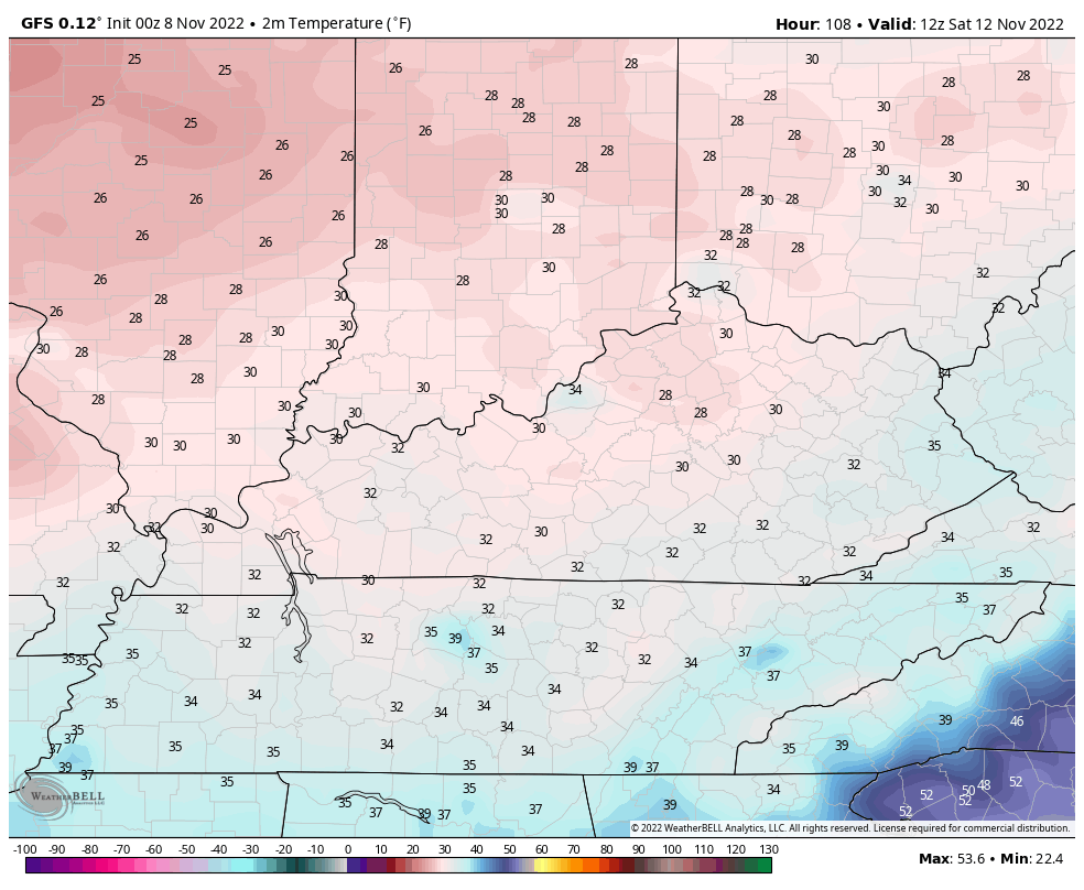
This will be followed up by another deep trough diving in here next week…

That may produce even colder air. Any flake potential will be handled on a system by system basis, but there’s definitely a few chances in there!
I will have another update later today. Make it a good one and take care.

keep a grinding bailey boy..
I’m on Team 540!!!
Here is the link for the summary of Saturday’s high wind event across the Chicago Metro area that caused scattered damage. Wind gusts were clocked between 55-75 MPH. There was even a brief EF-0 tornado that hit the far Western suburbs when the front moved through.
https://weather.gov/lot/20221105_HighWinds