Good evening, folks. As we get set to wrap up our Election Day, it’s all eyes on a wild setup across the country with a near blizzard in the high plains and a hurricane hitting Florida. Rain from that system is likely to impact our weather before temps tank.
Let’s take a look at Tropical Storm Nicole as this storm is getting its act together…

This will become a hurricane as it heads into Florida and then turns to the north and northeast, likely riding up the eastern slopes of the Appalachian Mountains. Here’s the officical track from the National Hurricane Center…

It’s good to see the NHC adjusting the inland track farther west. They were holding on to that eastern solution without any kind of model support.
This kind of track will bring rain into central and eastern Kentucky with an increasing potential for heavy rain. A corridor of 1″-3″ of rain is possible in the east. Here’s my updated map…
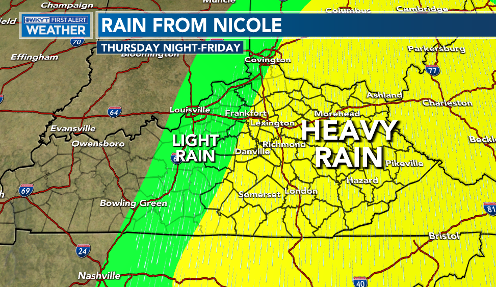
There’s going to be a fine line on the western cutoff to the rain shield and I think that can get as far west as Interstate 65.
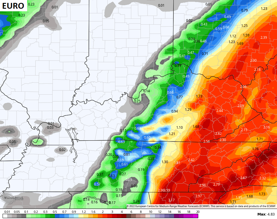
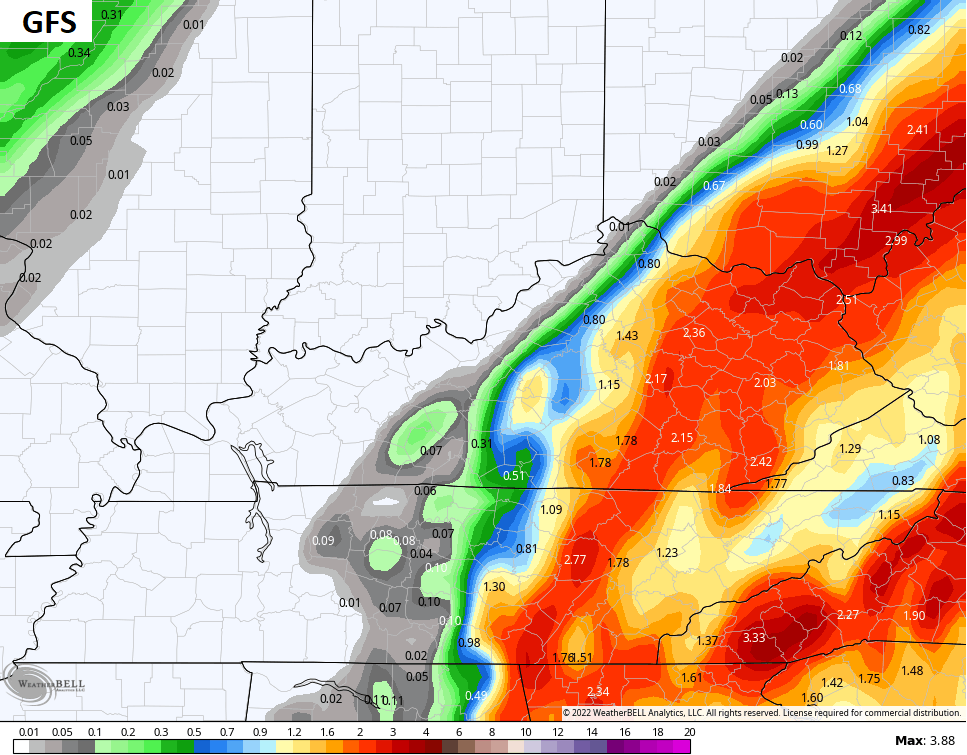
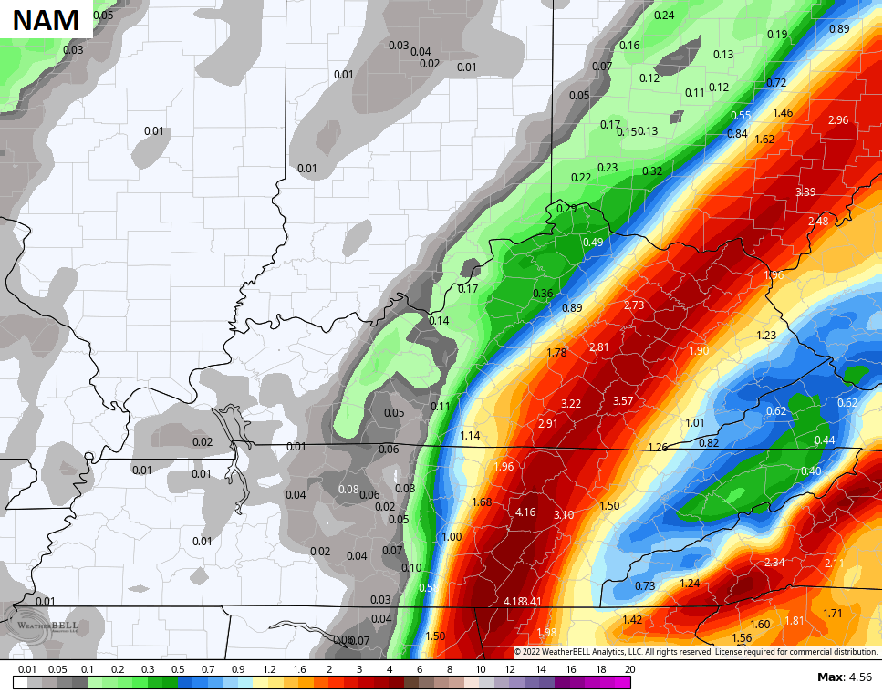
Take a look at the current rain numbers from the forecast models…
![]()
![]()
Much colder air then sweeps in here behind this system for the weekend. Highs over the weekend will range from the upper 30s to middle 40s but winds will make it feel even colder. Lows by Sunday morning will drop into the upper teens and low 20s and may do it again for Monday morning.
From there, we watch colder shots coming in for the rest of next week. Can we get these to be accompanied by some winter weather? That’s a possibility. You can see the chance showing up on the EURO…

GFS

These cold shots will likely keep coming at us into Thanksgiving week.
I’ll see you kids later tonight for a full update. Have a good one and take care.
