Good afternoon, folks. Heavy rain continues to push across the region on this Veterans Day. From here, the focus is on the increasing potential for a slushy, light snowfall for parts of the state on Saturday.
Let’s start with the rain that’s out there because it’s bringing a nice drink of water in here. Many areas of central and eastern Kentucky pick up 1″-2″ of rain with locally higher amounts possible.
The rain shield begins to work eastward through the evening, with the heavy rain pulling away. That may leave some misty showers going into the evening. Here are your radars to follow along…

The next system quickly zips in from southwest to northeast later tonight and Saturday. This low pressure is riding along a cold front that has wintertime air coming in behind it and this will lead to a quick-hitting band of light to moderate snow. A few flurries and snow showers will then drop in behind this from the northwest by this evening.
You can see all this playing out on the future radar from the HRRR…

Here’s a look at our first First Call For Snowfall of the season…
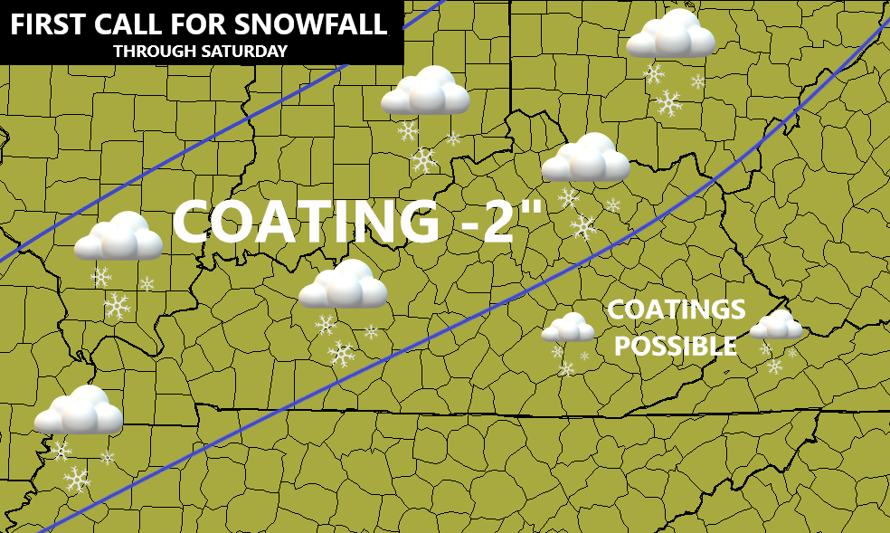
Again, that’s mainly on grassy and elevated surfaces. A few spots could even see slush briefly accumulate on roads as snowfall rates overcome mild ground temps.
Here’s a look at the latest snowfall forecasts from the models…


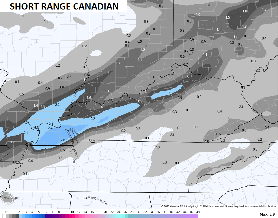
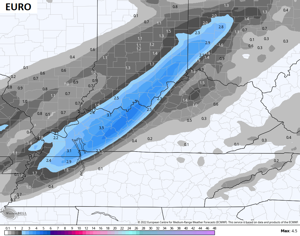
As you can see, there’s still some disagreement on the placement of the band of snow. The stuff you see across the southeast would mainly be from northwest winds creating some snow showers and flurries Saturday night.
Cold winds blow Sunday into Monday as we await the arrival of the next system for Tuesday and Wednesday. This will bring rain and snow our way. If the track is right, I can’t rule out the chance for another snowfall.
Another update or two will come your way later today as I have a rare day off from WKYT.
Enjoy the rest of the afternoon and take care.

bailey do the push the winter weather dance to future.