Good eveninf, folks. It’s been a super soaker of a day across central and eastern Kentucky, and that’s just what the weather doctor ordered. Now comes the winter part of the program with a light snow maker coming in here for Saturday.
The steady rain is moving out of the state this evening with a little leftover drizzle or showers lingering. Here are your radars to watch this stuff push away…

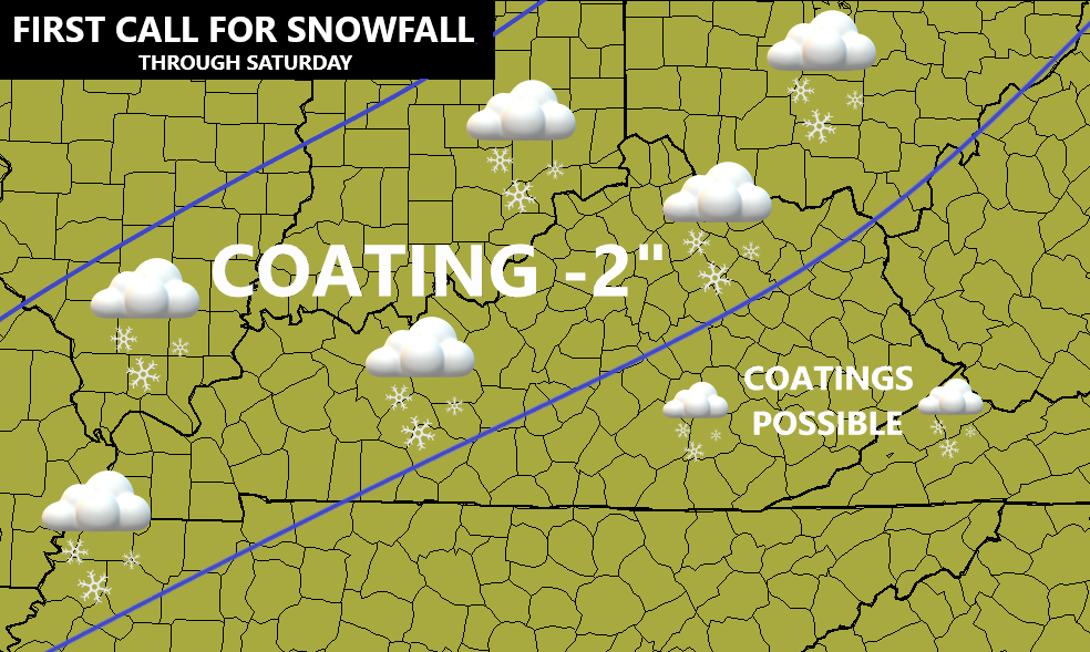
I’ve made no changes to my snowfall map from earlier…
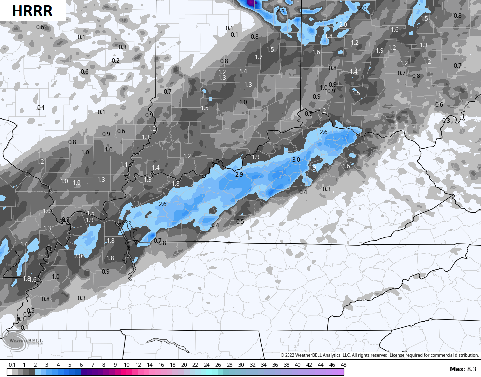
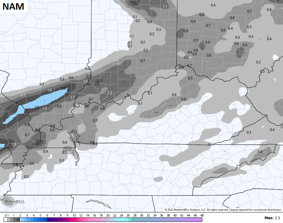
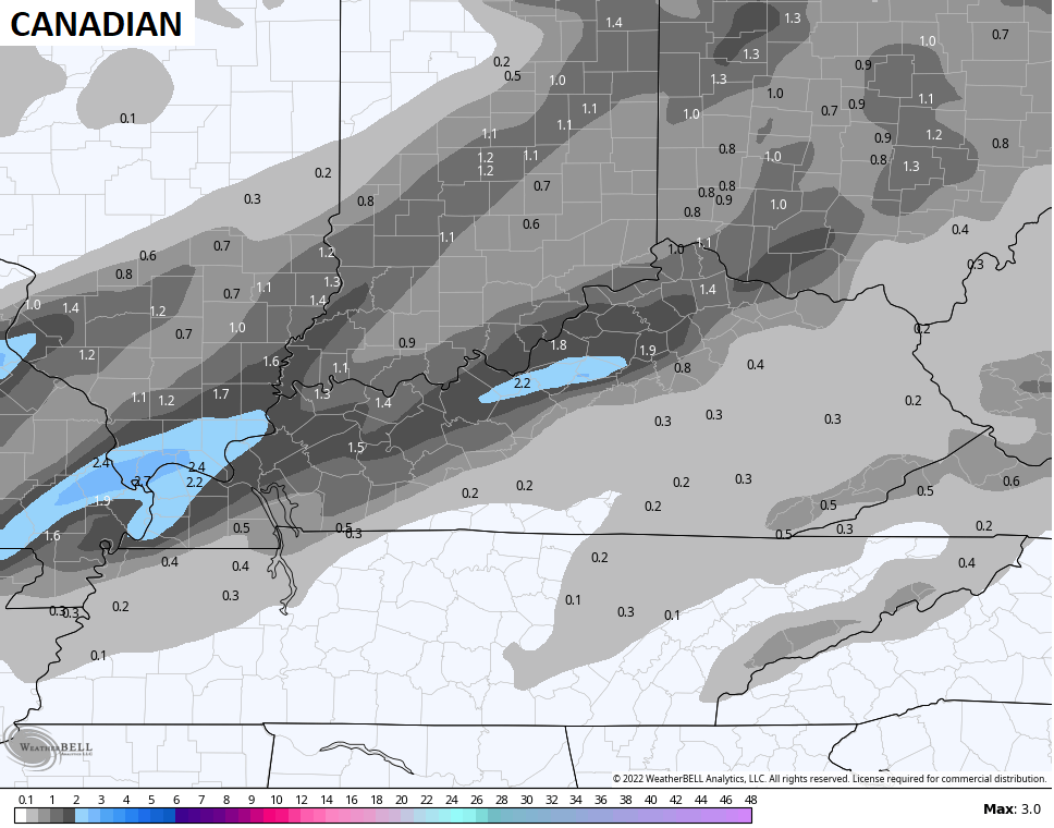
The models are still showing a few differences, but they have the overall trend right…

This is the kind of setup that can bring a few hours of moderate snow in a southwest to northeast corridor. Those snowfall rates would overcome the mild ground to produce the slushy snowfall, especially on grass and elevated surfaces.
Leftover snow showers and flurries then carry us into Saturday night and Sunday morning.
I’m also watching the Tuesday through Thursday time period for more winter weather!
I will get into that with the main update later tonight. Enjoy the rest of your Friday and take care.
