Good evening, folks. It’s a busy day for your friendly weatherdude, but you know I can’t stay away from you guys. I’m dropping by for a very quick update on the pattern for the weekend and into Thanksgiving week.
Another cold front sweeps in here late tonight and Friday morning. That has the chance to produce a brief period of light snow and flurries. The future radar from the HRRR is hitting the northern half of the state with the best chance…

That unleashes very windy and cold temps for the weekend. Yes, even colder than what we’ve had already this week. Check out the wind chill forecast from 7pm Friday through 7am Saturday…

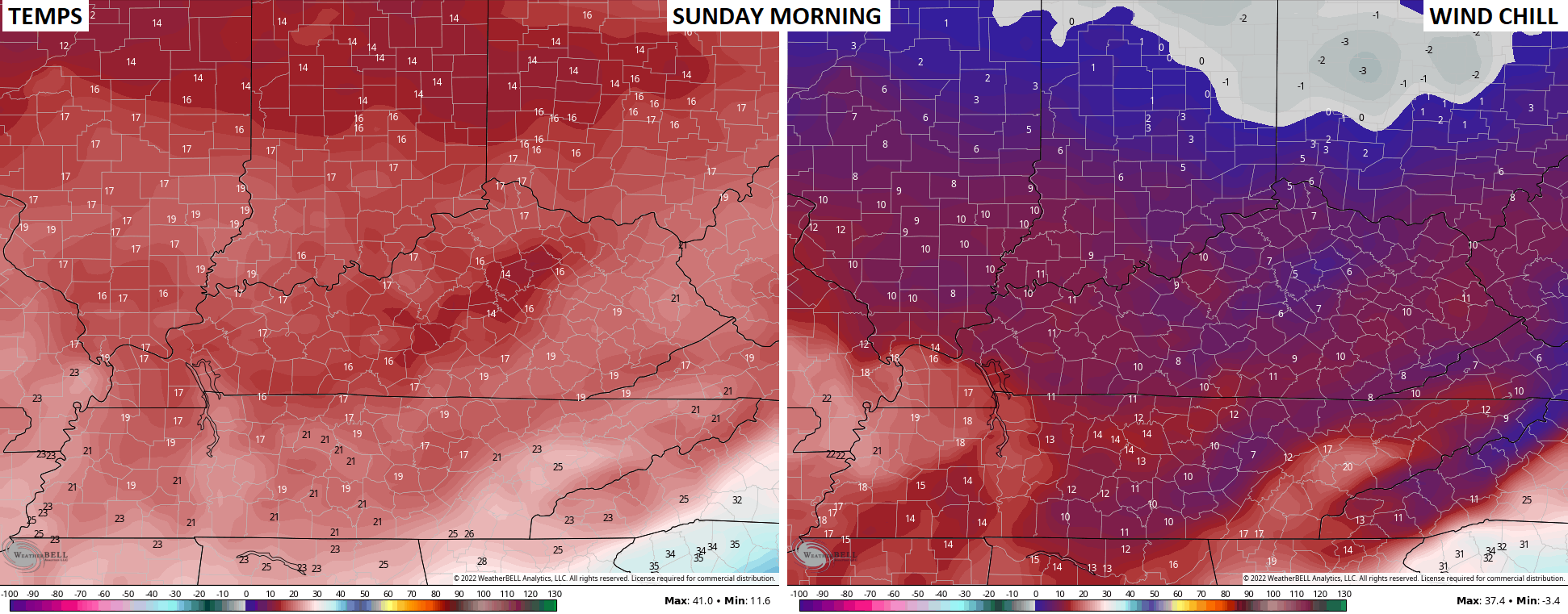
Sunday morning temps and wind chills look even colder…
That’s gonna leave a mark!
I have no changes on my thoughts for Thanksgiving weekend, but I do want to show how model biases are coming into full play. The bias of the EURO is to hold too much energy in the southwestern part of the state instead of ejecting it eastward.
The latest model run is doing just that…

See that big bowling ball taking the route deep into Mexico?
You don’t see that on the EURO Ensembles…

You also don’t see that on the Control run of the EURO Ensembles…

The latest GFS goes strongly against the EURO…

That produces a wound up storm system…

Again, we are several days away from the models coming to grips with the overall setup, so sit tight.
So much for a quick post.
Enjoy the evening and take care.

Excellent job on your long range presentation for Winter Chris. I thank you and appreciate all your hard work. Looks like a lot of opportunities for several decent Snows in your area of the state. Even a bold prediction for a blizzard.