Good evening and Happy Thanksgiving, again. Scattered showers continue to push eastward across the state as we start to focus more on that potent late weekend storm system. This one kicks off a very active pattern as we close November and roll into December.
The showers that are out there this evening are scattered and rolling to the east. This will pick up the pace a little bit later tonight into very early Friday. Here are your radars…

Some sun shows up late Friday and that continues into Saturday as temps come down from today’s numbers.
Our next system brings rain and high winds in here Saturday night and Sunday. Wind gusts may cause issues for parts of the region as they hit 40mph or higher. The NAM has some gusts over 50mph…
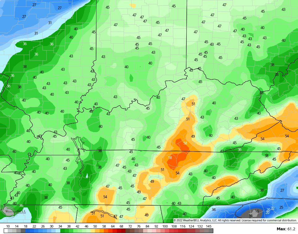
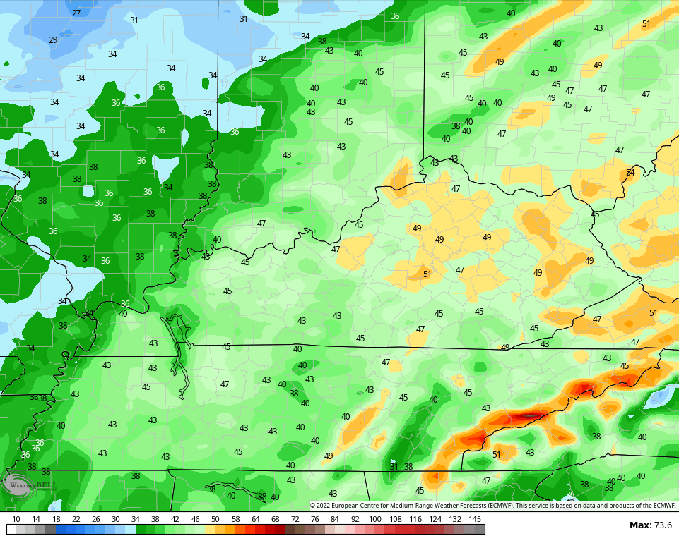
The Euro pushes 50…
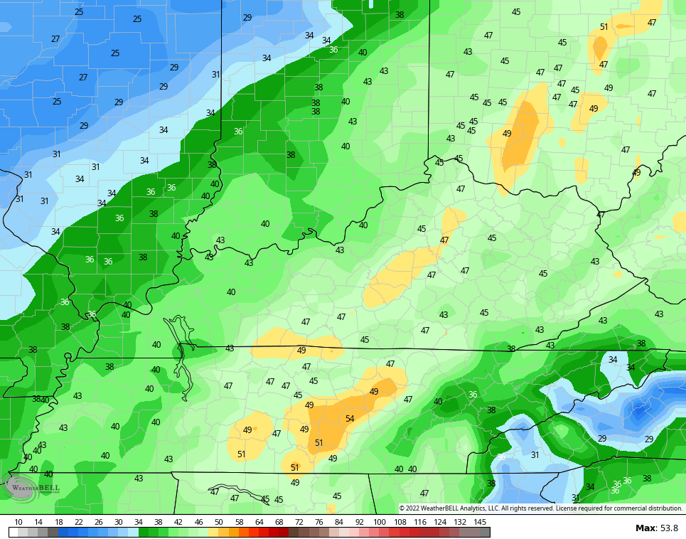
So does the GFS…
The next system then rolls in here by Tuesday night and Wednesday and is another potent one to close out November…

The threat for some strong storms is with us ahead of that front and the EURO shows the lightning potential…
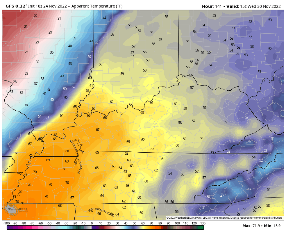
 That’s a pretty wild Wednesday taking shape as we go from mild weather and thunderstorms to crashing temps and the chance for some flakes.
Look at this “feels like” drop on the animation that goes from 10am Wednesday through 1am Thursday..
Enjoy the rest of your Thanksgiving and take care.

Best movie ever! Guess we can be friends now.
Thanks Chris for watching our weather your work is never done.I use to work some of those holidays myself. Hope everyone had a nice Thanksgiving.