Good Friday, folks. It’s the official start to the Christmas and holiday shopping season and we have some changes on the way. Better weather blows in later today, but the focus is on that big storm system rolling in for Saturday night and Sunday. Winds are gonna be a problem.
Let’s begin with our Black Friday forecast. We start the day out with low clouds, a few showers and just overall yucky weather for many. By the afternoon, skies clear from north to south as chilly winds blow back in.
Here are your radars to follow today’s showers out of the state…

Saturday is a dry day with a mix of sun and clouds. Temps reach the middle 50s to low 60s as we wait on our big storm system. This bad boy spins through the region Saturday night and Sunday, bringing widespread showers and even some thunder. Much colder winds come in behind this late Sunday and Monday with lingering showers…

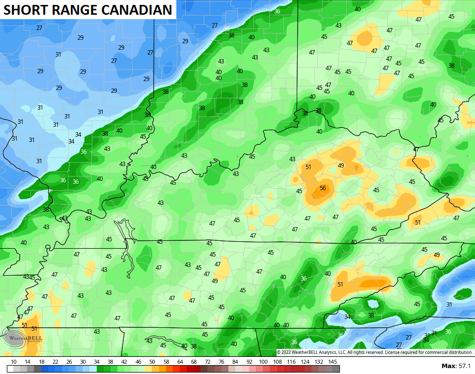
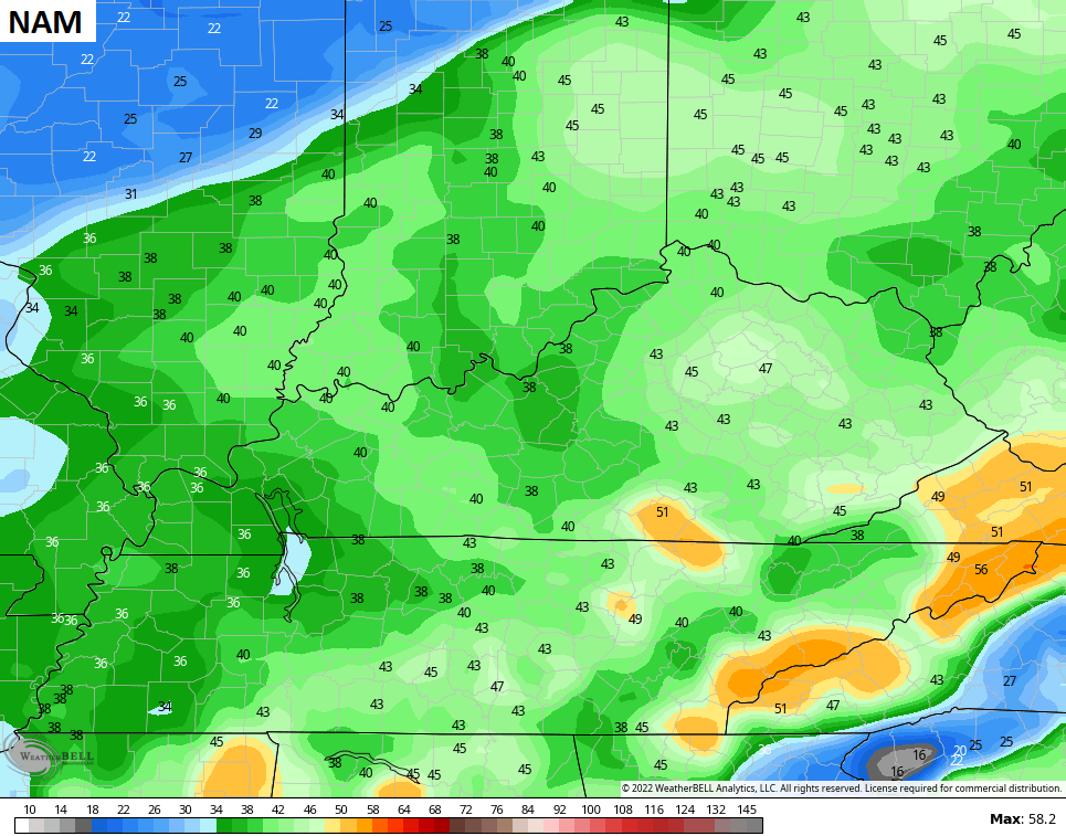
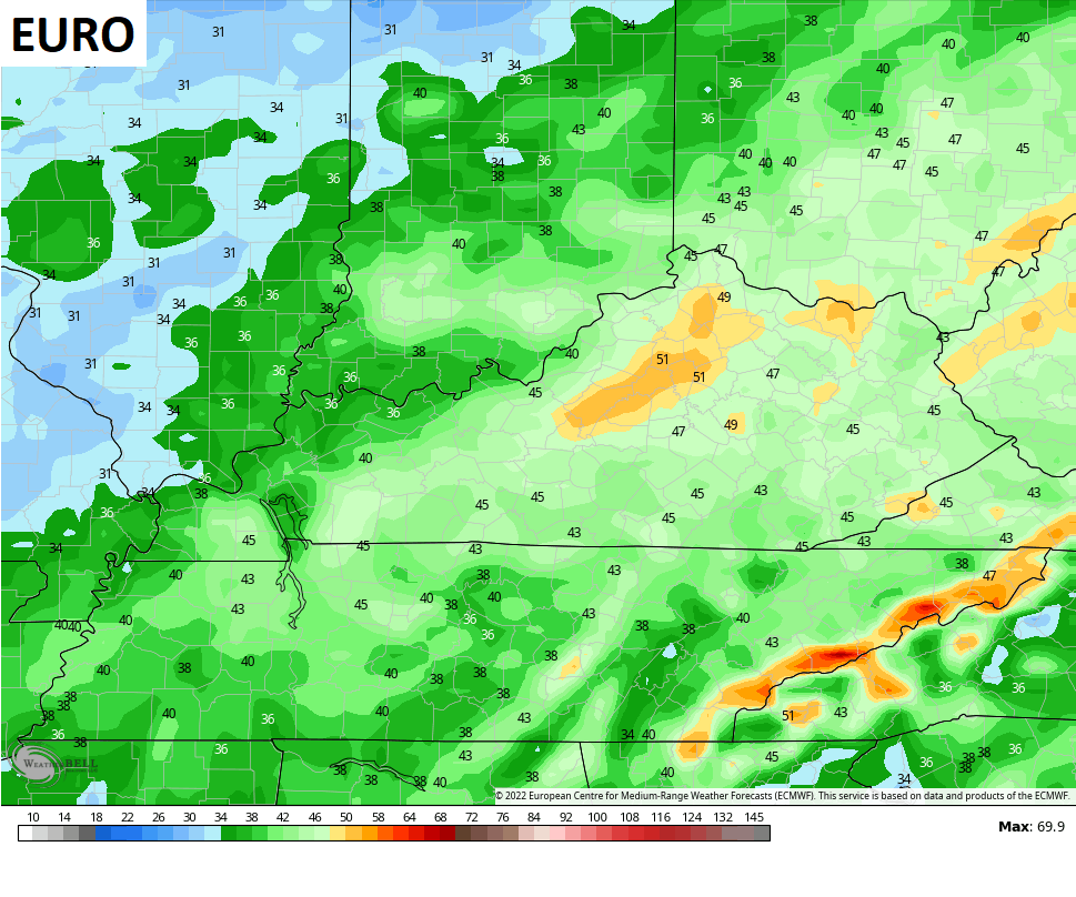
Winds are a MAJOR player with this system and those gusts may reach more than 40mph and may even reach 50mph in some spots. Check out those wind gusts from the models…

The next system coming in for late Tuesday and Wednesday continues to feature a big temp spike ahead of it and a big temp crash behind it. Temps go from the 60s to the 20s in under 24 hours.
We are starting to see the models showing the colder air pressing with this system and that’s something I’ve been alluding to a lot lately. That lessens the overall strong storm threat as it means a less wound up storm system, but stronger push of cold behind it…

There should be another temp spike and drop with another storm system before we really see the cold starting to press. Many of the Ensembles are pointing toward this…

I will have your normal updates later today. Make it a good one and take care.

get up kentucky!!!!! its 2am
Winds will only aggravate the drought situation, but this will have to happen to promote the change. We are ending this year on a very dry note, and we need the rains and snows to keep the wildfire potential down.
wow the last system that just moved through was pitiful in terms of rain…0.01 inch.. it really was the least that it could do.
We received 0.00 ” of rainfall in the past 48 hours. Appears now that the best chance is Saturday night. Hope it pans out ?