Good afternoon, everybody. Our showers have moved away as chillier air slides in from the north. This is ahead of a potent storm system rolling in late Saturday and Sunday, and it’s one that’s going to bring some big winds in here.
Chillier winds are blowing this afternoon and through early Saturday, but it’s nothing out of the ordinary.
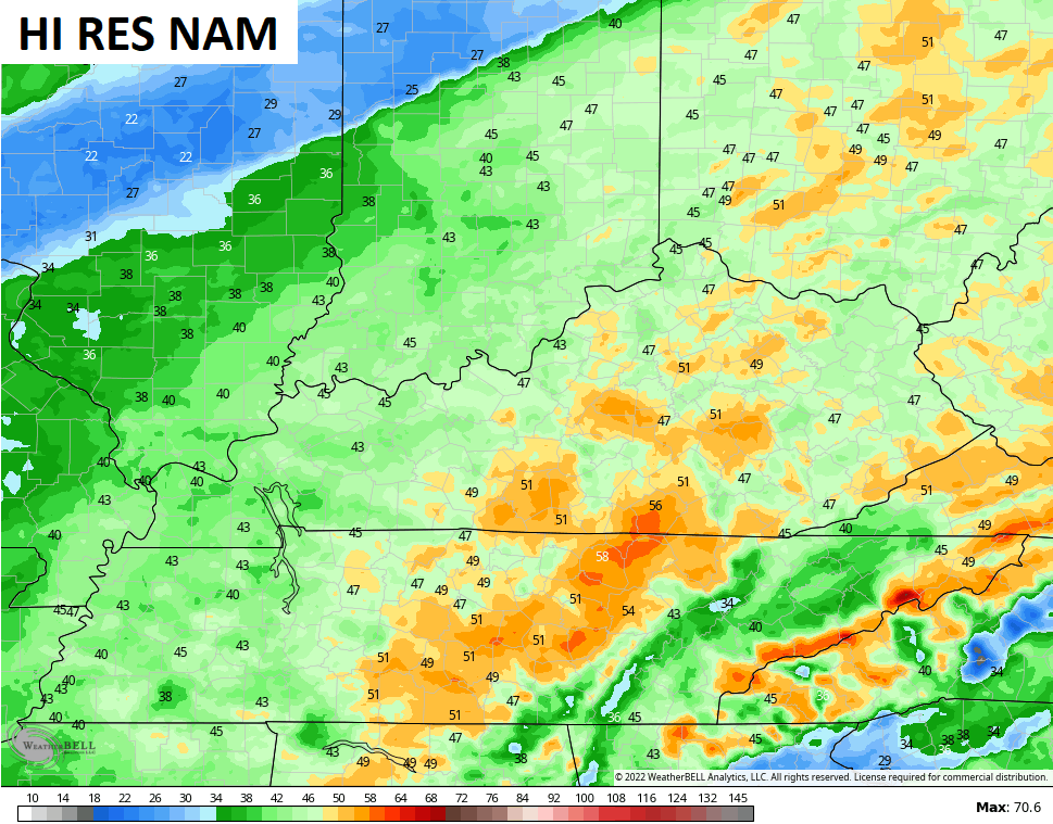
Our next storm is a classic bowling ball type storm that rolls in from the southwest starting late Saturday. By Sunday, this low is to our north and northeast and is wrapping in colder winds to our region. Check out this photogenic storm on the Future Radar from the Hi Res NAM that goes from Saturday afternoon through 7pm Sunday…

Up to an inch of rain will be possible for some areas and I can’t rule out some thunder and lightning.
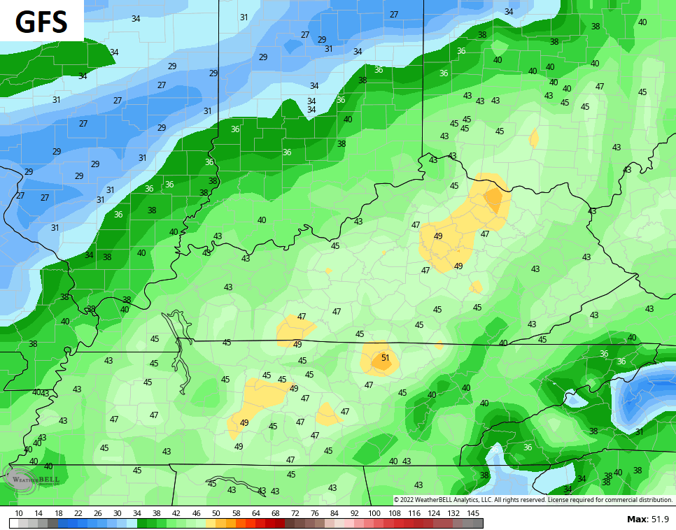
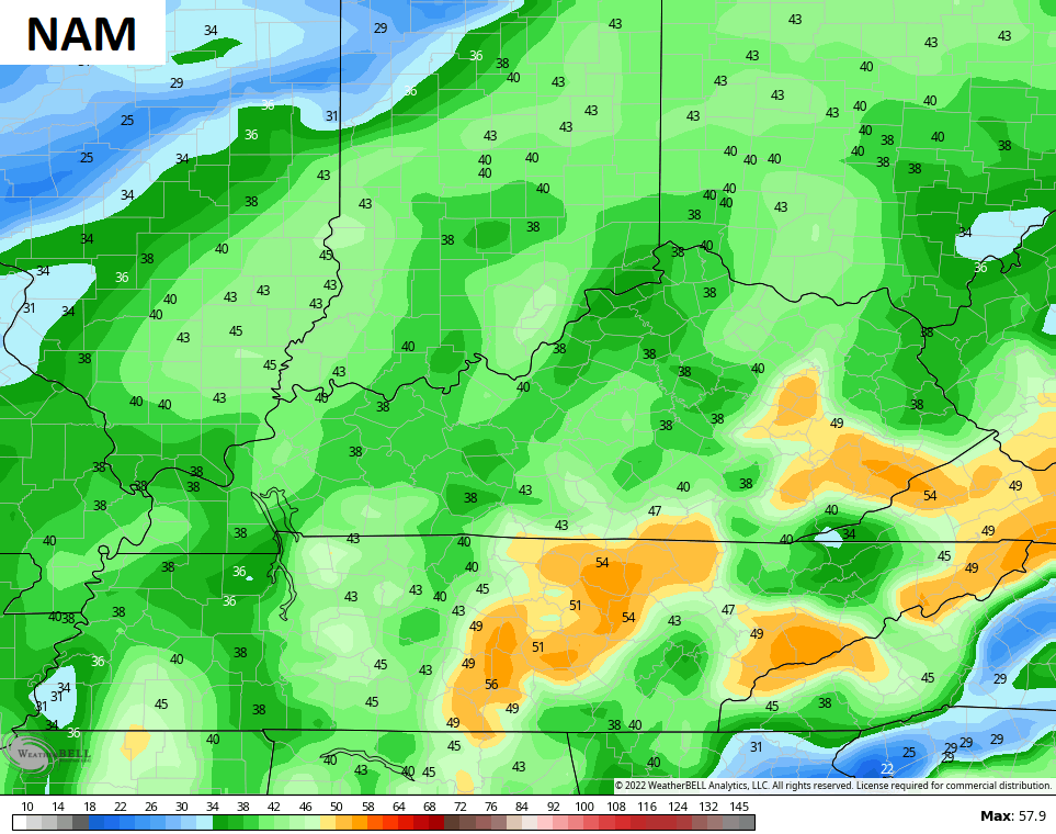
The winds are the main story of this storm, though. Gusts of 40mph-50mph will show up late Saturday night and Sunday. Here are some of the peak gusts from a few of the computer models…
Lingering showers and chilly air will be noted on Monday.
Winds crank from the southwest on Tuesday as our next weather maker rolls across the plains and into the region. Scattered showers and storms may develop in western Kentucky on Tuesday, but the bulk of the rain arrives Tuesday night and Wednesday. I can’t rule out a few strong storms with this, especially in the west. The trend on the models is for a weaker surface low as they sense the cold air really pushing in behind our front…

Regardless, we will be seeing gusty winds, rain, some thunderstorms, and a big temp crash. Wednesday temps start in the 60s and drop into the 30s in just a few hours time, with 20s that night. There’s also the chance for a few flakes.
A fairly extreme look is taking shape across the northern hemisphere once again and this means the models are gonna really struggle with the medium range. I recall saying this back a few times earlier this fall and that holds true now. Why is this important? Because ahead of the 3 prolonged major cold shots, the models really didn’t find them until they were almost upon us. Watch for something similar to happen as we head into December.
I continue to target the middle of the month, but the Canadian tries to start the party much earlier by next weekend with this setup…

That’s a major block over the top, pushing arctic air into the country. I think that may be a bit too fast, though.
I’ll through you another update later today. Have a good one and take care.

Thanks for the update Chris.
Thanks Chris, the words come through on your blog but the maps aren’t loading. May be on my end or yours ?
Hope we get the rains and maybe the snows later. Sure has been a gloomy day.