Good Saturday, everyone. A powerful storm system is moving into the region late today and will bring high winds and heavy rain tonight into Sunday. This kicks off a very active weather pattern that likely leads us into some big December cold.
Let’s break this system down with the headlines:
- Clouds slowly stream into the state today with temps ranging from the middle 50s to low 60s.
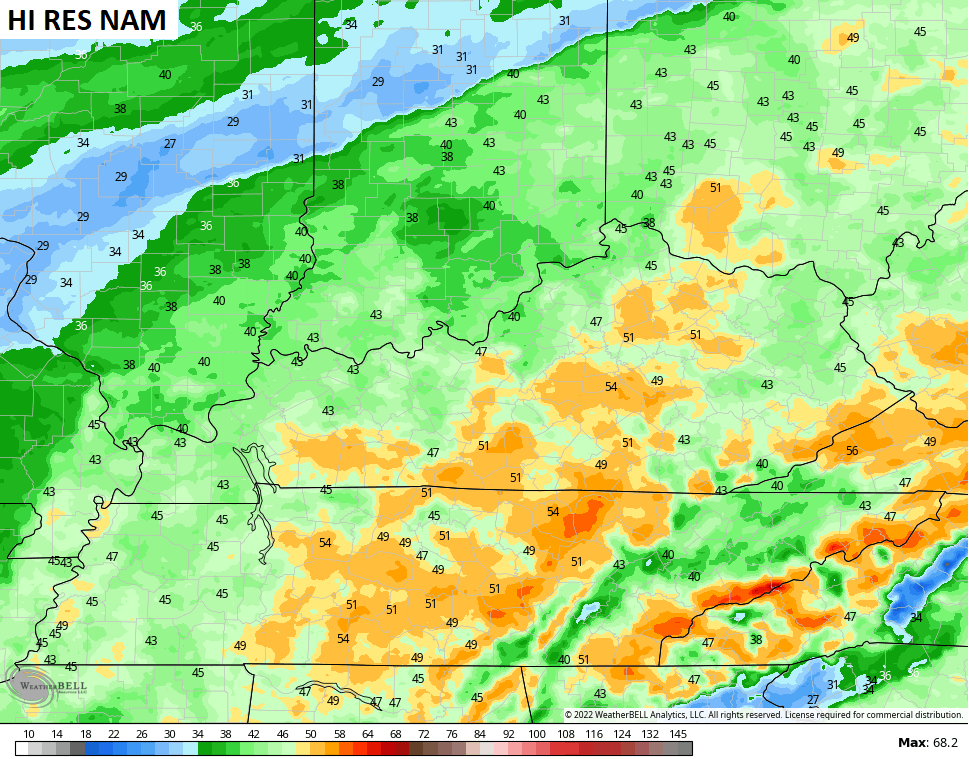
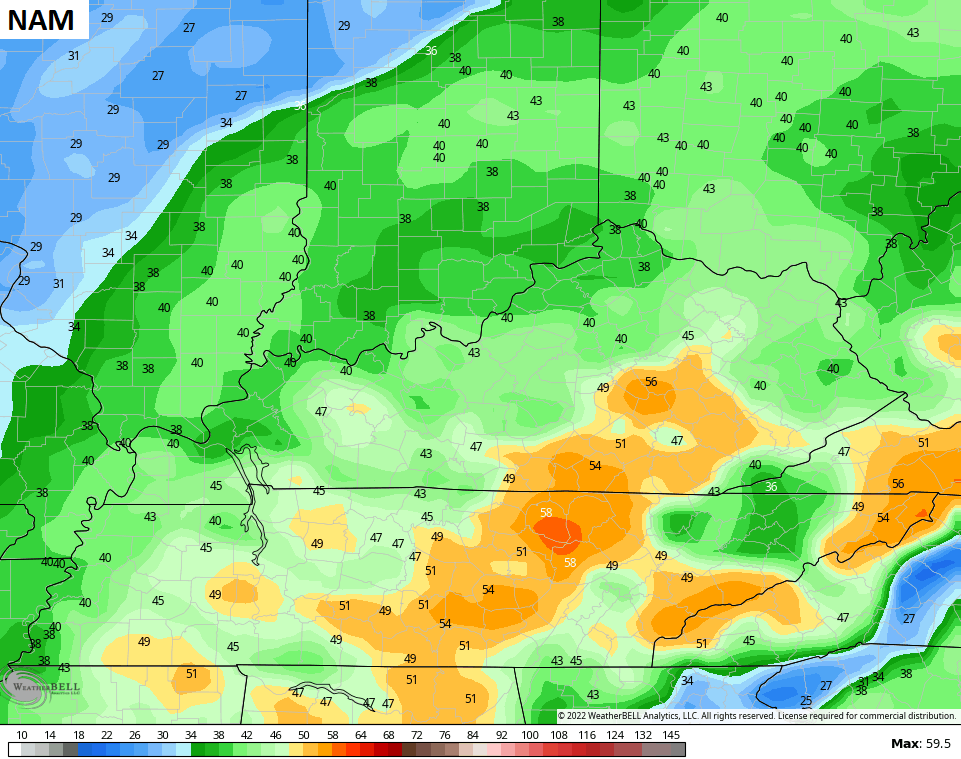
- Rain moves into western and southwestern parts of the state this afternoon and moves across the rest of the state this evening into the wee hours of Sunday.
- Spiraling bands of showers and a few thunderstorms will be with us into the first half of Sunday. Some local 1″ rain amounts will be possible.
- Winds are a major issue and likely to cause problems. Late night and early Sunday wind gusts of 40mph-50mph will be likel.
- Sunday’s winds will stay between 30-40mph for much of the day as temps fall behind the departing storm.
- Lingering showers will take us from Sunday afternoon into Monday morning.
Look at some of those peak wind gusts on the models over the next 24 hours…
As we skip ahead to Tuesday, we find gusty southwest winds kicking in ahead of another big storm system. This is a low pressure working from the plains into the Great Lakes and dragging a cold front across the state. Showers and thunderstorms, some strong, will develop later Tuesday and work across the state Tuesday night and early Wednesday. As cold air crashes in, there’s the chance we get some festive flakes as we start December Wednesday night…
GFS

CANADIAN

The “feels like” temps absolutely tank. Check out the numbers from 7am Wednesday through 7am Thursday…

That cold doesn’t hit and hold and I don’t think that fully happens until the middle of December. Still, the Canadian Ensembles are trying to bring that in earlier…

I will have updates later today. As always, I have your radars on duty to track the rain in from the southwest…

Enjoy the day and take care.

wake up from your turkey comas.
Thanks Chris, maps on your blog are now fully loading. Must have been one of those computer glitches ?
Hoping we get the heavy rains and not the heavy winds tonight and tomorrow. It’s too bad that the rains won’t turn to accumulating Snow like it use to after Thanksgiving.
Sounds like an early Winter. Maybe an early false Spring followed by a return to Winter in April. Followed by Summer in May. Not a prediction, but isn’t this the way it’s been these past several years ?
Over the past few years, Summer has been the only season that lives up to its billing, the rest have consisted of wild swings from one extreme to another. It’s our new normal, and one of the reasons why most forecast models beyond a few days in the future have seemed so erratic. The math behind their algorithms isn’t at fault, so much as it is the effect that amped up weather systems are having, presenting scenarios with unexpected dynamics.
The Bermuda High has amplified over the last three Winters. It is totally responsible for the ongoing drought. My latest local forecast for better than an inch of rain has decrease down to thirty hundreds, so it sounds like the rain won’t be as heavy now ?