Good afternoon, folks. Winds continue to crank out there today as a potent low pressure works through the region. This is kicking off a very active setup with another big system ready to blow in here by Tuesday and Wednesday.
Gusty showers will continue to be noted this afternoon and evening as winds slowly start to come down. Here are your radars to track the scattered showers…

Another strong low pressure develops in the Plains by Tuesday and rolls into the Great Lakes Wednesday. Mild air ahead of this system will clash with colder air coming behind a strong cold front to produce showers and thunderstorms. As expected, the chance for strong to severe storms is there from the Lower Mississippi Valley into western Kentucky late Tuesday and Tuesday night.
The Storm Prediction Center has western Kentucky in the Marginal to Slight Risk for severe storms Tuesday…

The front itself slams through here on Wednesday with showers and storms racing through. Cold air tries it’s best to catch the back edge of the rain to switch it over to a brief period of festive flakes…

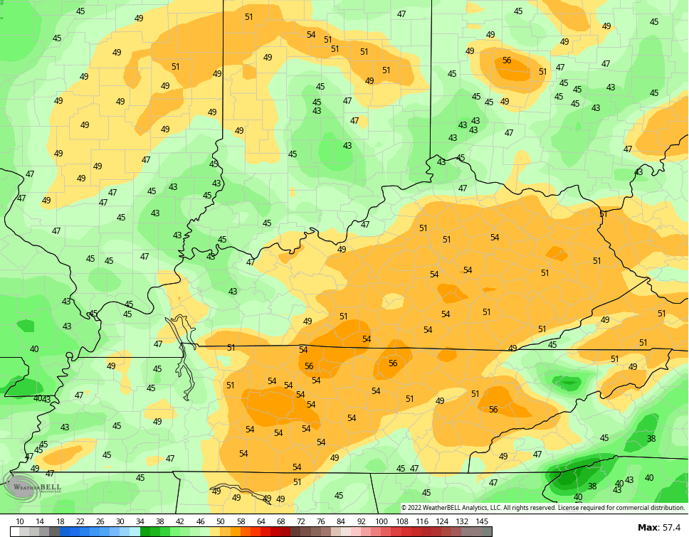
With or without thunderstorms, winds are a huge player again. Gusts of 50mph or greater will be possible…
In terms of cold, the GFS is catching up to other models with a faster arrival time of the cold. Here’s the updated hour-by-hour “feels like” forecast from 7am Wednesday through 7am Thursday…
GFS

CANADIAN

Looking farther down the road to the period I highlighted in my last post, the operational models like the GFS are beginning to pick up on the cold look…

Operational models are going to show some crazy looks in the coming days. Get ready for wild swings in all directions.
I’ll update things later today. Make it a good one and take care.

Wondering if we’re entering record territory for -NAO..Be interesting to see what models will show with all the blocking..Hopefully something shows up besides cold and dry..the worst possible weather..
Thumb up with your statement.