Good afternoon, everyone. It’s a chilly day across the Commonwealth as we turn our attention toward the big storm system revving up for Tuesday and Wednesday. This brings high winds and strong storms our way before a big temp crash.
The Storm Prediction Center keeps the Tuesday Slight Risk for severe weather in the far west with the Marginal Risk now extending into central Kentucky…

Wind damage is the main threat here in Kentucky with the tornado threat much lower. The greatest tornado risk is from western Tennesse down the lower Mississippi River Valley.
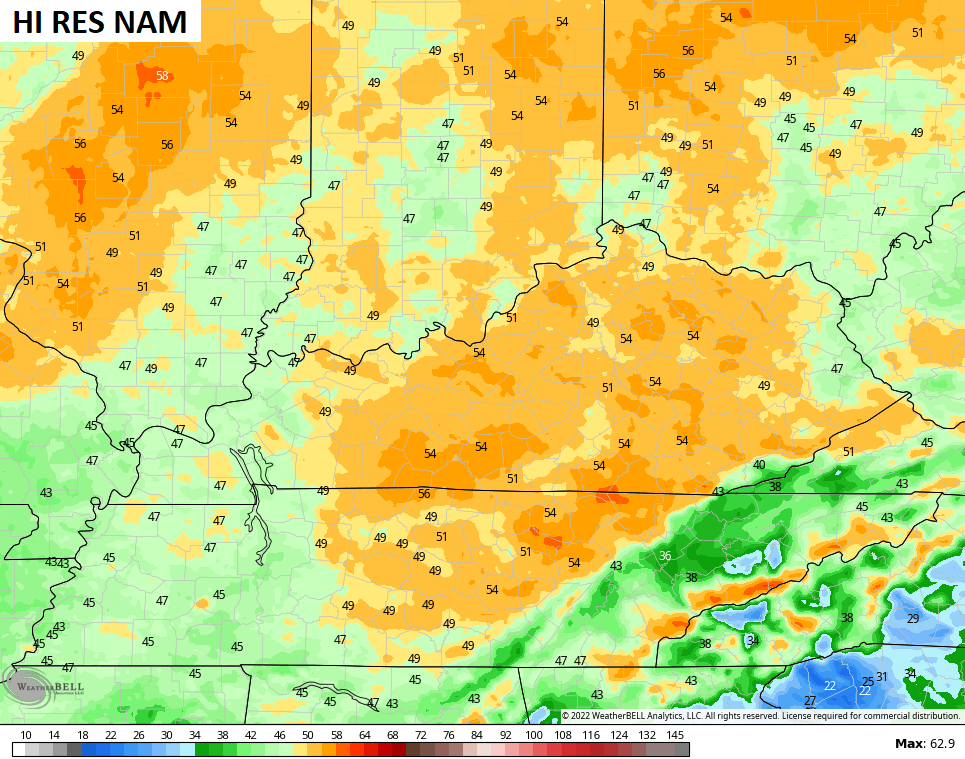
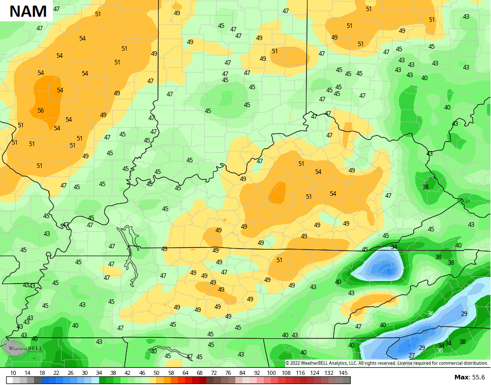
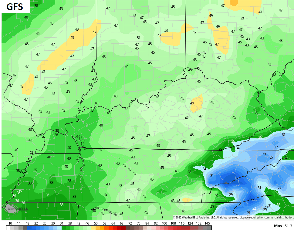
With our without severe storms, high winds are likely to become a big player again. Gusts to 50mph will be possible through Tuesday night and some models are showing gusts in excess of 50mph…
Temps crash from west to east behind our cold front Tuesday night and Wednesday. Wind chills will wind up in the teens by Wednesday night. That means December starts with a seasonable brand of cold on Thursday.
Temps bounce back on Friday as another cold front drops in from the northwest. This brings a gusty round of showers later Friday night into Saturday…

Temps turn chilly behind that front as we get set for the next system to arrive right behind it.
That looks to be the catalyst to get our first shot of cold to dive deep into the country early next week…

This happens as we see a monster block going up around Greenland. This -NAO means temps will absolutely tank across the eastern half of the country later next week and likely into the following week…
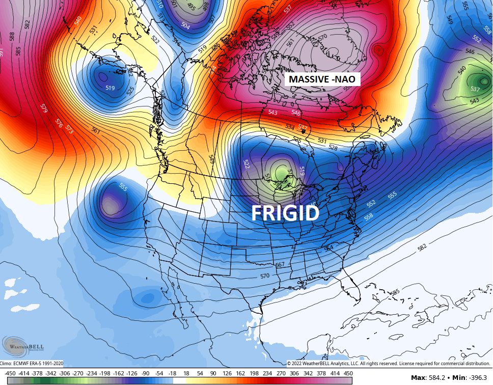
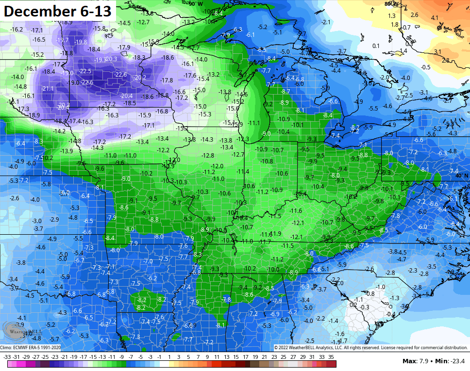
Here are the current 7 day temp departures from normal from the GFS…
For snow lovers, you have to get the cold in here before you can get the flakes to fly! ❄️🥶🤔
I will have another update later today. Have a good one and take care.
