Good afternoon, folks. We continue to track the potential for a few strong to severe storms this afternoon as a stout cold front races across the state. This brings a big drop in temps to close out November on Wednesday. Down the road is throwing up some red flags in terms of a lot of rain.
The latest from the Storm Prediction Center has the Marginal Risk for severe weather deeper into the state with the Slight Risk still mainly in the west…

Wind damage is the primary threat across Kentucky, but the western half of the state continues with a low-end tornado threat…
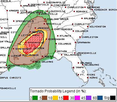
You can see how areas of the Lower Mississippi Valley are in line for a significant severe weather outbreak today.
If we look at the HRRR, we see the model is indicating a few rotating storms across western Kentucky this evening…

That’s why the west is in the low end risk for tornadoes.
Winds are a big player regardless of storms. Gusts to 50mph or greater will be possible through tonight as our cold front sweeps through. Temps plunge quickly late tonight and Wednesday behind the departing cold front.
Friday looks good with increasing clouds and milder air but another cold front rolls in here on Saturday with more showers…

That front slows down as it gets sandwiched between the cold in the north and a ridge of high pressure in the southeast. I’ve talked about this possibly becoming an issue with repeat rains along a stalled boundary.
That’s certainly a possibility early next week and something the models are going toward…

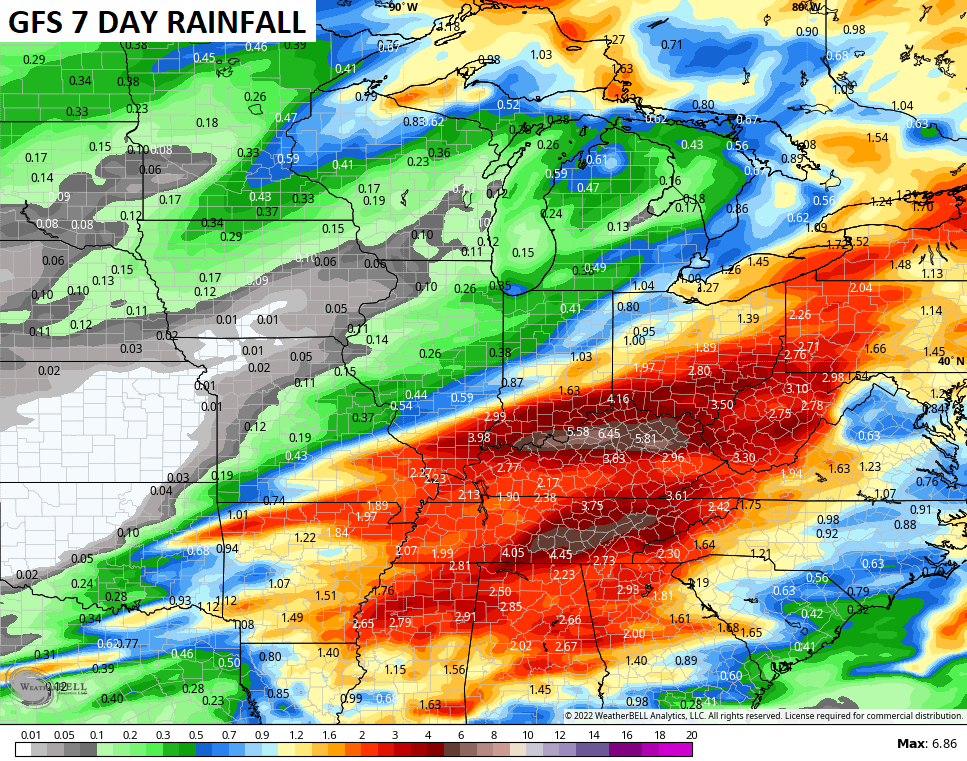
The rainfall numbers from that run of the GFS over the next week…
The Canadian has a similar setup, but it’s a little colder and farther south and evening brings a winter weather threat…

Notice how the heavier rains are just to our south into Tennessee…
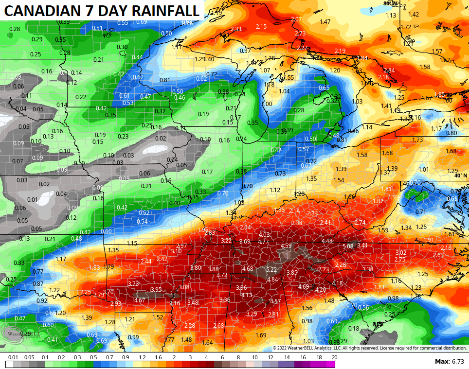
We need that cold to win the battle next week or else some trouble may show up.
I will have another update later today. I leave you with your severe weather trackers. Our exclusive interactive radar also features live storm chaser video streams, so be sure to check that out…

Current Watches

Possible Watch Areas

Enjoy the day and take care.

Chris,Sure missed you tonight when the severe storms moved through fayette county . Oh by the way you might mention that Falmouth is not pronounced “foul mouth” as the on air meteorologist said. Lol