Good afternoon, folks. Cold winds continue to blow across the state as our powerful cold front is now off to the east of us. After a short break, another strong cold front looks to plow through here to start the upcoming weekend.
Temps are seasonably cold for the closing hours of November and that takes us into day one of December.
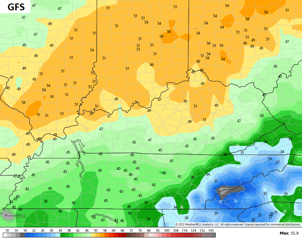
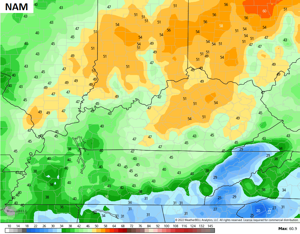
Temps spike into the 50s on Friday as clouds thicken ahead of our cold front. This moves in Friday night with showers developing and taking us into early Saturday…

That’s likely another big wind maker with gusts Friday night and Saturday morning back into the 40mph-50mph range…
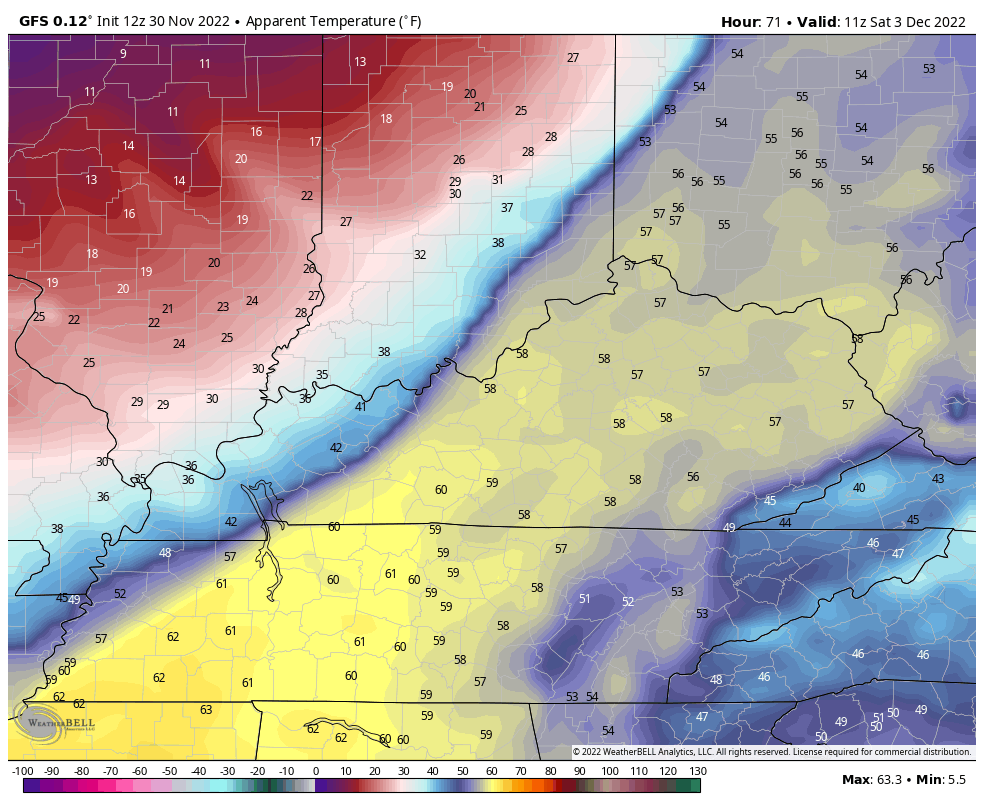
Those winds turn cold very quickly on Saturday as the front blasts through. Watch the “feels like” numbers from 7am to midnight on Saturday…
The front slows down just to our south and brings a light precip maker eastward along it on Sunday. With colder and drier air in place, a touch of sleet may be noted on the northern side of this. That will be followed up by an increase in rain on Monday ahead of a stronger front due in here late Tuesday. Here’s the Canadian showing this…

That cold air presses in and we may very well see another low pressure develop and roll along the leading edge of this. The Canadian is showing a winter weather maker later next week…

The GFS was running way behind this morning, so the new run is delayed. That means it misses the cut for this update, but I’ll throw it in on the next one later today.
That comes your way this evening, so check back. Have a wonderful Wednesday and take care.

Thanks Chris, appears in the model suggestion that the cold air is not making it as far south as earlier this Fall, hence the freezing rain is in the forecast. I hope this weather type doesn’t dominate our Winter to be, but in La Nina Winters the Southeast Ridge ( dominating ) causes fronts to hang up just to our south. I’m hoping we go to ENSO- neutral soon or better El Nino where the Southeast Ridge is weak.
So pretty..Can’t ask for a better look..
https://media.discordapp.net/attachments/882486624037011457/1047599314958028901/IMG_1532.png?width=714&height=586
You can see ridging out in the Rockies on that map..Just wondering if that helps the East coast more..Anyway Sure look’s like a good signal around the middle of month..