Good Saturday, folks. A cold front continues to quickly zip across the area today and it’s ushering in a seasonable brand of cold air for the rest of the weekend. The focus of the forecast then shifts toward a much wetter pattern for next week. One that may put down some big time rain totals.
Let’s kick things off with what’s going on out there today. Highs come early this morning then drop through the 40s into the afternoon. Morning showers taper off from northwest to southeast this morning and early afternoon with some sun showing up. Here are your radars to follow the drops out of Kentucky…

Temps tonight tank into the upper teens and low 20s for several spots and that sets us up for a seasonably cold Sunday with upper 30s and low 40s.
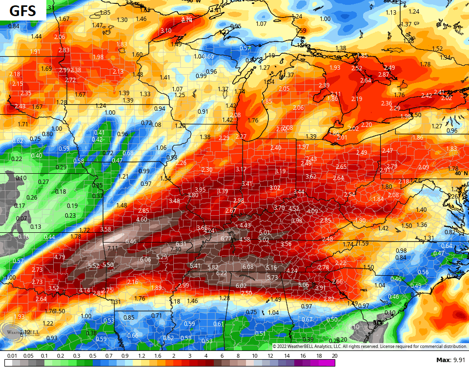
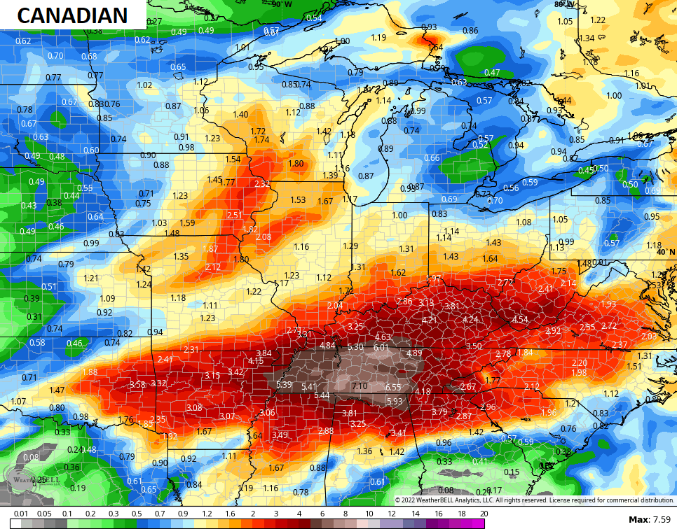
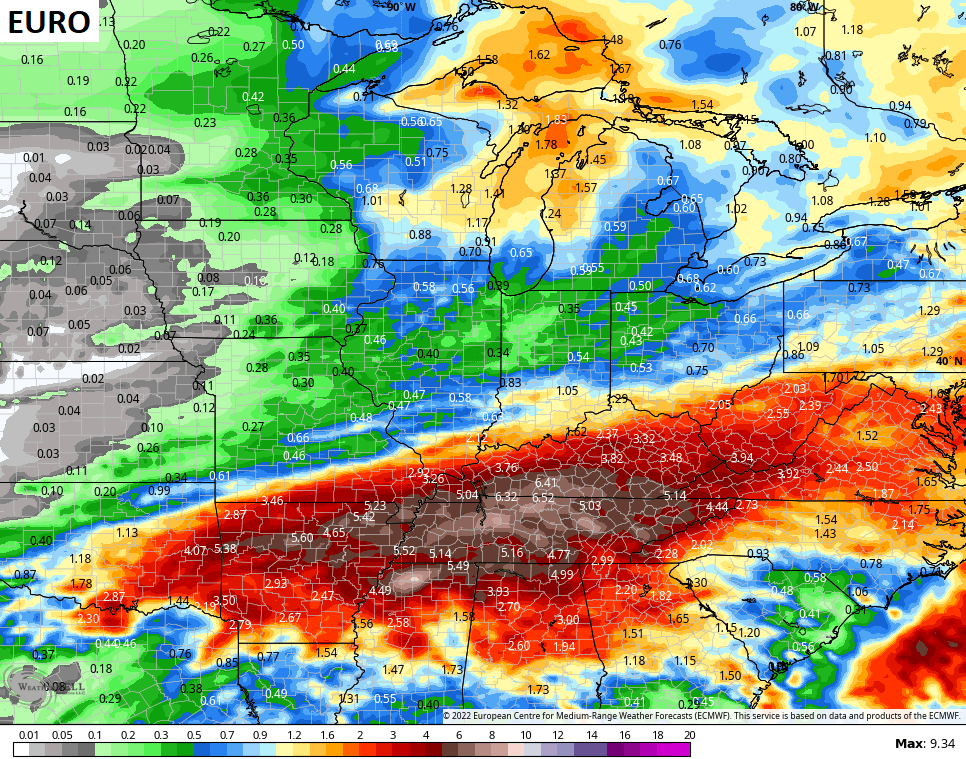
The setup for next week continues to be one that produces a stalled boundary in our region with waves of low pressure rolling along it. That likely means rounds of heavy rain starting late Monday and, potentially, going into next weekend.
The models vary on totals and placement, but you can clearly see the trend over the next week and change…
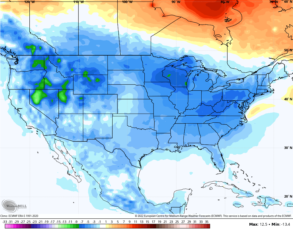
The setup for the week of the 12th will trend much colder across the eastern half of the country. With the major blocking going up, we will have to watch for winter weather threats showing up. Blocks like the one setting up can sometimes produce some highly anomalous systems coming underneath them. A recent run of the contril version of the EURO Ensembles tried to produce one of those…
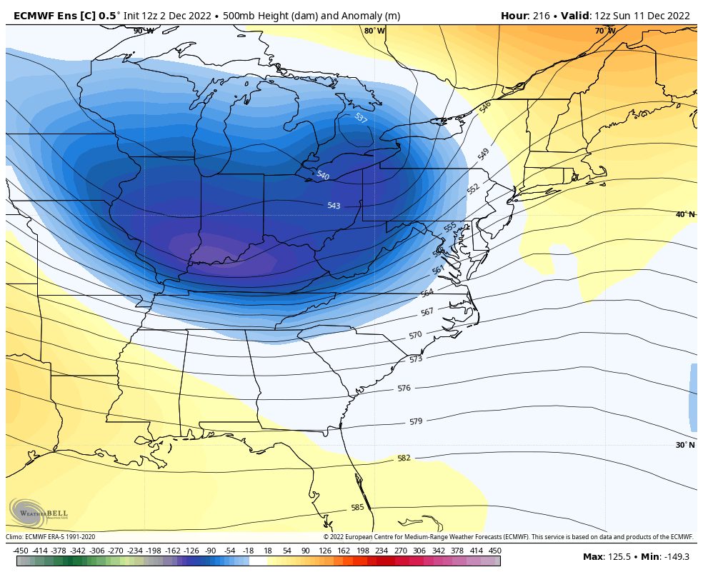
The latest EURO Weeklies have the pattern I’ve talked about setting up for the middle and end of December and that bodes well for folks who like winter weather leading up to Christmas. Check out the trough for the week leading up to Christmas…
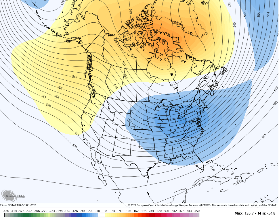
That’s a cold look and it goes from coast to coast for that week…
Remember, that’s a full 7 day average from a 51 member ensemble that normally can’t see cold air and troughs.
I will have updates later today, so check back. Make it a good one and take care.

fire in da hole!!!!!!!!!!!!!!!!!!!!!!!
Thanks Chris, appears that the end of astronomical Autumn will end on a wet and mild note, rather than dry and colder than normal like the season began. Good that you didn’t specifically define ” Winter weather ” as no one really knows what weather type we may receive later in the month. Hoping it’s Snow and not Ice or dry and very frigid.
As I was running the upper levels this Morning, what really stood out was the large ” Southeast Ridge ” now situated in the Gulf of Mexico. This ” Winter killer ” for our area, seems more persistent than the last two previous La Nina Winters ?
Out of this latest event we had about a quarter of an inch of rain / showers here in Maple, which was re corded in the past forty eight hours by the Kentucky Mesonet. Lots of wind that was previous forecast overnight, but wind damage was minimum.