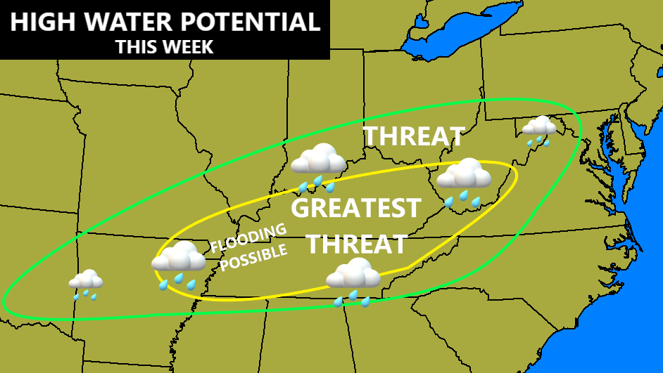
Good Tuesday, folks. Rain will continue across the state today as we our super soaker of a week rolls on. Heavy rainfall may even cause some local high water issues before all is said and done. The picture into next week finds Old Man Winter settling into the eastern half of the country.
Showers and thunderstorms come at us from the south and southwest today and this trend continues through Wednesday. This first round of rain will produce up to a half inch in the north and 1″-2″ across the south and southeast. Here are your radars to follow this first round of rain kicking in…

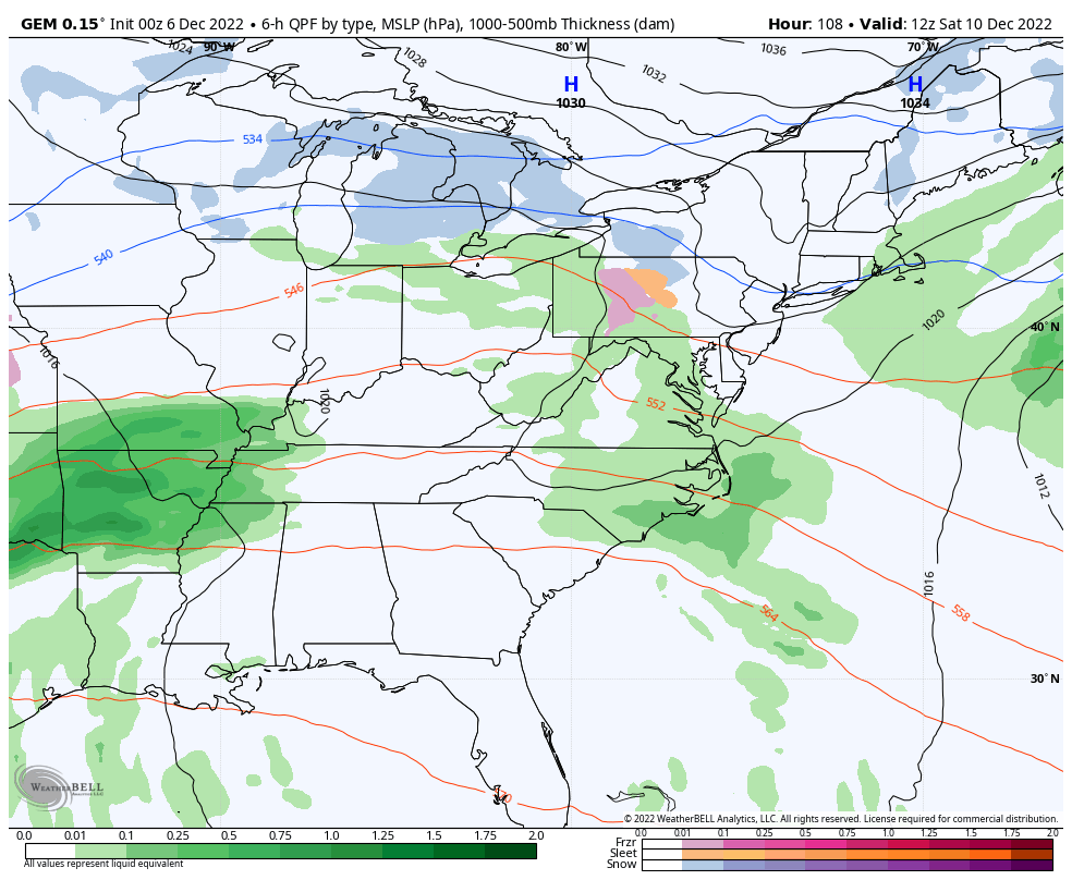
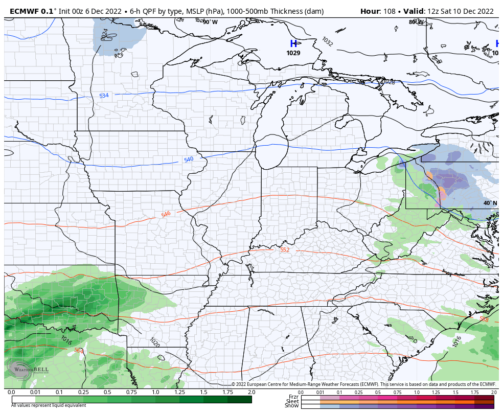
Another low pressure moves through here Thursday into Friday and brings more rounds of heavy rain producing showers and storms. That’s when another 1″-2″ of rain may fall across parts of the region.
All of this matches pretty well with the area I first highlighted a few days ago…
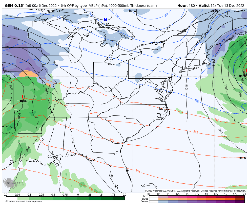
The system coming in later in the weekend continues to twist and turn a little bit on the models. The latest Canadian has a more wrapped up system that ends with some flakes in the east on Monday…
The EURO never really gets that system cranking and looks a little suspicious…
The EURO bias of holding too much energy back in the southwest is likely at play there and we will likely see that with the next system.
The big storm system coming behind that late Tuesday and Wednesday is going to be interesting to watch. In theory, the block should turn this thing more eastward as cold air crashes in behind it. That’s something the new Canadian is showing…
That’s a look that’s been showing up on the Canadian and Euro from time to time lately.
If we look upstairs on that same run of the Canadian Model, you can clearly see the bl0cking to the north, allowing for a deepening trough coming underneath that through the good old USA…
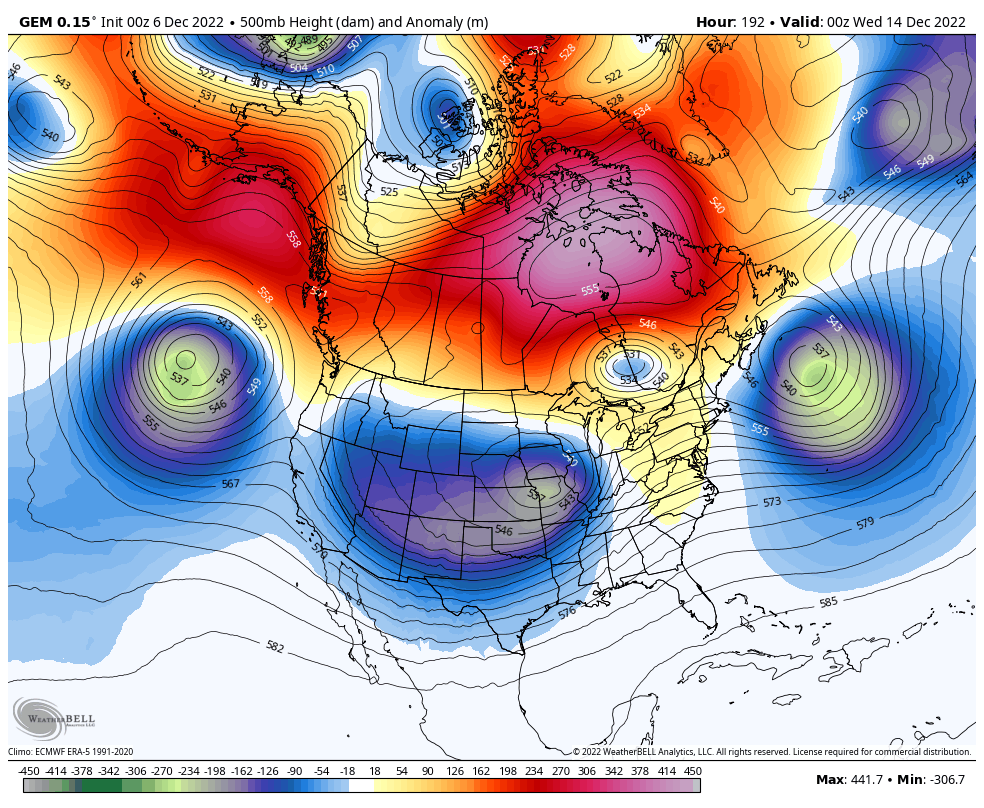
That’s something the Ensembles have been showing for a while now. Check out the cold coming on that run of the Canadian…
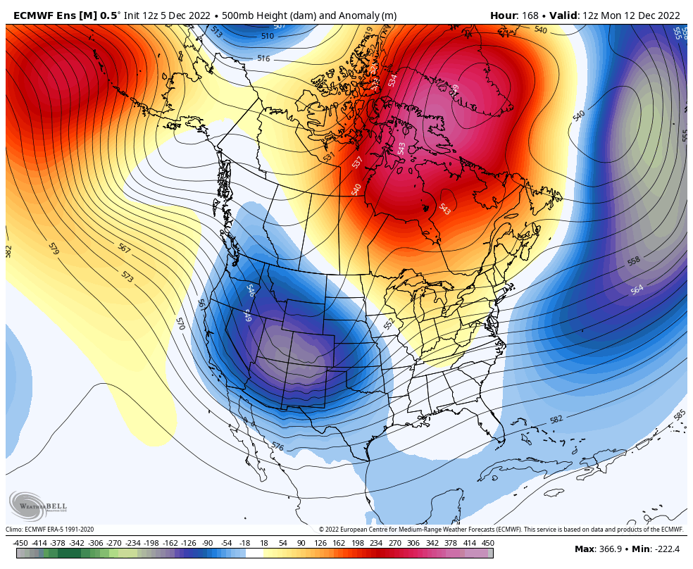
The European Ensembles show the block taking hold next week and into the week leading up to Christmas. This much talked about block forces that trough to swing eastward across the country before strengthening…
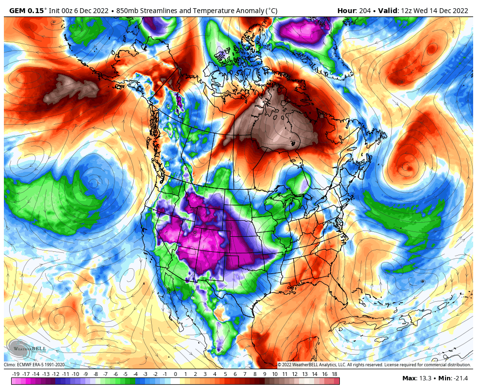
And here’s the cold air pouring in…
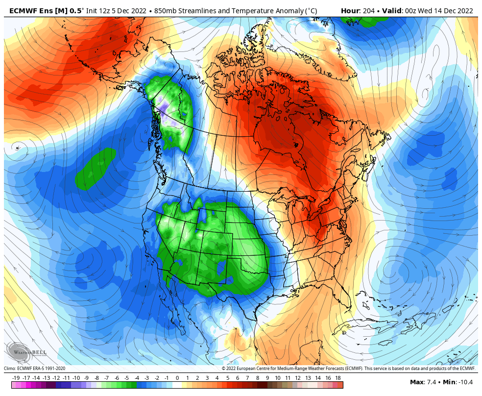
That’s coast to coast cold showing up there and is reminiscent of what happened for a time back in November. This one is coming when it’s much colder in December and will have more staying power and winter weather threats.
This is a really good look in the few weeks leading up to Christmas. 🎅❄️🥶
I will have updates later today, so check back. Have a terrific Tuesday and take care.

white christmas!!!!!!
My last White Christmas was in Vanderburgh County, Indiana in 2004. Dress regional Airport reported accumulations up to two feet in most areas. Very rare for this area. The Snow melted before the beginning of the New Year 2005. The rest of the Winter turned out mild and uneventful.
I don’t know if Maple, Kentucky ever had a real White Christmas ? Unable to find any records saying such. Maybe this year if it’s cold enough in the upper levels this will occur ?
With this current rain event only 0.13 inches of rain reported in my county of Taylor. Maybe when the warm front gets closer the rain will be a lot heavier in my area, but when the warm front moves north of my area the rain cuts off, but opens the door for isolated severe thunderstorms ?
The major cold wave predicted for next week is still not showing up on the Ventusky’s 14th day extension, but has been widely discuss by NWS. I’m hoping it doesn’t get that frigid as you know here in the Ohio Valley that when the warmer air returns in the upper levels that the precipitation type is not usually Snow.
GFS is either going to score a coup, or go down in flames
As has been the case for most of the year, the current rain event has underperformed so far, laying down 0.13″ of rain over the past 24 hours. This atypical La Niña continues to play havoc with forecast models, which seem to represent a different point of view with each run, until we are within 36 hours or so of the event. The data being fed to the models must seem chaotic, and as they so often do, forecast models tend to amplify that chaos.