Good afternoon, folks. Talk about a wet day, we have it going on out there today as rounds of heavy rain roll across the state. This is ahead of a flip to a more normal wintertime setup for the end of the week and weekend, with a MUCH bigger flip coming Christmas week.
Some areas have already picked up an inch or more of rain since last night and more is on the way through tonight. Some spots may finish this thing with 2″-3″ total inches of rain by Thursday morning.
Here are your radars to track the heavy rain bands across our region…

A cold front sweeps through here on Thursday with colder air bleeding in from the west and northwest. There’s almost a secondary push of colder air arriving on Friday as an upper level system pushes across the Ohio Valley. As this moves through, it can spit out some periods of light snow and flurries from Friday through early Sunday.
The Canadian family of models continues to be in the most festive mood for flakes…
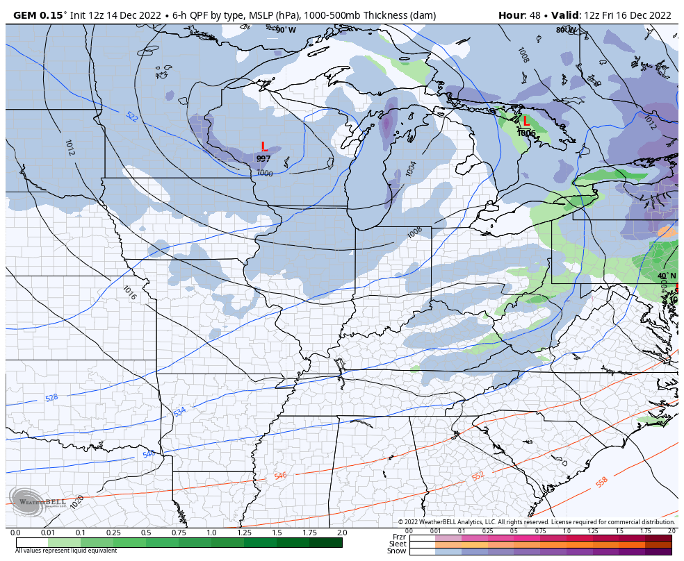
Short Range Canadian…
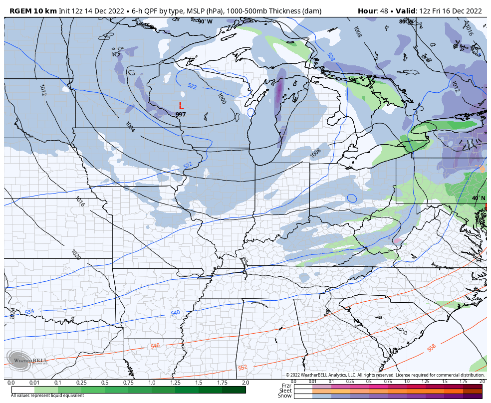
Canadian
My thoughts on the runup to Christmas have not changed at all. I expect a monster arctic front to drop in here around Thursday of next week. That’s being pushed by bitterly cold air and should have, at least, a wave of low pressure along it. Accumulating snows in this kind of setup are likely, but how we go about making it happen is still to be determined.
The operational models continue to have the signal, even if they change a little from run to run.
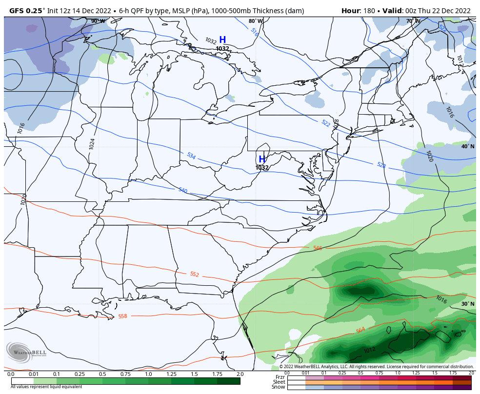
The GFS is too progressive, but still has a healthy snowfall…
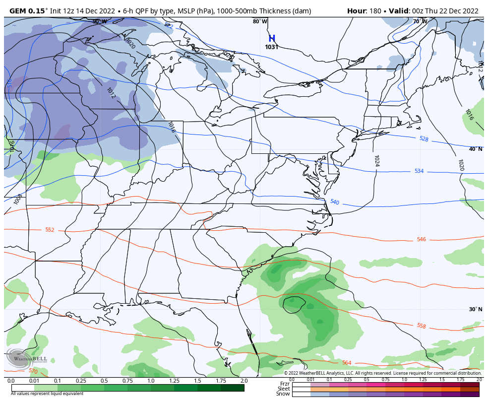
The Canadian is showing what I talked about in my last post as it cranks out a major wind driven snowstorm…
I warned you this was a setup for the models to occasionally show a blizzard. Now, slow your roll on that as it’s a week away. That said… the chance isn’t zero.
I will update things later today. Have a good one and take care.

That looks like some serious wind on the Canadian model..Probably be some power outages..Opening present’s in the dark..With the cold let’s hope it’s wrong..
Go buy some chestnuts just in case. LOL
I have never taken a deep dive into the Euro model. but I believe the last run didn’t have the brutal cold air. It was still cold but not as intense.
Still along way to go but the odds of a White Christmas is growing everyday.
Note: 1” of snow is considered official.
I am dreaming of a white Christmas
Schroder, I hope you are ok, kind of odd you haven’t posted anything on here today.
I’m Okay. Thanks Winter lover. I just posted on the evening blog that I don’t like Frigid, dry Arctic air without at least a foot of Snow on the ground.