Good evening, gang. Is is wet enough out there tonight? Don’t answer that, it’s rhetorical. The heavy rain continues through tonight with colder changes behind this, that will lead to a few flakes later in the week with a harsh winter pattern moving in next week.
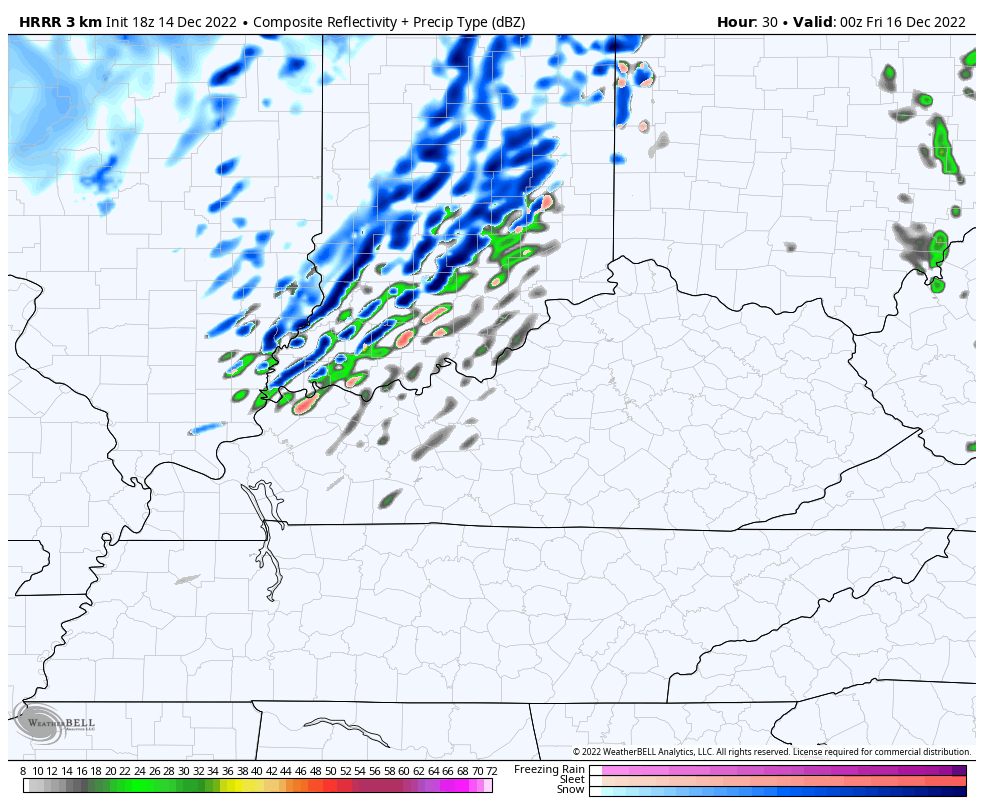
There’s nothing left to say about the rain, so here are your radars to track the downpours…

Colder weather bleeds in behind the front on Thursday. A few upper level systems pass through the region starting Thursday night and continuing into the weekend. The future radar from the HRRR from 7pm Thursday through 7PM Friday shows some snow showers trying to get into the mix…
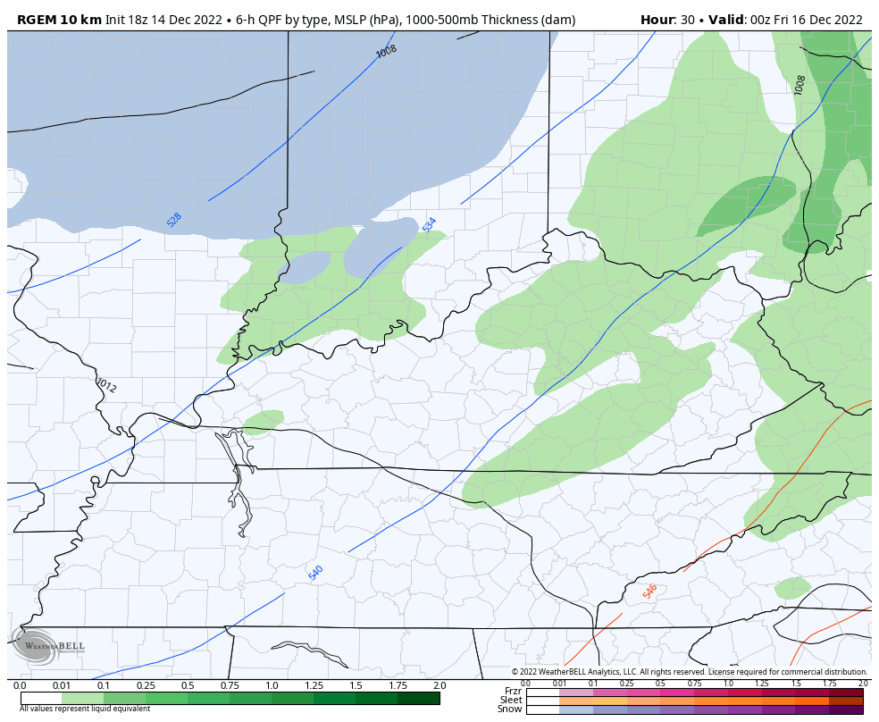
That’s something the Canadian family from the north has been showing . The short range version of the Canadian continues to show some light snows and flurries through the end of the run Saturday night…
Say it with me… I have no changes to my thoughts for Christmas week and Christmas weekend. We are likely to get some snow to be followed by bitterly cold temps.
As expected, the operational models are dancing around from run to run. They have a consistent signal and that’s all I’m looking at right now. Details are days away from being worked out, folks.
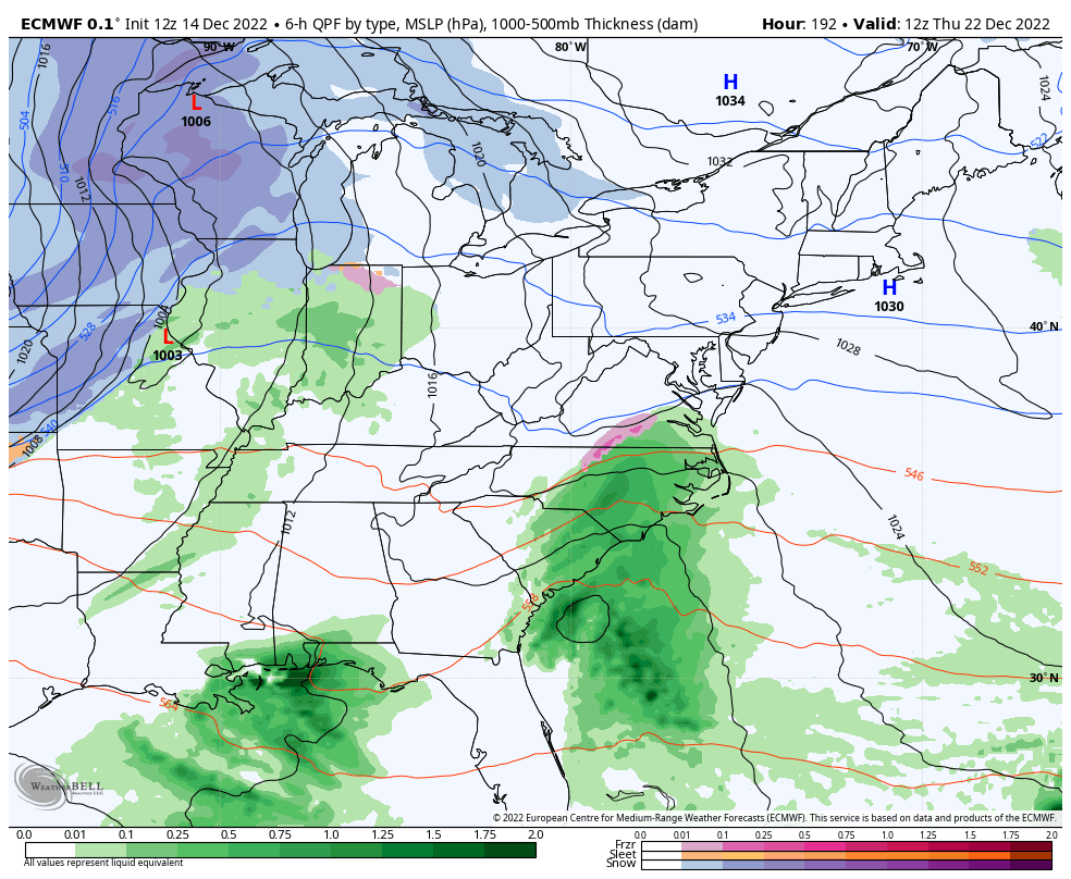
The EURO looks like this…
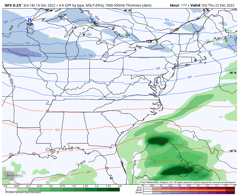
The afternoon GFS went back to its roots of being too progressive..
Regardless, the signal is there. As I said with my last updates, I can’t tell you how much snow can come from this setup, but we have an increased threat to make snow lovers happy. 😏🎅
A little snow or a lotta snow won’t make much of a difference in the bitterly cold air coming. There’s a chance for below zero temps Christmas weekend with wind chills to hit deep into the danger category.
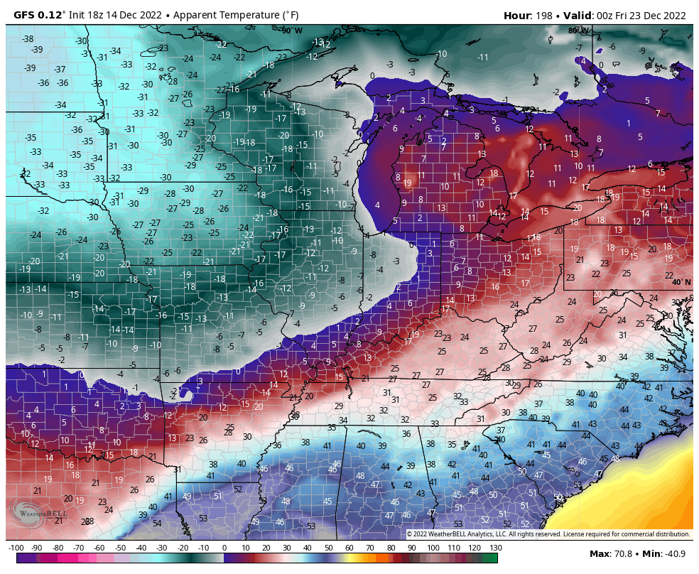
Check out some of the early wind chill numbers from the models…
Here’s the GFS from Thursday night through Christmas morning…
The EURO goes from Thursday night into Christmas Eve morning…
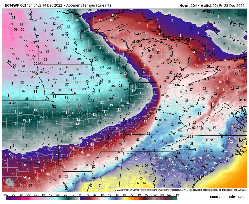
That’s dangerous stuff!
I’ll update everything later tonight so check back. Make it a good one and take care.

Thanks Chris, Best rains I’ve seen for a long while. Over an inch so far. I just can’t get interested in the frigid, dry Arctic air without at least a foot of Snow on the ground.