Good Thursday to one and all. Heavy rain is moving out as Old Man Winter starts to flex a little muscle on us. This flex brings some flakes in over the next few days, but the Old Man looks to go full blown Incredible Hulk next week as a harsh winter pattern develops.
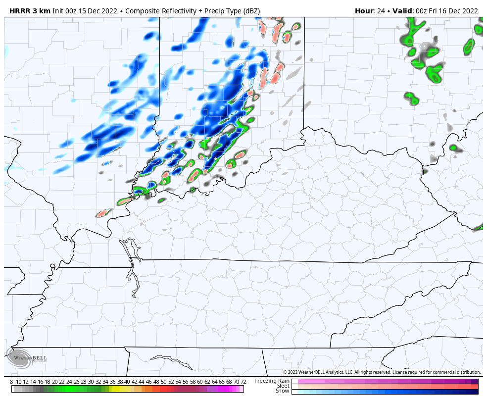
Let’s kick this part off by talking about the rain. We’ve had a lot of it over the past 24-36 hours with a widespread 1″-3″ rainfall. The steady rains end early this morning as our system presses to our east. Here are your radars to follow the drops out of town…

Colder winds blow from west to east this afternoon and that will be accompanied by a better looking sky for a bit.
A few upper level systems then swing through the Ohio Valley Tonight through Saturday. Each of these will open us up to colder air and will also spit out a few periods of light snow showers and flurries.
You can see these on the Future Radar from the Hi Res NAM from 7 this evening through 7pm Friday…
Another system will bring some flakes in here on Saturday as temps continue to trend down. Highs over the weekend are in the low and middle 30s for many with overnight lows making a run toward the upper teens and low 20s by Sunday and Monday.
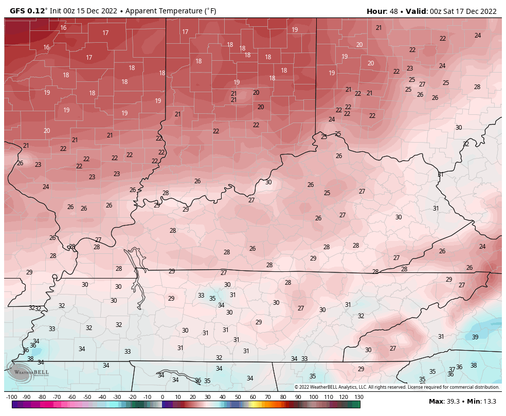
Winds will make it feel even colder. Check out the wind chill numbers from late 7pm Friday through 7pm Sunday…
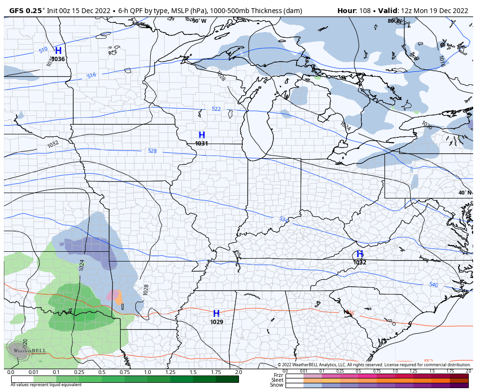
A few of the models continue to try and develop that weak system in the southern Mississippi Valley on Monday. This is likely to weaken and dissipate as it heads our way, but the GFS is trying to bring some light snow into western Kentucky…
The main show arrives shortly after this as America goes into the deep freeze late next week through Christmas Weekend.
The arctic front ushering in this bitterly cold air is likely to be accompanied by a low pressure that digs into our region and pops another low to our east. This setup is usually a good one for accumulating snow in our region, but the details will be ironed out later on.
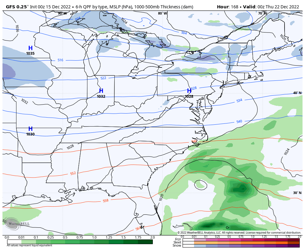
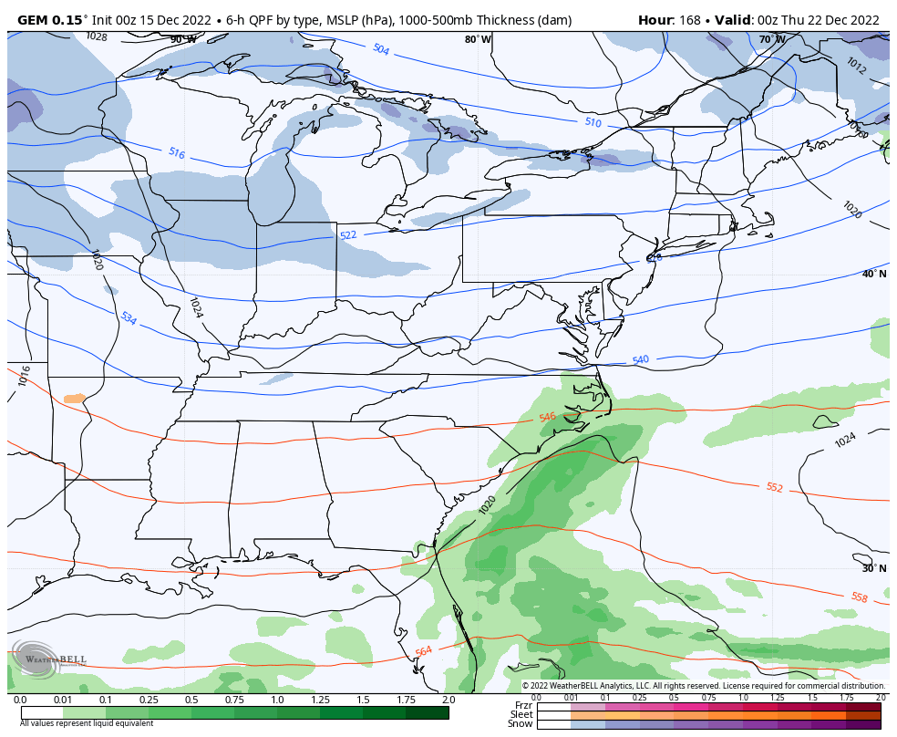
The operational models continue to show a healthy signal in the time frame I first outlined for a storm threat last week… December 21-23. Individual runs will vary on things, but they continue to have the overall theme of the setup…
GFS
CANADIAN
A few days ago, I told you guys we would likely see the models showing a full blown blizzard from time to time. We’ve already seen that a few times, but the EURO just went absolutely ballistic…
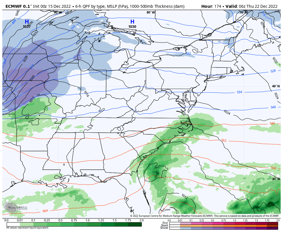
That would certainly be BOLD, but don’t get too caught up in any one run, folks.
The potential is there for this to turn into a major winter storm across the eastern half of the country. To have that happening just a few days before Christmas could mean some major travel issues for millions of folks.
The cold behind this is absolutely brutal and may very well bring below zero temps into our region Christmas Weekend. Winds will also be a major player and that could create dangerous wind chills. The models continue to show some wild examples of those wind chills…
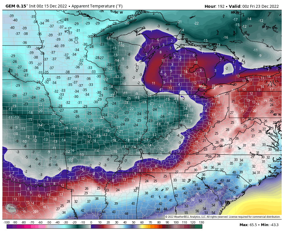
This severe cold will likely continue through the first part of the week after Christmas before easing off some. It’s still going to be very cold, but not like the stuff for Christmas weekend. This cold and stormy pattern likely takes us into early January and we may very well see another severe cold shot reloading during that time. Overall, the next month is likely to feature harsh winter weather for much of the country.
I will have updates later today, so check back. Have a great Thursday and take care.

bailey watching u last night i once again relized we are so gratful to have you as the GOAT of weather men, today song is long line of losers by montgomery gentry.
Over the past 36 hours, I’ve recorded 1¼” of rain at my PWS just south of Bowling Green. Unlike other rain events this year that dropped a deluge of several inches in a short amount of time, with a considerable amount. of runoff.. The current precip has been a steady off and on soaking rain, in other words, just what we needed.
The way next week’s pattern is shaping up leads me to believe that the prospects for a White Christmas in South Central Kentucky are the best we’ve seen in the last 10 years. That’s my bold prediction!
We ended up with a little over an inch of Rain. Still need more Rain or Snows before Spring arrives. Maybe in the next few months we’ll catch up, but we have to get through this ” potential ” Arctic Outbreak ” first. Seems weather casters have been discussing this Outbreak and Snow potential due to model disagreement delays over the past few weeks. Something I don’t really understand. NOAA say one thing and the others say another. Confused over the recent teleconnections. Particular the Arctic Oscillation which is currently very strong and negative and the North Atlantic Oscillation is almost neutral the last time I checked. My question does a strongly negative Polar Vortex mean a ‘ lock up ‘ of the frigid air or does it means it is coming south into the lower 48 ? And does the North Atlantic Oscillation just effect the precipitation potentials ? Clear as mud right ?
Strong polar vortex keeps cold air locked in the Arctic region..When it weakens it becomes displaced letting cold Arctic air move southward..Polar jet stream becomes wavy with trough in the East..-NAO can effect precipitation..It slows systems down and they can become much stronger has they move up the East coast drawing moisture from Gulf or Atlantic..All this with a +PNA which should allow waves to dig farther South and then cut North East and we get a Old School big dog mother of all snow’s if the track is perfect..
Thanks WxWatcher you answered my questions. Less confused now.
Test
coming in loud and clear..
10-4 LOL
the roloeuro update below zero lows and teens fer high with 6-10 inches snow on ground fer christmas.
Rolo is that your bold prediction lol??? I will take the snow.
Santa will be riding the polar express.
He will definitely have the wind flow with him.
The best fuel mileage he has had in years.
It’s been a steady, soaking, off-and-on rain the last two days here in the Chicago area. 2.15 inches of rain has fallen since Wednesday at the NWS Forecast Office in the SW Suburbs, while 1.39 inches has fallen at O’Hare Airport.
We have now gone six days in a row with temperatures above freezing the entire time, and we are now averaging 4 degrees per day above normal for the month so far.
La Nina’s effect.
operationals still all over the place, lean ensembles