Good afternoon, everyone. Colder weather continues to filter into the state today as we track a few flakes over the next few days. This is a precursor to a harsh winter pattern developing for Christmas week and beyond.
A mix of sun and clouds will turn back to cloudy later today as a weak upper level system swings through the Ohio Valley. This will bring a few flurries and a couple of snow showers tonight, especially in the eastern half of the state. This will be followed by a few more systems that can spawn some more flakes late Friday into Saturday.
The future radar from the HRRR starts at 10 tonight and goes through 7pm Saturday…
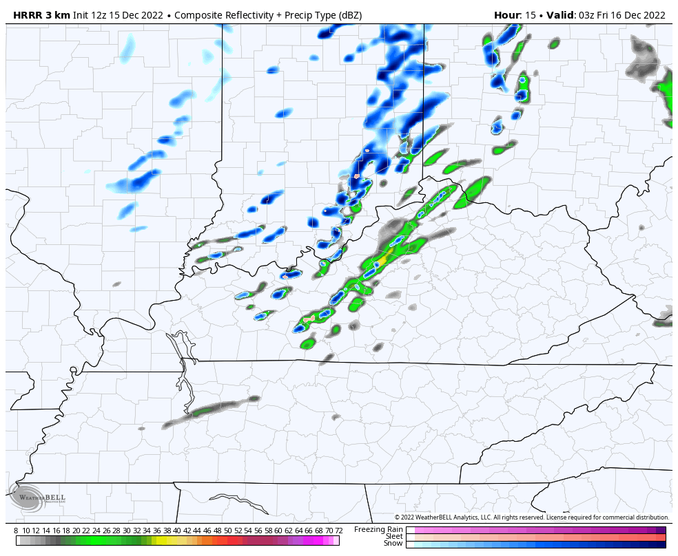
Here are your radars to follow any flake working at us from the northwest today…

It’s a seasonably cold weekend across the region, with wind chills making it feel much colder.
The system early next week is trying to show up just a touch stronger on the models, especially the GFS. Now… It is the GFS so we have to take that into consideration. Here’s the latest run bringing in some light snow from this…

After riding a hot streak, the Canadian looks to be drifting away from reality. It’s somehow overwhelming the pattern with arctic air early in the week…
That essentially takes away any late week system on that run. But, that’s not likley to happen.
The GFS has a monster storm system that’s farther south and east compared to what should happen. It also follows that up with a weak system on Christmas Eve…
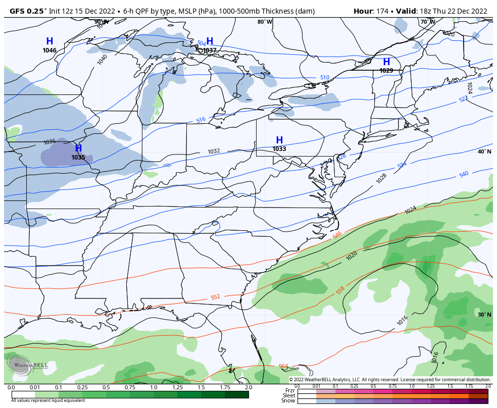
The progressive bias of the GFS is strong on this run!
With such an extreme pattern, the models will continue to spit out some wild swings. They’ll go from showing a blizzard to nothing but flurries or vice versa. Just understand this is going to happen for a while so keep your excitement… or anger in check. 🤣
This will be fun to track in the coming days!!
I’ll have the latest on WKYT-TV starting at 4pm and with another KWC update this evening. Make it a good one and take care.

bailey hitting mid winter form.
12z GEFS agrees with operational, CMC the new Dr. NO ?
Canadian is in a batting slump.
Also showing a lot of wild swings in temperatures.
Who knows. Perhaps a repeat of the years ago, with more state coverage for western peeps.
Whatever the case, there’s a Dumb and Dumber chance.
Two years ago.
18z GFS with a big hit