Good Friday, folks. Colder winds continue to blow across the region today as a few snowflakes try to show up. This is is starting off what’s going to become a harsh winter pattern complete with a storm threat and arctic air as we head toward Christmas weekend.
Let’s start things out with the flake chance we have to end the week and start the weekend. This isn’t anything other than a few festive flakes flying around on occasion today through Sunday morning. Can we get a few out and out snow showers? Yea, but I’m not expecting much from this setup.
The future radar from the HRRR is likely a little overblown with the snow showers, but it spits some out on this animation that goes from 7pm today through 7pm Saturday…
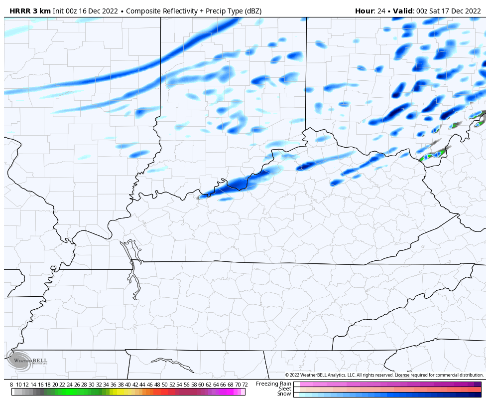
Again, that’s probably too aggressive with the snow showers, but a few flakes will still be nice to see for some of us.
Here are your radars to follow along with whatever flake action shows up today…

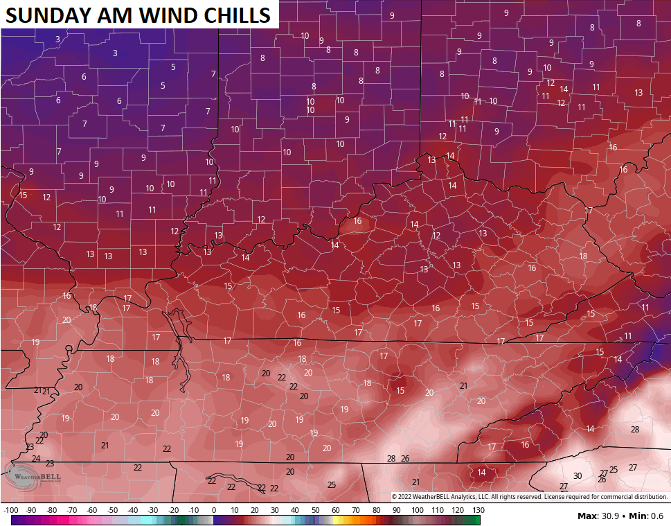
Highs this weekend are generally in the 30s with wind chills in the 20s. Upper teen wind chills show up Saturday morning, but Sunday morning likely features wind chills hitting the low teens…
This takes us into a Christmas week that has the chance to become memorable.
The first system developing in the lower Mississippi Valley, as I’ve said for a while now, will likely get sheared out fairly quickly as it moves eastward. That’s just a fancy way of saying this weakens and dissipates.
This is something most models agree on. Here’s the EURO…
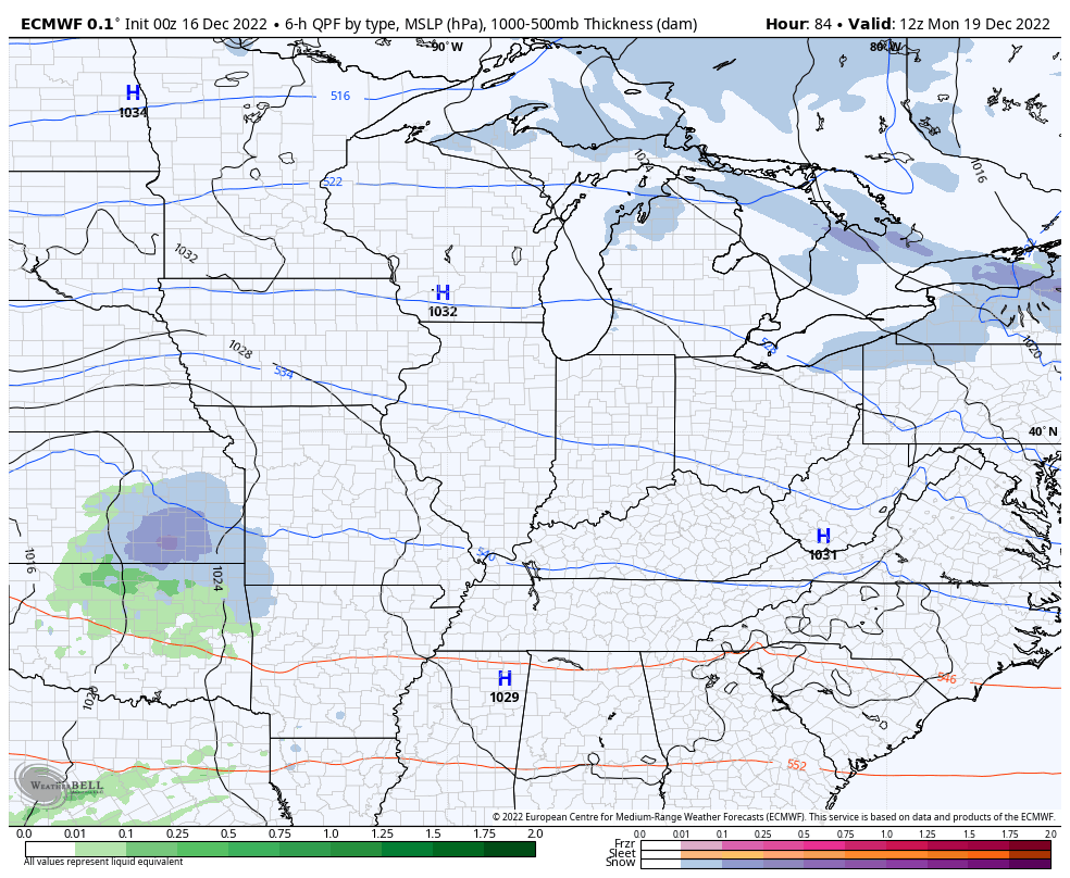
The Canadian looks a lot like that, but the GFS does not. This model continues to bring a band of light snow across the state as this system weakens…
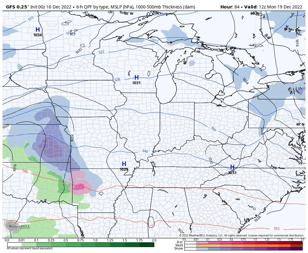
While not likely, this isn’t a scenario where I can totally discount what the GFS is saying.
This brings us to the setup for late next week into Christmas weekend. The potential is there for a major eastern US winter storm that would be followed by a severe arctic outbreak. How all this plays out exactly will continue to come into focus over the next few days, but there’s a very strong signal for a big event taking place.
Last week, I told you guys to watch December 21-23 for a possible storm. Not too long after that, the models started showing something and they continue to have the signal. Again, the exact evolution of the storm changes a bit from run to run and will continue to do so for a while longer, but they aren’t wavering in showing the potential.
What impact this has on our weather remains to be seen, but we will be hard pressed to go through this with, at least, SOME snow. I can’t tell you if it’s a little, a lot, or somewhere in between. 😜
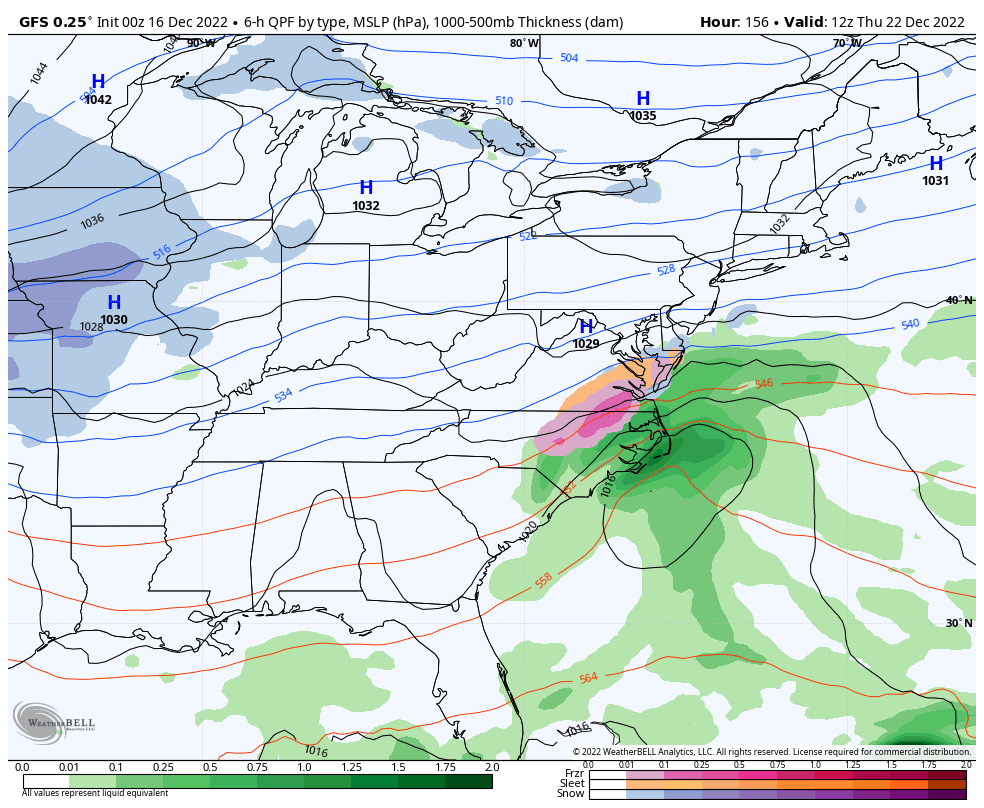
Here’s the latest GFS as of this writing…
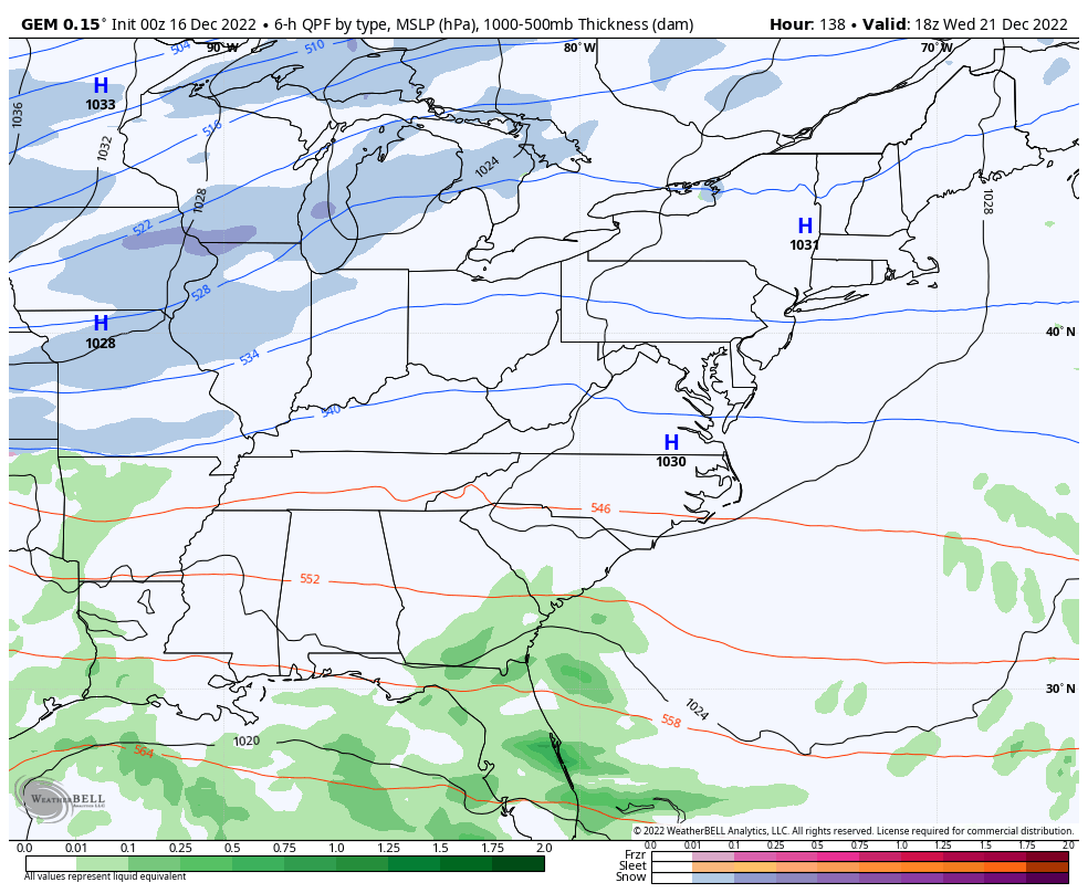
The Canadian…
And the European…
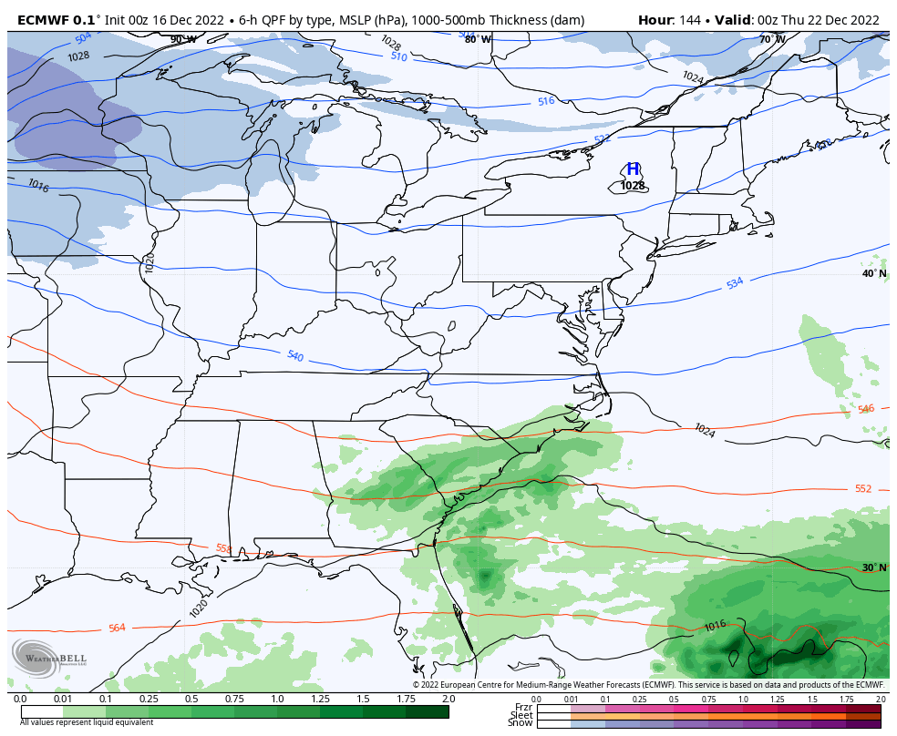
You can see how they all have a general theme, but vary on placement and timing. The models are into that 4-7 days out of an event window and this is usually where we get some wild swings. You may see one run with a blizzard while the next run shows a simple arctic front passing with just a band of snow.
Oh yeah… about that arctic air. Lows from Friday into Christmas weekend can make a run at zero or below. Wind chills may be absolutely brutal…
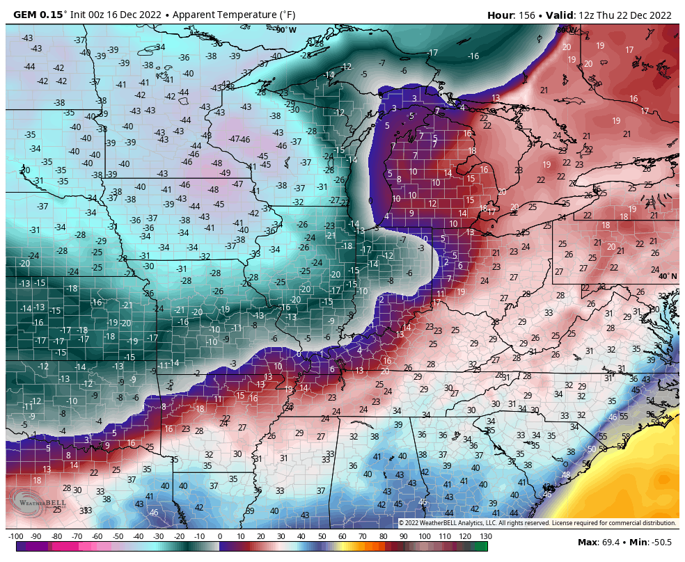
Severe cold takes us into early the following week, but should ease a bit but remain much colder than normal. We will also have to watch for another southern stream system before the week is over.
I continue to see a cold and stormy pattern well into January with another severe cold shot or two a good possibility.
Your normal updates will be on here later today. Have a fantastic Friday and take care.

Hang on kids it’s going to be a wild ride lol but we got the best watching it for us thanks Chris. ROLO what’s the song of the day???
you beat me, u rascal. song is high cost of living by jamie johnson.
It looks to be shaping up that the further east you reside in the state the better chance you will see accumulating snow.
1-75 east has the best chance.
“The same dog and pony show” we have seen for over the past few years.
We’re due which way, this will be the winter we will get it. Heck I’ve already received 3-4 inches back in November very rare.
The look of that Christmas Eve-eve storm on the GFS, oh my goodness!!! I am both excited and concerned that this may keep me from my holiday dinner with the fam! We may have to postpone!
Seems the more intense the system might become, the main action would be more south and east of KY. East and north east could be a doozy. It would be cool to be in a cabin up in the Smokey Mountains for this. Presuming stocked up for it!
Still a Dumb & Dumber chance though for snow!
We’re bound to see one or two model runs over the next few days that will make us say, “Freeze it, I’ll take that one!” I’ll be happy if South Central Kentucky doesn’t get left sitting high and dry, which is what usually happens.
With the possibility of subzero cold on our doorstep, it’s a good idea to make sure that your garden hoses are drained, and outdoor faucets are insulated. Frozen/busted pipes are no joke!
JoeD, I’m sure all the plumbers are already dreading all the burst pipe calls they’re going to start having.
06z GFS bringing home the bacon.for EKY..2 systems on the 23/27..Noticeable shift NW..Long way to go..Just for fun snowfall map..
https://hosting.photobucket.com/images/i/5475feet/Screen_Shot_2022-12-16_at_8.34.59_AM.png
06z GFS doesn’t even agree with its own ensembles, long way to go
Fingers crossed that WKY finally gets some snow!
imagine a blog update will be coming with that 12z gfs run
CMC does not agree with GFS