Good afternoon, folks. Colder winds continue to blow across the region today as some sun and clouds do a little battle. While some flakes will fly from time to time into the weekend, the main focus continues to be on the harsh winter pattern ahead leading up to Christmas.
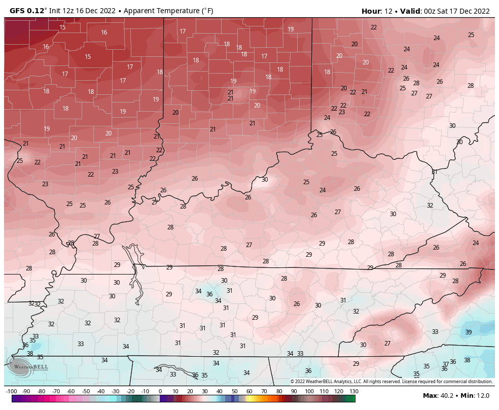
In addition to a few flakes flying tonight and Saturday, temps continue to come down as winds stay a bit gusty. This makes for seasonably cold wind chills through the weekend. Here are the wind chill numbers from 7pm today through 7pm Sunday…
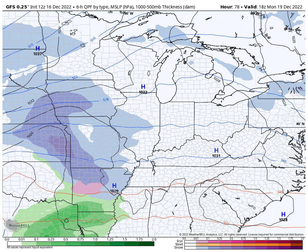
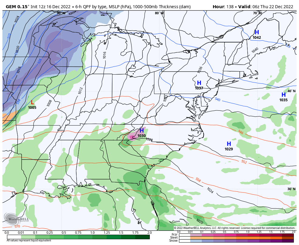
The system early in the new week continues to be pretty much a nonevent as even the GFS is now weakening this…
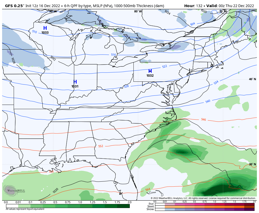
All eyes continue to be on the increasing threat for a major winter storm to blast much of the eastern half of the country by Thursday and Friday. There’s enormous potential with this setup and this is likely to turn into widespread disruptive storm for millions of people.
While the exact impact this storm will have on our weather is still days away from being known, confidence continues to grow that we will have an impact. What’s on the table? Anything from a simple arctic front passing through with a little bit of snow to, at the other extreme, a blizzard. Of course, there’s a lot of scenarios in between those two, so keep that in mind. It’s not too often where you have a ceiling as high as this storm, though.
At one point or another, all models have been showing this storm becoming a blizzard across the eastern US. They show it, then then have a weaker system on the next run. That’s what I told you guys would happen for a while.
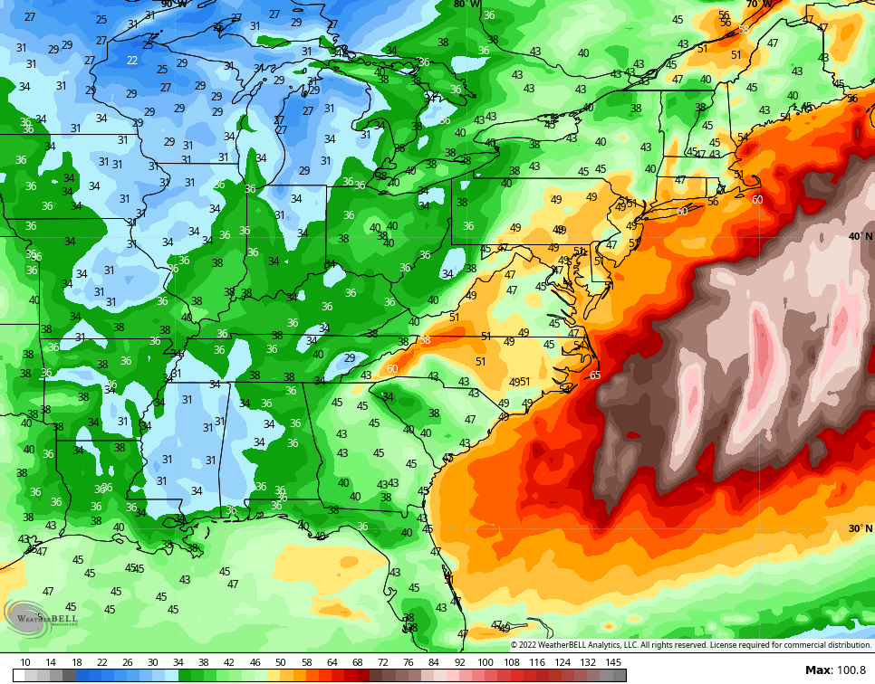
The latest GFS flexed again…
Check out the peak wind gusts with this run…
The latest Canadian Model doesn’t go to that extent and has a solution that’s quite a bit different…
Even with that different solution, you can see how we still get snow around here.
The Canadian is having the most run to run variability right now and the solution you see above isn’t likely. It’s putting too much emphasis on the northern stream energy instead of digging farther south and east.
Again… It’s too early to talk about anything specific as I can’t tell you how much of this storm will impact us at this point. The possibilities are certainly there and the ceiling is high.
Regardless of the exact impact of this storm, bitterly cold air follows for Christmas weekend. Temps have a chance to head to zero or below with wind chills well into the danger category.
I will have updates on WKYT-TV starting at 4pm and again here on KWC this evening. Until then, here are your radars to track any new flakes in from the northwest…

Make it a great rest of your Friday and take care.

Thanks CB! Seems snow lovers would cherry pick the long range GFS right now.
I think the best Snow chances will be in the Appalachians and inland Northeast. Hoping we won’t get any colder than we are today for Christmas.
Schroeder, I’m thinking that the system will be a tad slower than the models are predicting, so chances are better than even that we could see 4-6″ in South Central Kentucky, with higher amounts to the east and north.
This system is ticking all the boxes for a sizeable Nor’easter. Growing up on the Jersey shore, I’ve experienced more than a few, and this setup reminds of a particularly nasty one in the late 60’s.
We had a particularly nasty Nor’easter back in the late 60’s that had a little of everything. Winds gusted near hurricane strength, there was lightning & thunder, snowfall rates at times were 3 to 4 inches an hour, and drifts were huge! I can’t remember the exact accumulation, but I’m pretty sure that it was over 30 inches.
Joe, I’ve seen some deep Snows too, but not what you experience there in the Northeast. Only experience Thunder Snow once in 1975.
I read the long range accrue weather is saying people as far Nashville might see snow and saying ky is right smack in the middle of it, oh it also said could be blizzard type one .
We’ll see what happens as we get closer to Christmas.
Looks like quite a shift west on GFS..Looked like a baby step in the Euro direction..Cutter..Don’t understand,every weatherman and there mother talking about all this blocking but we may end up with a cutter..lol..