Good Saturday and welcome to the weekend. We continue to see a few flakes and seasonably cold weather, but it’s all eyes on the harsh winter pattern ahead. For those dreaming of a white Christmas, how big do we dare to dream? That’s the question as we track a potential storm system.
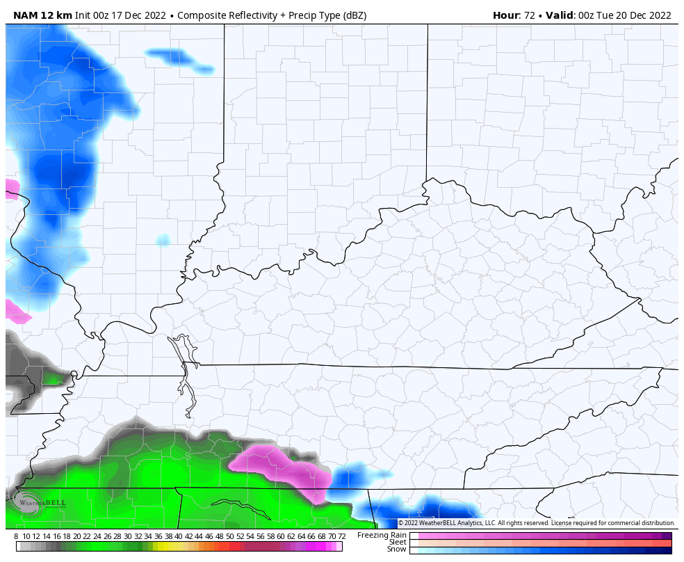
Before we get into the storm threat and bitter cold, let’s start with what’s out there today… A few flakes.
We continue to track a few pieces of energy working through the Ohio Valley and these may touch off some flurries or scattered light snow showers through tonight. Areas getting in on these won’t see much of anything besides some festive flakes. ❄
Here are your radars to follow the festivities from the sky…

Temps are seasonably cold this weekend with highs in the 30s and lows that can reach the upper teens to low 20s Sunday and Monday mornings. The wind will make all the numbers feel much colder.
That weak system early next week is still likely to fall apart before it gets into Kentucky, but the NAM is trying to buddy up with the GFS in showing a little bit of action Monday night and early Tuesday…
I doubt much of that actually shows up.
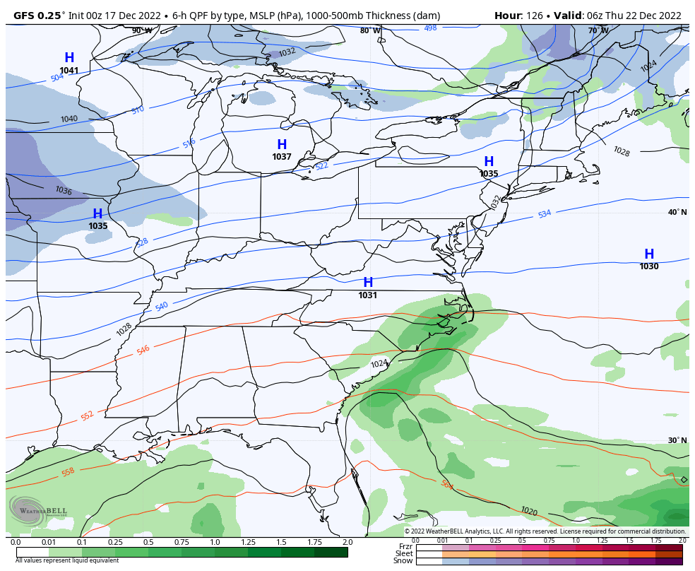
As we look ahead to the main show for the second half of the week, we are finding two distinct camps in terms of how the models are playing this storm, but remember we are in that window I always talk about how some model shows a solution then loses it, only to bring it back a few days later.
One model camp has a farther east storm as the energy digs farther south into our region and into areas of the deep south. The other camp is for a farther west solution for the initial storm as the energy digs more into the Ohio Valley and Great Lakes.
In terms of the east camp… The GFS continues to have a pretty steady solution and has for several days now…
The ICON had been in the western camp unto its last run, then decided to give the GFS some support…
![]()
![]()
Both of those scenarios pretty much represent the ceiling in terms of the potential with this storm.
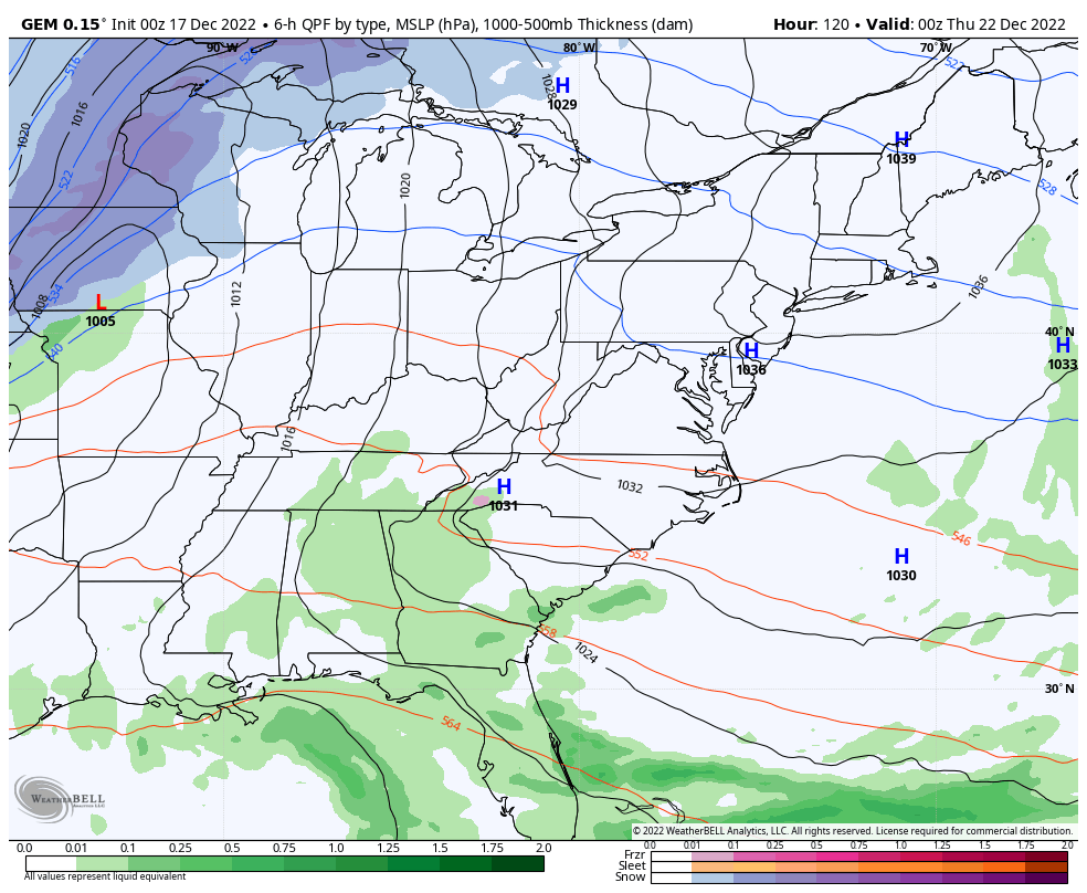
As far as the floor goes, we have the EURO and Canadian models representing that at the moment, but the floor is still a pretty good smack. Both of these models wrap up the upper low farther northwest, resulting in the initial low cutting across the Ohio Valley before a new low pops across the east.
CANADIAN
EURO
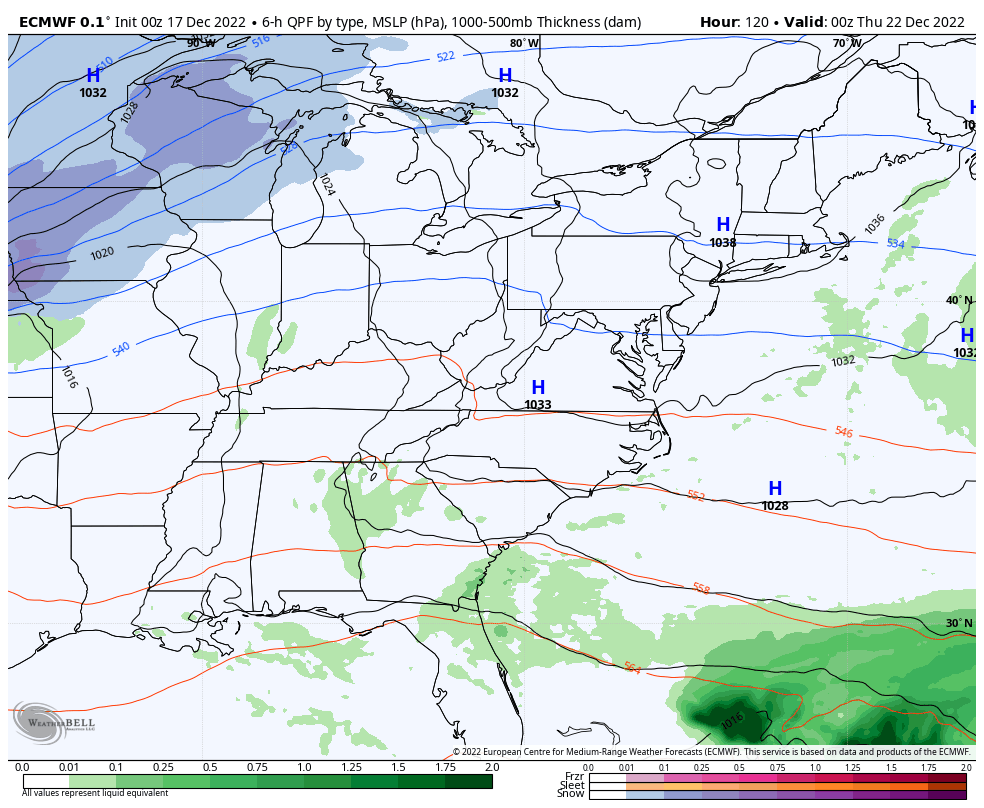
You can see how both of those models of those models start us as rain then quickly go to snow as temps drop some 30-40 degrees in just an hour our two behind the arctic front.
Which of those camps are right? I can see arguments for both, but I’m somewhere in between those two camps. It’s interesting to note that all 4 of the models above produce a blizzard but differ on where it will hit.
I suspect it won’t be until late Sunday or Monday before the models settle down and come into better agreement. Either way, it’s likely to snow around here Thursday and Friday with amounts to be determined.
Let’s talk about the wind with this storm. No matter the solution, some serious winds will show up. Check out the current peak wind gust forecasts from the models…
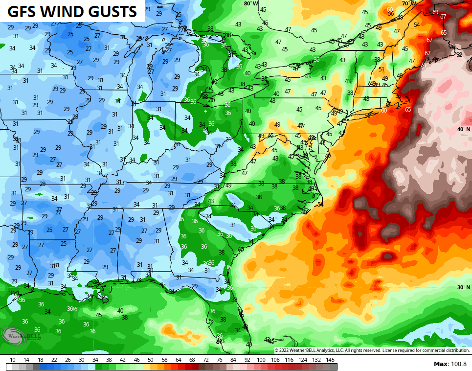
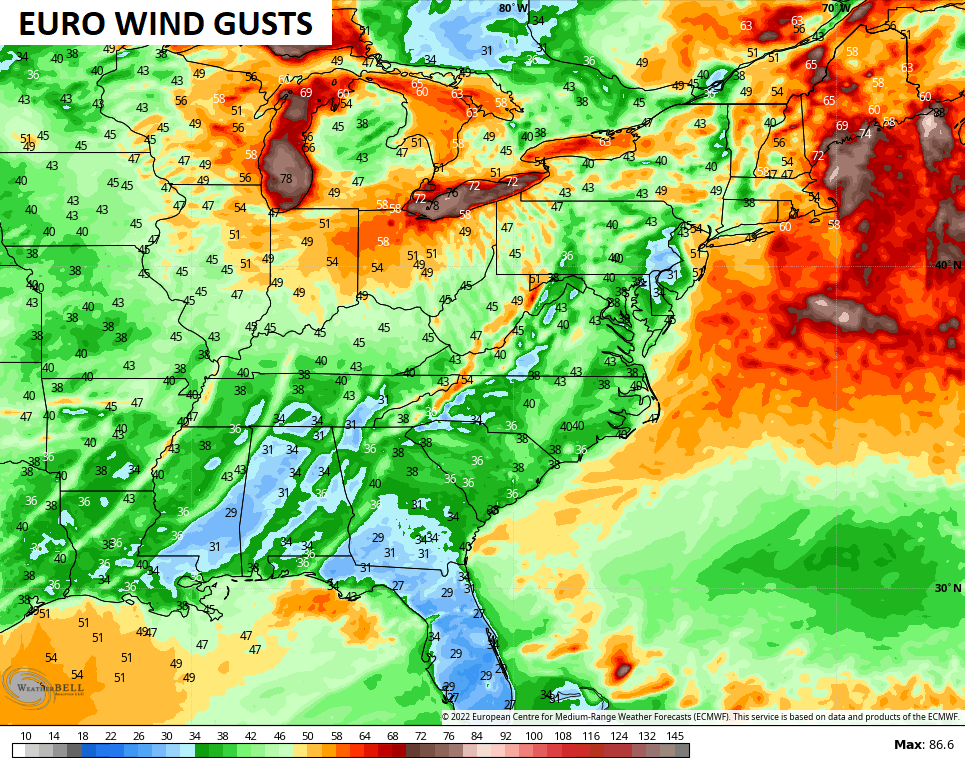
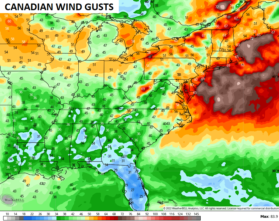
Those kinds of gusts with snow would be nasty!!
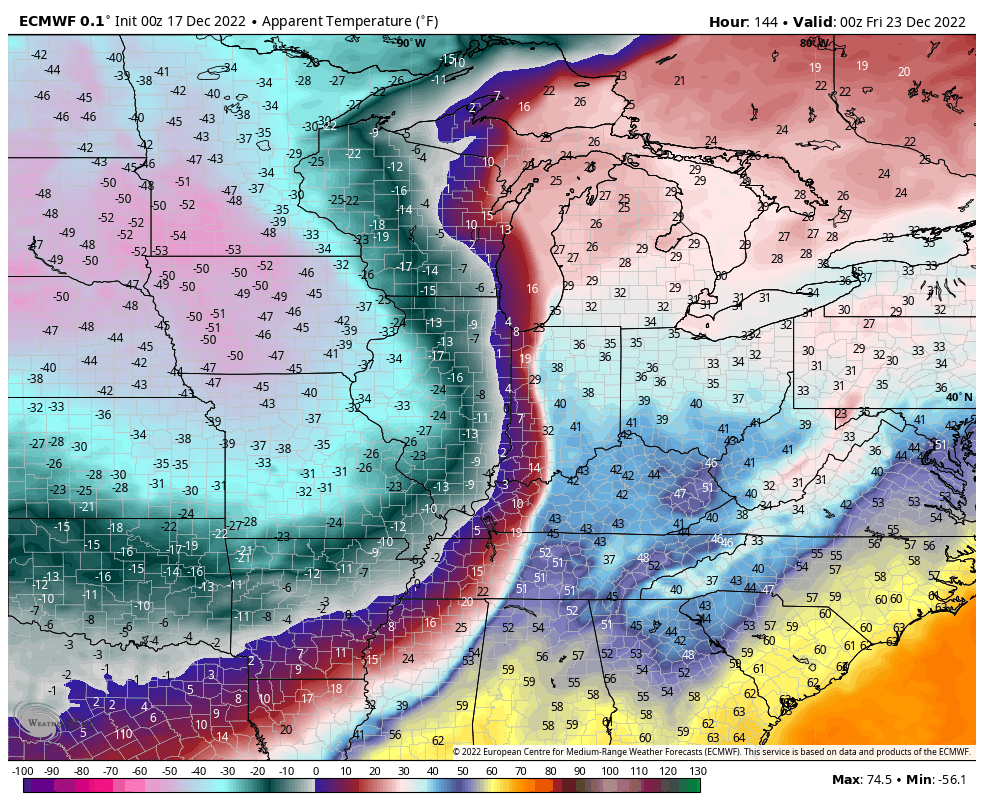
Bitterly cold air pours into the region behind the arctic front. Lows can make a run at zero or below this Christmas weekend. Wind chills could be absolutely brutal and the models are spitting out some ugly numbers…
EURO
CANADIAN
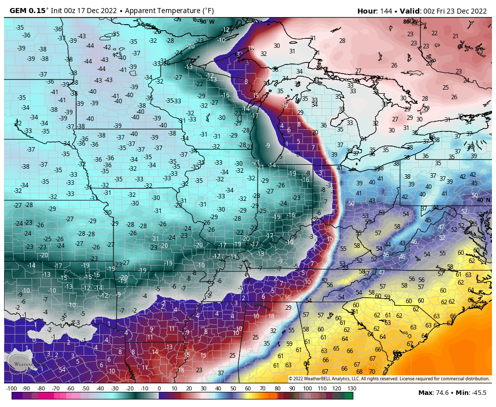
GFS
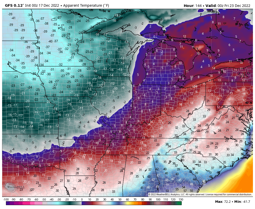
That’s a lot to unpack and I feel like I’ve rambled because I’m already tired and we aren’t to the heart of the tracking yet! 😩🥶❄️
I will have multiple updates later today. Have a good Saturday and take care.

song of day, if drinking dont kill me by the possum, her memory will.
A couple of days of model battles before an agreement.
Thanks Chris for all your hard work. Maybe some agreement between the various weather models will be coming soon on this impending Snowstorm / Blizzard. Always enjoy your live weather presentations on WKYT.
By the way, I received an answer from NOAA and this third year La Nina maybe weakening soon. Some warmer water showing up beneath the Tropical Pacific sea surface. El Nino will then form and give the Ohio Valley better chances for major Snowfalls.
The snow outlook for the Chicago area for late next week is the same as it is for Kentucky – there could be just a little light snow, or there could be a blizzard.
We currently have about a half-inch of snow on the ground from off-and-on snow showers the last two days. It is very cold, with temps around 25 and a wind chill near 10.
When does CB sleep?
GFS caves to cutter
GFS went digging more westward..Russel in Western Ky will like..