Good afternoon, folks. It continues to be all eyes on the big storm system set to impact much of the country in the days leading up to Christmas. This is likely to bring, at least, some snow and bitterly cold temps to Kentucky.
In the short term, we are still watching a few flakes trying to fire, especially across the north. Outside of that, it’s windy and cold. Here are your radars to follow along…

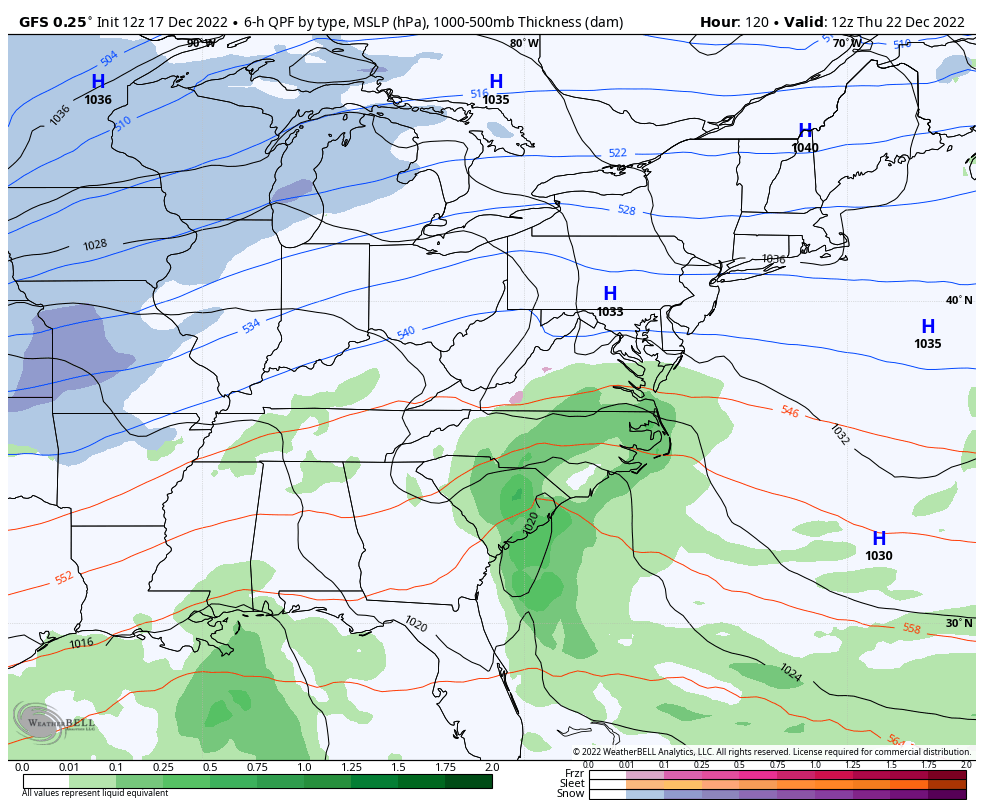
We are following the trends for the late week sprawling winter storm, but the exact details of how this storm evolves are still a few days away from being known.
The GFS has trended more toward what the but is much more of a big hit for our region.
The model now brings the arctic front in here on Thursday and slows it down as upper level energy digs in from the northwest. That spawns a massive low right on top of us with rain and a mix developing. This low then strengthens quickly into a monster storm system that moves from Kentucky into Ohio. As that happens, a rapid transition to snow takes over as temps tank and winds absolutely crank.
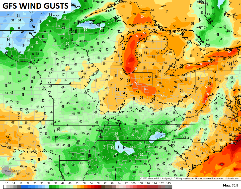
Taken verbatim, the GFS winds up at our ceiling by producing blizzard conditions…
Check out the peak wind gusts from this storm…
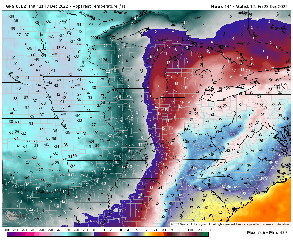
Temps on the GFS turn brutally cold. This animation starts at 7pm Thursday and goes through 7am Christmas Eve Morning…

Throw in those big winds and the wind chill numbers hit deep into the danger category…
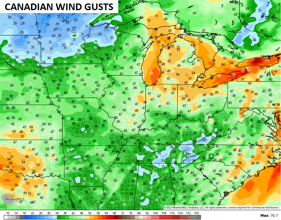
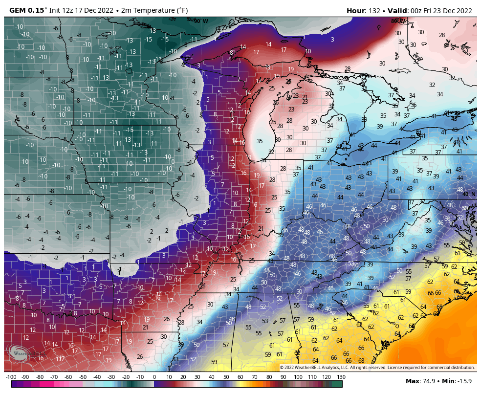
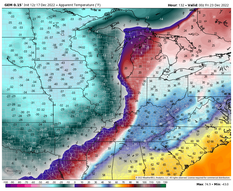
The Canadian Model is showing something similar to the GFS…
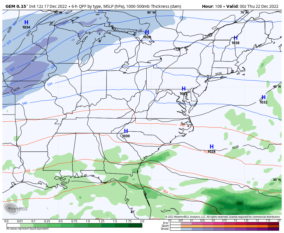
Here are the wind gusts…
The temperature crash is even more extreme than the GFS. This animation goes from 7pm Thursday through 7am Christmas Morning…
Wind chills during the same time…
Some things to consider:
- We are still in the early stages of forecasting this system.
- Expect the models to continue to flip around for a few more days before settling on a scenario.
- I won’t be able to give you exact details on this storm for another day or two.
- I can say, with confidence, we will be impacted by this winter storm. The extent of that impact is the forecast challenge.
- I am very confident of bitterly cold air invading Kentucky this weekend. Make preparations now.
- Be careful of where you get your forecast in the coming days. 😜
There’s an interesting analog to the storm the models are currently showing. I’ll talk about that with my next update.
Have a great afternoon and take care.

looks like roloeuro was on target a few days ago, below zero and 6-9 inches of snow, im ready to say full blown monster. afternoon song is I FEEL a COLD one comingon by montgomery gentry.
Should I ask Santa to bring milk and bread since the stores are about to get bombarded?
PRETTY MUCH.
GFS & Canadian as of this moment favors the heaviest snow northwest of Louisville area.
Imop
Look forward to the Euro run in an hour.
Need the Euro to start trending in the GFS direction..Just looked like to me GFS was baby stepping toward the Euro last few runs..
https://www.pivotalweather.com/model.php?m=ecmwf_full&p=sn10_acc&rh=2022121712&fh=162&r=us_ov&dpdt=&mc=
Again you can’t take any model run for granted untill the day of the snow gets closer. This low is way up above in western Canada as of now.
Climatology favors apps track, GEFS and CMCE still look good for us