Good evening, everyone. We continue to track a few flakes across the state through early Sunday, but our focus is on the harsh winter weather heading our way later this week into Christmas weekend. A major Ohio Valley winter storm will be followed by bitterly cold air.
Tonight’s flakes are more of a novelty than anything else. There’s a chance for a few snow showers in the southeast and east. I can’t rule out a rooftop duster or two.
Here are your radars…

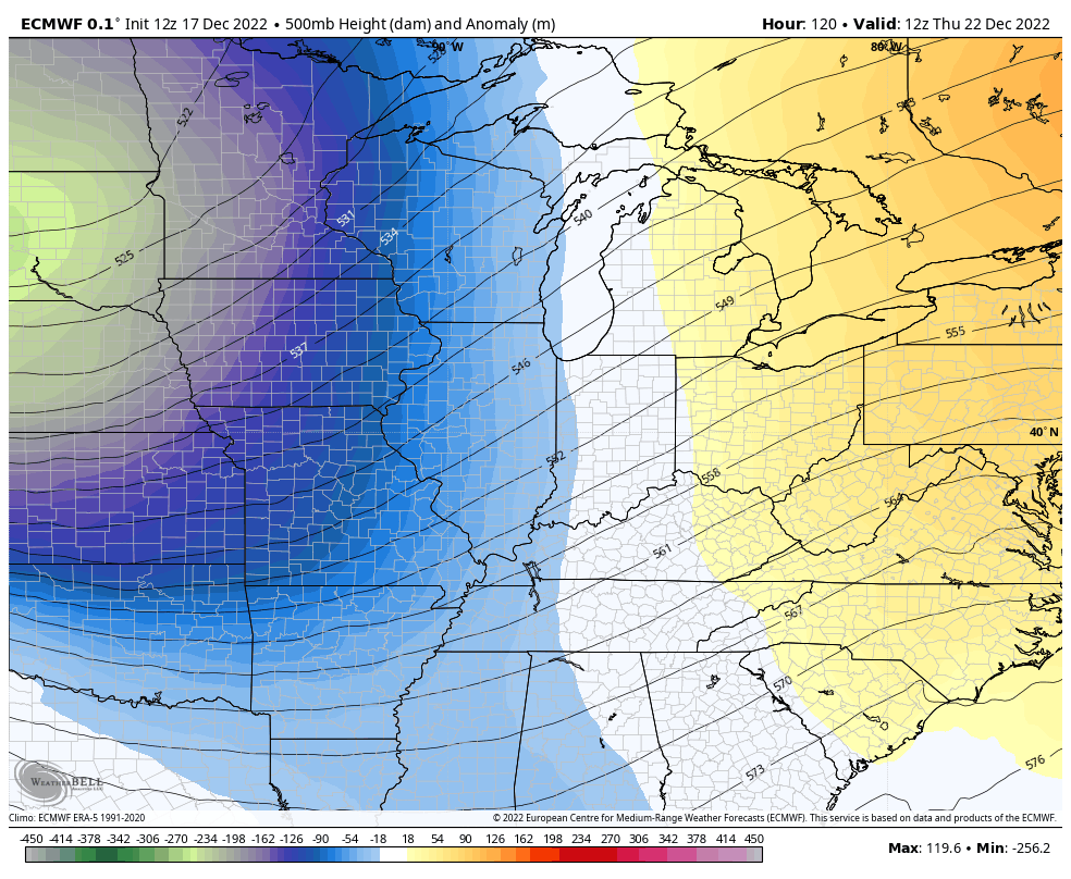
Let’s get to the storm system for Thursday and Friday. The models continue to dig in on a powerful Oho Valley winter storm, but they still have the typical differences in timing, strength and placement.
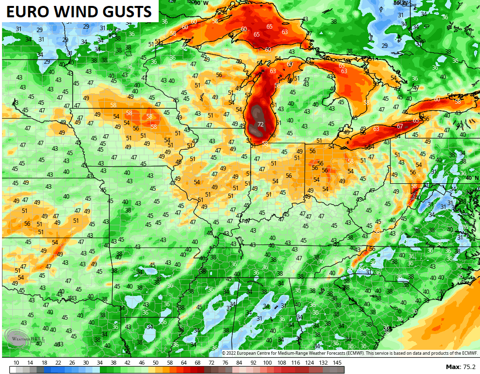
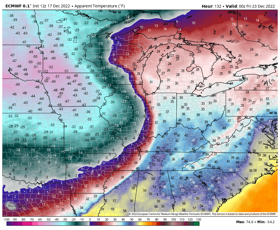
All this depends on the path of the monster upper low crashing into the region. The EURO is wrapped up with this thing and has the farthest north track…
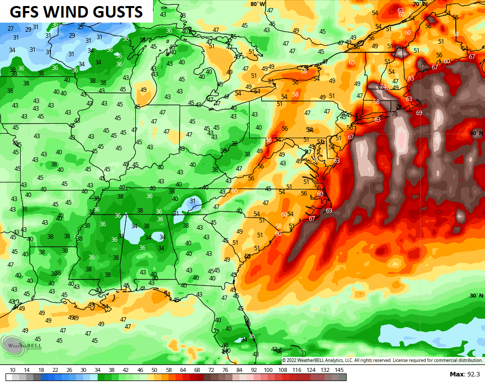
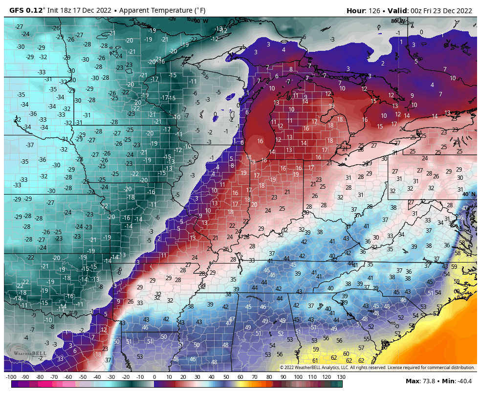
The GFS has that coming in slightly farther south and not as wrapped up…
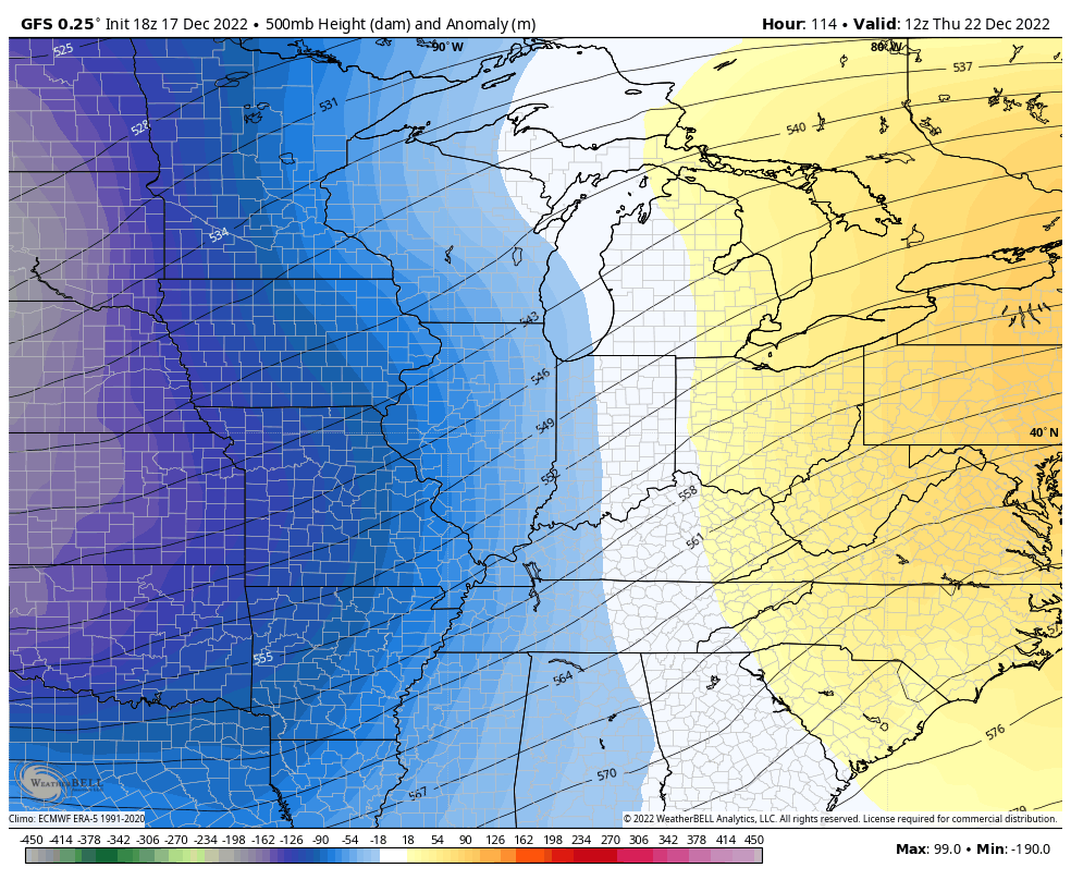
Just that much of a difference means a lot for the actual weather around here.
With the farther north and more wrapped up upper low of the EURO…that means the surface low tracks a little farther west with rain changing to wind driven snow around here as bitterly cold air surges in…
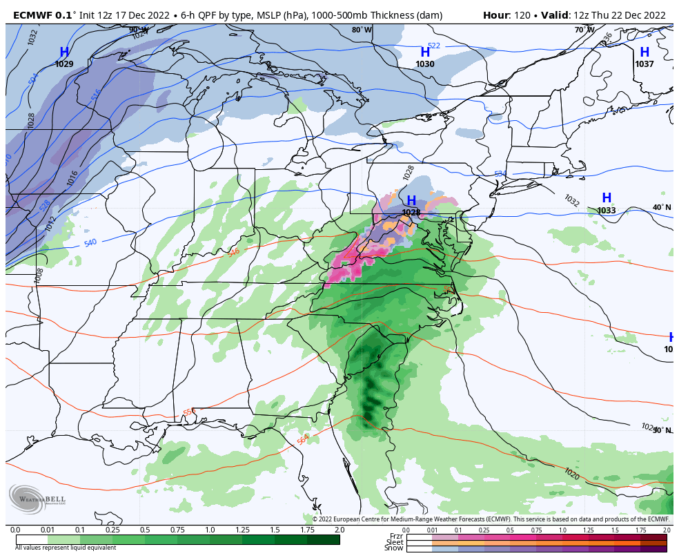
Taken verbatim, that’s a 2″-4″ wind driven snowfall across Kentucky.
The GFS is farther east with that low and wraps it up even more as it moves through Pennsylvania and New York …
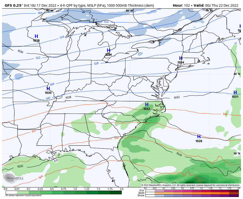
That run is a crushing double digit snowfall for much of the state.
Essentially, the EURO represents our snow floor while the GFS is the ceiling.
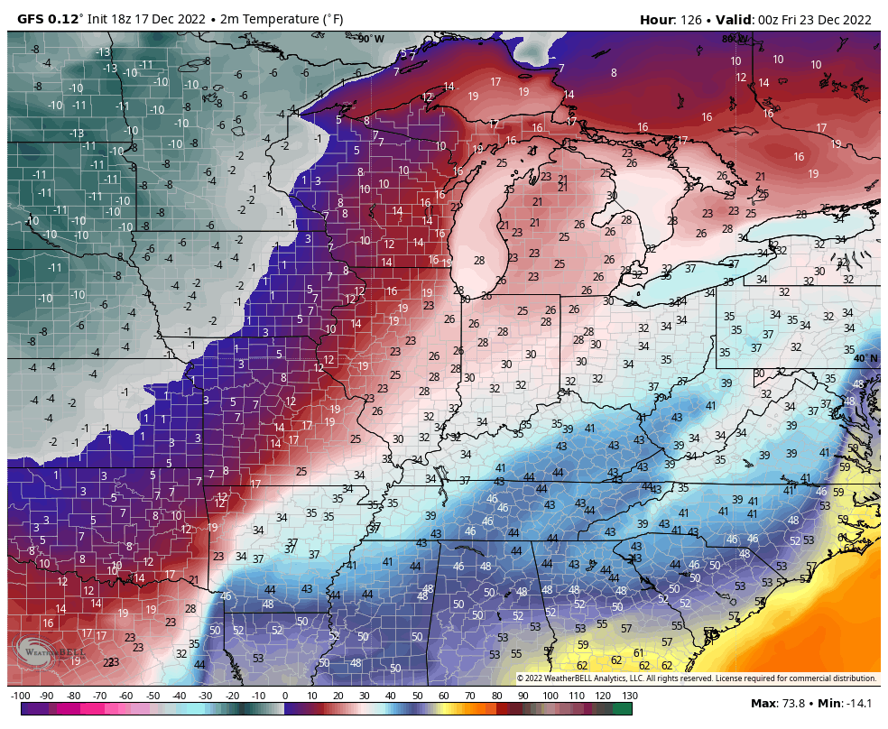
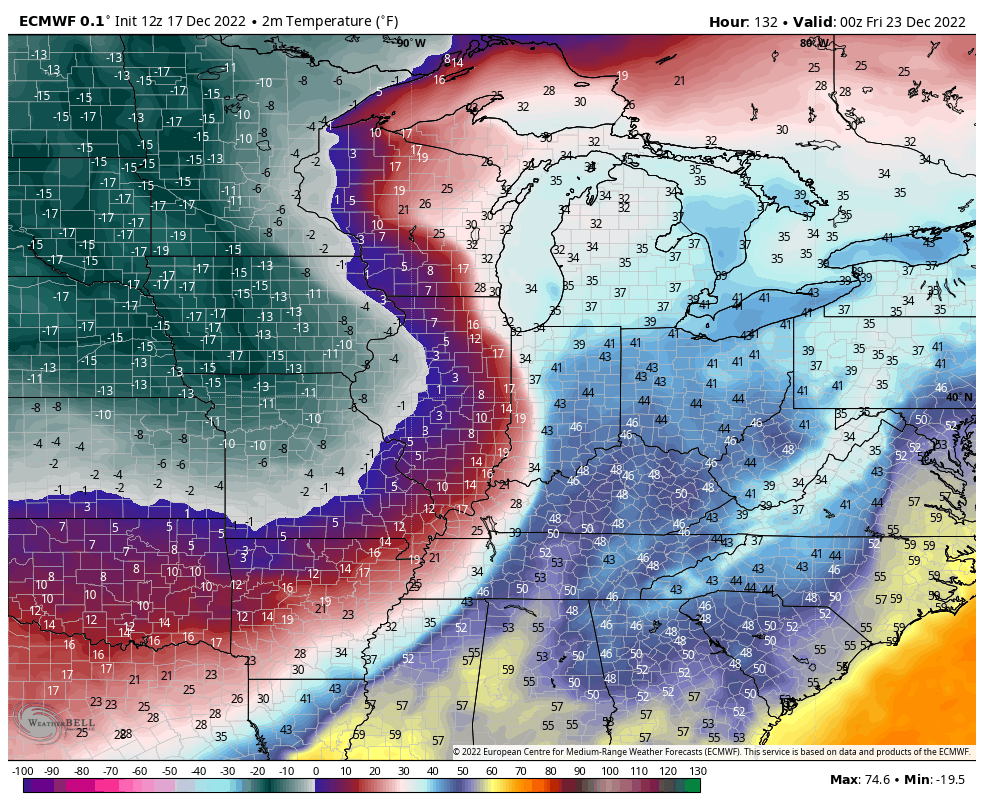
Regardless of the track and intensity… High winds and BRUTAL cold will be likely with this storm.
Both models take low temps below zero at times over the weekend. This animation goes from 7am Friday through Christmas Morning…
GFS
EURO
Wind chills for that same time are brutal…
GFS
EURO
Those kinds of numbers can be deadly. I urge everyone, including local and state governments, to start preparing now for the bitterly cold temps.
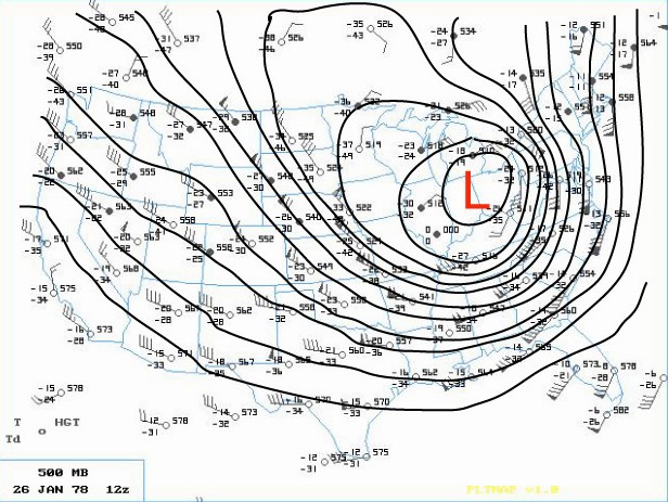
There’s no real analog to this event and that includes the Blizzard of 1978. That’s in a league of its own. Still, the upper level setup isn’t too dissimilar…
I hope to be able to give a rough outline of this storm’s impact on us later tonight or Sunday.
Make it a great evening and take care.

Brutal cold is right Chris. I hope you get some rest before all that but I don’t believe you rest or sleep lol. You always say sleep is overrated. We appreciate all you do and your hard work. Bundle up guys.
The GFS is overdue to deliver, and I’m ready. I found the snow shovel brought with me from Pennsylvania about 29 years ago, and my leaf blower is my plan B.
I’ve already got plenty of bread and milk, what I need to get are steaks and wine!
Again, GEFS looks good
Cold air and high wind are a bummer combo, but will take that and whatever snow, any day over ice.
Will be interesting in a frigid sort of way.
Ticked back East some..Looked liked maybe trying to go negative tilt looking at the vort maps…Have no clue..Should be about time for Euro to hop on board or GFS is on it’s own..
https://www.pivotalweather.com/model.php?m=gfs&p=snku_acc&rh=2022121800&fh=156&r=us_ov&dpdt=&mc=
I guess it’s bad news in eastern Ky on that run isn’t It??? As Chris says it will change.