Good Sunday, folks. The harsh period of winter weather I’ve been alerting you about for weeks now is just about here, and it’s looking really nasty. Bitterly cold temperatures will be introduced by a major Ohio Valley winter storm Thursday and Friday.
Let’s start this party off with the early day flakes that are flying. This is part of the festive flakes we’ve yapped about for more than a week now. It’s not much at all, but a coating can’t be ruled out early today in the east.
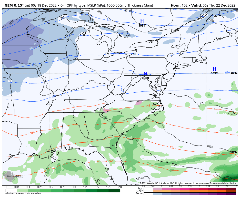
Here are your beloved radars…

Ok. Let’s talk about the winter storm potential and the bitterly cold air for Christmas weekend.
I’ve made no bones about the potential with this setup. What happens around here depends on how things play out in the upper levels and the setup is rather extreme way up there. We will get a major piece of upper level energy to dive into our region, but the exact track of that energy is crucial to just how strong this storm gets and, in turn, how much snow you can get in your backyard.
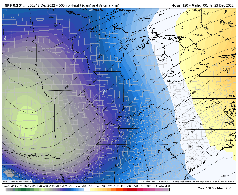
The GFS, oddly enough, has been the most consistent model with this storm. If you know anything about me, you know I like to ride consistency when it comes to models, but only if the scenario is plausible.
The GFS has been showing this upper level energy being much farther south than all the other models with the track right on top of Kentucky and Tennessee…
The Canadian Model had been taking that same “ball” of energy farther north into the northern Ohio Valley. The latest run came south to join up with the GFS…

You can see how the angle of the “dive” is a little different, but the final placement is similar.
The UKMET also jumped into the GFS party…
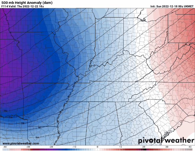
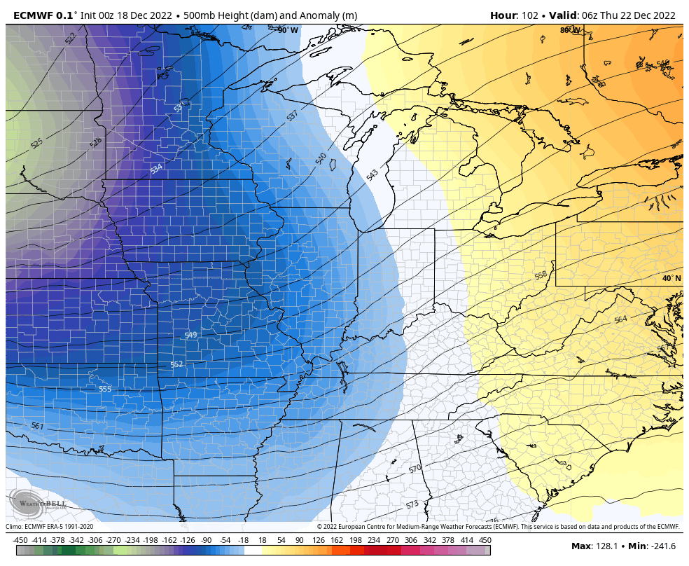
The EURO was the farthest north of the entire bunch and still is, but it’s also trending farther south…
The GFS continues to show a big hit for our region and the Great Lakes, especially…
With the upper level energy on the Canadian coming farther south and east, it makes sense for the surface low to come farther south and east…
It’s not quite as strong as the GFS in terms of the surface low and that has to do with the difference in the angle of “the dive” of that upper level energy.
The EURO continues to go the way of the Canadian…
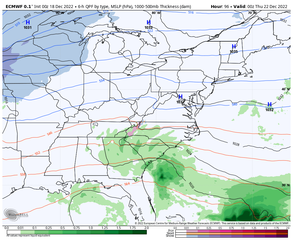
The EURO would bring the lowest snow totals of the bunch, but would still be good for, at least, a few inches of snow.
Folks, it’s about paying attention to the trends and not a single snapshot of any one forecast model.
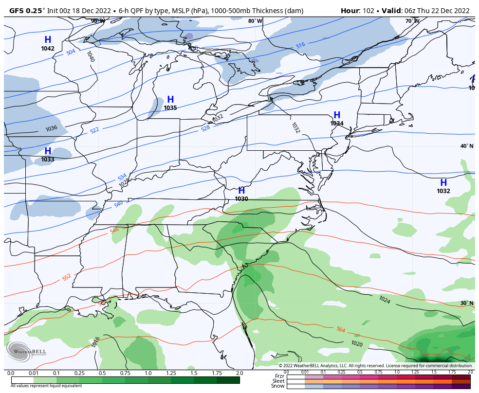
Regardless of the track of the low or snow amounts, winds are a MAJOR player. Check out some of the forecast wind gusts…
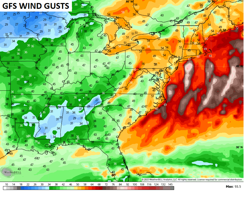
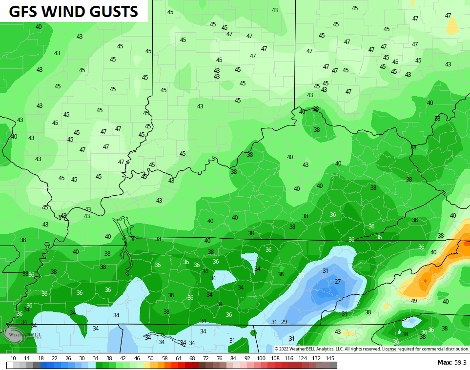
The EURO…
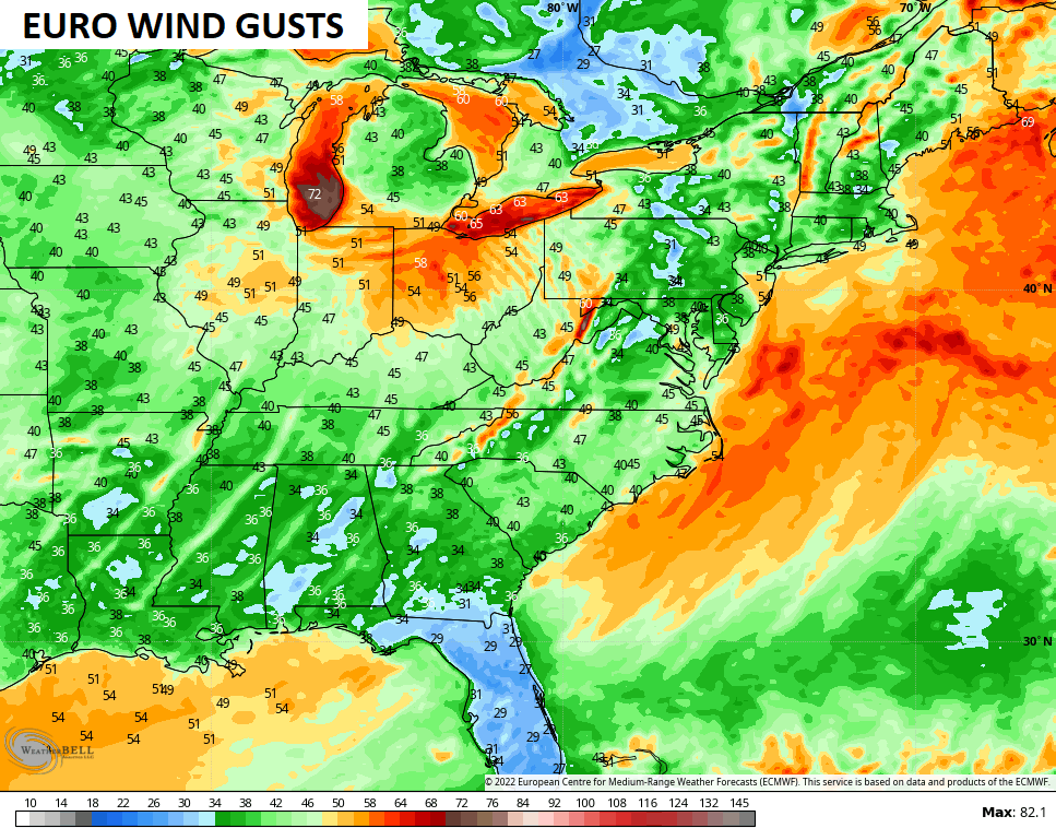
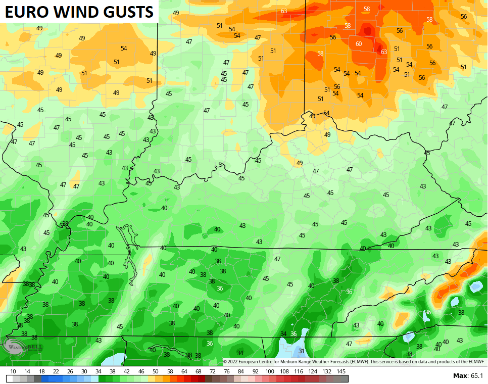
Imagine those wind gusts with snow falling? You will be hearing the term blizzard and blizzard conditions a lot in the coming days. Do we get in on that part of the storm here in Kentucky? I simply can’t answer that at this moment.
The cold coming in behind this is serious and may very well become life-threatening.
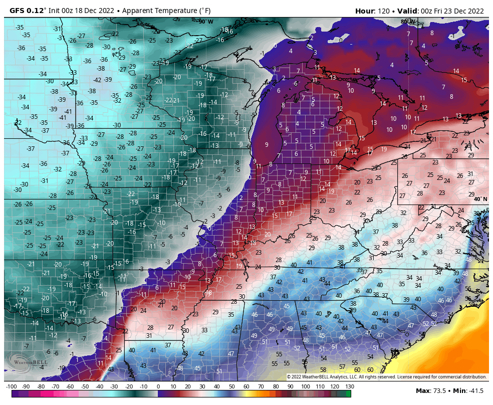
Check out the forecast lows on the GFS…
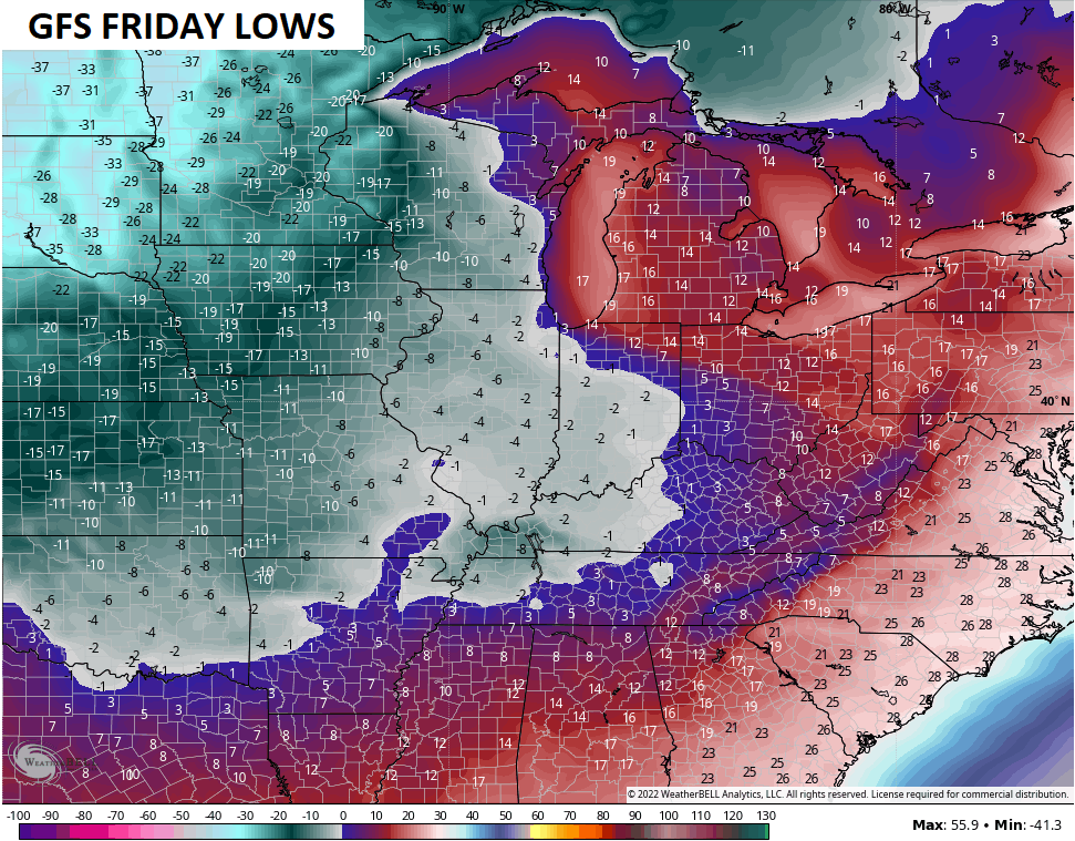
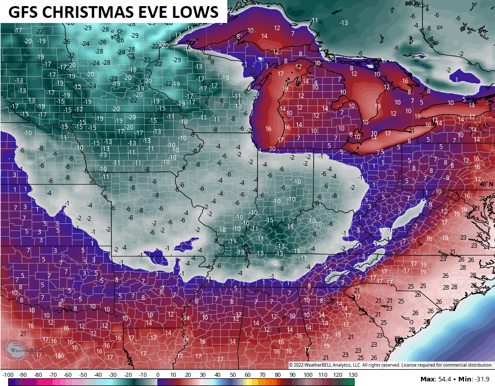
Combine those bitterly cold temps with the gusty winds and you get incredibly dangerous wind chills…
GFS
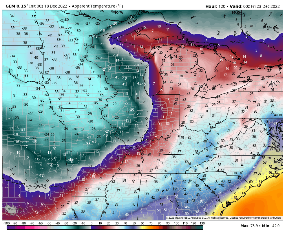
CANADIAN
EURO
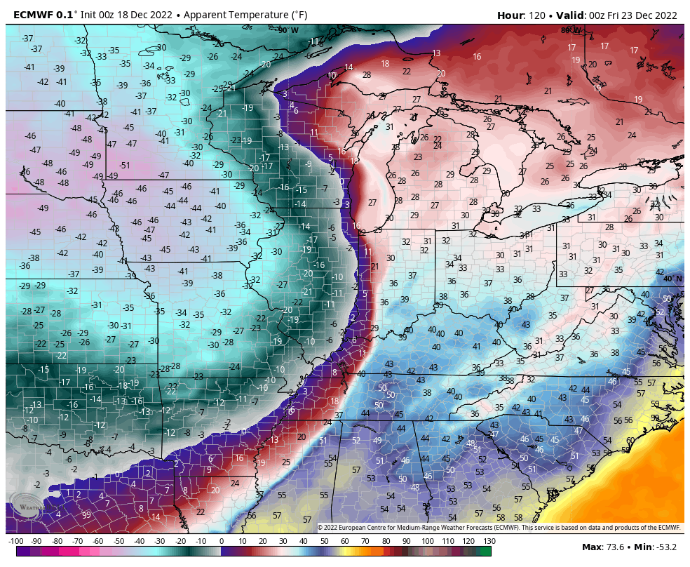
As I said earlier, you need to prepare now for the bitterly cold air coming. Below zero temps and wind chills well below zero are possible Christmas weekend and, perhaps, into early the following week.
I understand everyone wants to focus on the snow potential, but it’s too early to talk specifics. My confidence is high for snow later Thursday and Friday, but I can’t get more specific than that. Maybe I will feel more confident in talking about possible amounts later today. Maybe. 🤔
I’ll see you back here for updates through the day. Have a great Sunday and take care.

fire in the hole!!!!!!!!!! song is long december by counting crows
The most recent runs of the GFS have shown that the changeover from rain to snow is decreasing with each successive model run. This will provide a better environment for snow to stick, and will cause road conditions to deteriorate rapidly. Make sure to insulate your outdoor faucets and drain all of your garden, since repairing pipes in these conditions can be a monumental task.
Joe by it moving east do you know if that would take eastern Ky out of the snow??
I really don’t think so, Crystal, you are likely to get a bigger hit than my neck of the woods, just on the basis of your area being at a higher elevation than Western and South Central Kentucky. Nothing’s guaranteed, but it seems like the odds are getting better with every successive model run, and it could be memorable!
Oh okay thank you Joe. I too hope we don’t have any pipes freezing but as Chris says the cold may be brutal.
Drain your garden HOSES!…
I’m trying to remember the last time we had temps well below zero… I do remember it getting -17 to -20 several years ago..but I don’t think I’ve ever insulated my outdoor hose connection…I’m definitely going to do that.
Thanks Chris, for all your updates on this impending and potentially dangerous Winter weather that may affect a lot of plans for Christmas. Hoping all the young and old who want a nice Christmas Snow get their wish.
Bring the snow, but not the extreme cold. Will Chris bold winter prediction come to a fruitation only time will tell
Quick freeze could become a major problem.
Frozen electrical lines will snap. Extreme gusty winds.
I watch transformers blow up all during the night in 1978.
Hope this system stays predominantly snow.
Morning GFS surface low in Indiana/Ohio..Not a track EKY wanted to see for heavier snow..Was ticking SE For the last few runs and that was what we wanted to see keep happening ..Me think’s the Euro has been consistent also..Would have to give the nod to the Euro so far ..Still a 2-5 snow statewide..
Trend is not our friend..Cutters gonna cut..This keeps up be lucky to get a dusting..
Latest GFS bears that out. Center of activity trending trending to the North and East. Great lakes and New England may get hammered, us not so much, unless you have snowmaking artillery!
GEFS says GFS is too far west
Dangerous situation setting up honestly..Hope this monster keeps going NW personally..Zero degrees with wind gusts possibly over 50 and no power..Lot of travelers on the highway..Yikes..Looks historic up North..
On you talking like a nor’easter for the coast??? I love snow but maybe we will get a little. I like having power too lol. I hope in East Ky we got something but maybe we will get an inch or two. I am dreading the bitter cold though. Chris said on Twitter prepare for the cold and stuff now.
It’s a wound up system Crystal,,would think everyone gets some snow unless it keeps trending NW and that could possibly hurt EKY..Lets hope the SE trend comes back..