Good evening, folks. As the festive flakes wrap up in the east, the focus continues to be on the harsh winter pattern for the end of the week ahead and into Christmas weekend. This will bring the threat for snow, high winds and bitter cold into the region.
Before I get into my thoughts on the late week setup, I wanted to share two great discussions written by forecasters from a couple of the local NWS offices.
This comes from our old KWC friend MJ at the NWS in Louisville…
Here’s another from the NWS in Paducah…
Both of those are well-written and spot on with what I’ve been saying here. It’s always a good thing when some really good forecasters share my thoughts. Here’s hoping those folks are given the keys to the NWS forecasts this week.
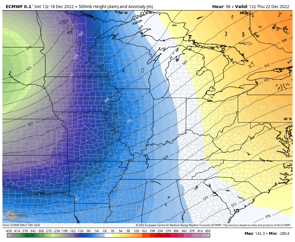
The setup comes down to the upper level system digging in from the northwest. The track and intensity of this will be the difference between just a little bit of snow or a lot of snow where you live.
I’ve made two graphics to illustrate my point. The first track isn’t a good one for snow lovers across Kentucky, but would still produce light snows…
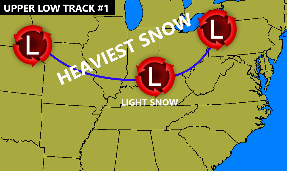
That track puts the heaviest snows to our north and northwest.
If you want heavier snow here in Kentucky, you want that upper level system to pass farther south…
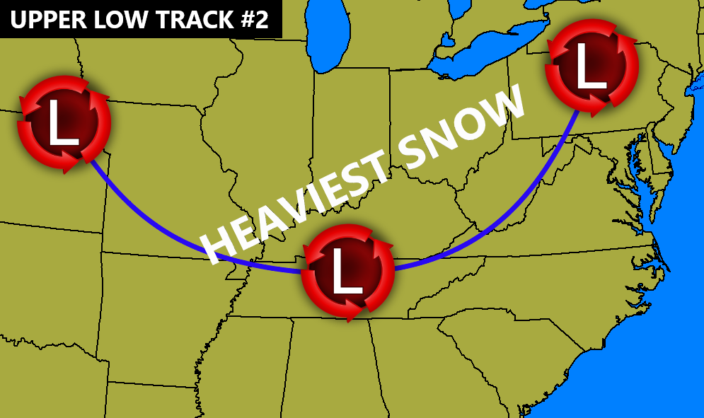
Of course, we have some in between those two, but they represent the farthest south and farthest north I think the track could go.
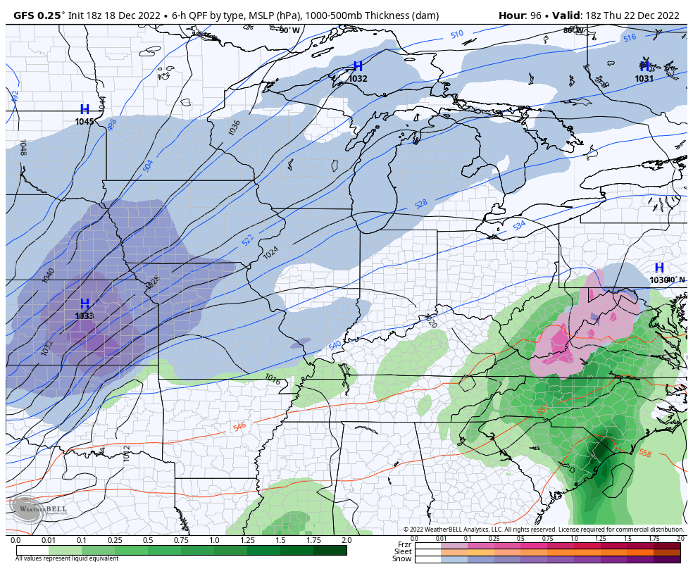
The new GFS is in between those two scenarios and it’s forecasting a monster storm…
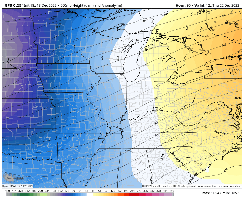
At the surface, you can almost see an eye-like feature under the center of the storm…
Wind gusts are absolutely nuts…
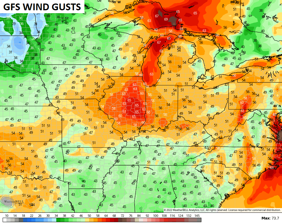
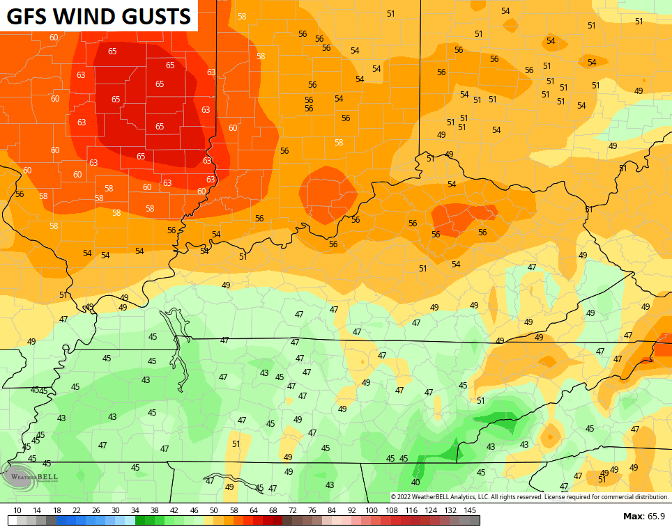
Goodness gracious.
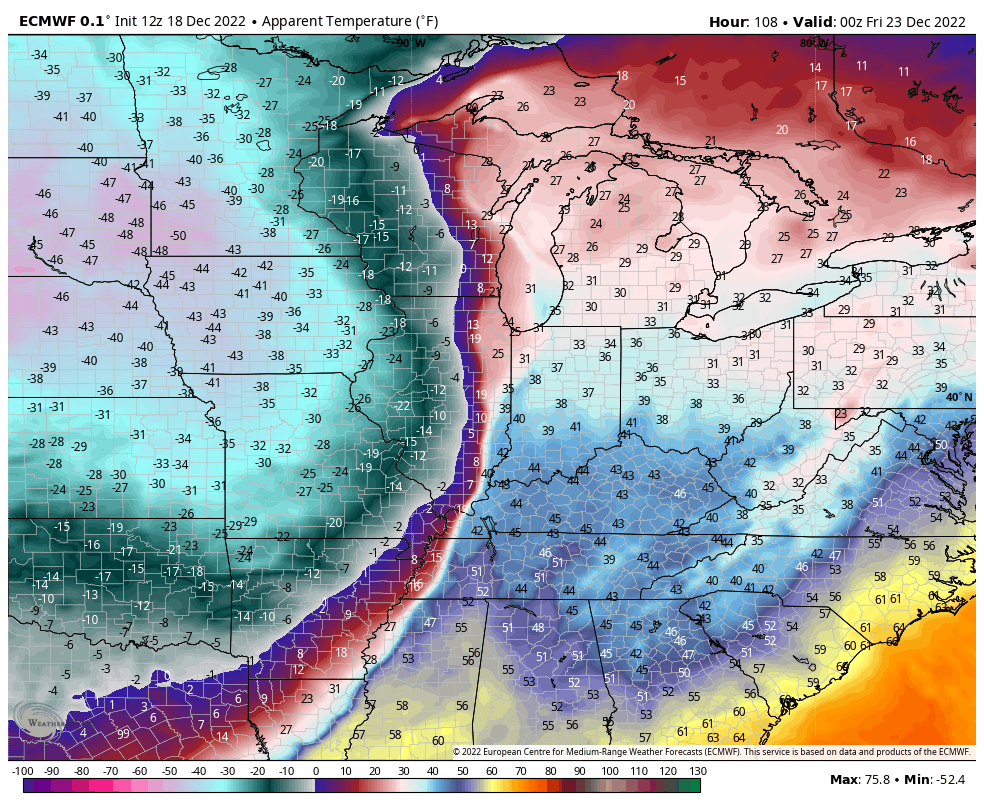
The EURO is right on scenario #1 with the track of the upper low…
But, that energy is so strong that it develops an even stronger and more wrapped up surface low that’s similar to the GFS. That brings rain to a wind driven snow followed by nice wraparound lingering into Christmas Eve…
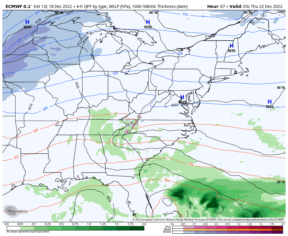
That whole scenario is actually a really ugly one around here. Why? We get rain to wet everything up before a rapid transition to snow as temps drop 30-40 degrees in an hour or two. The flash freeze with snow on top of could get nasty.
Here are the wind gusts from the EURO…
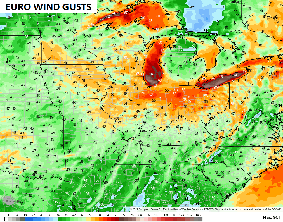
So, you can clearly see why you’re going to be hearing blizzard and blizzard conditions with this storm for parts of the Ohio Valley and Great Lakes.
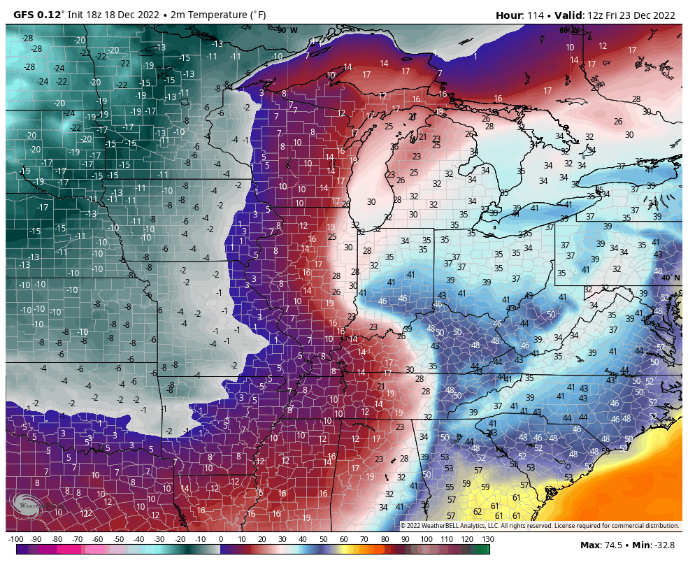
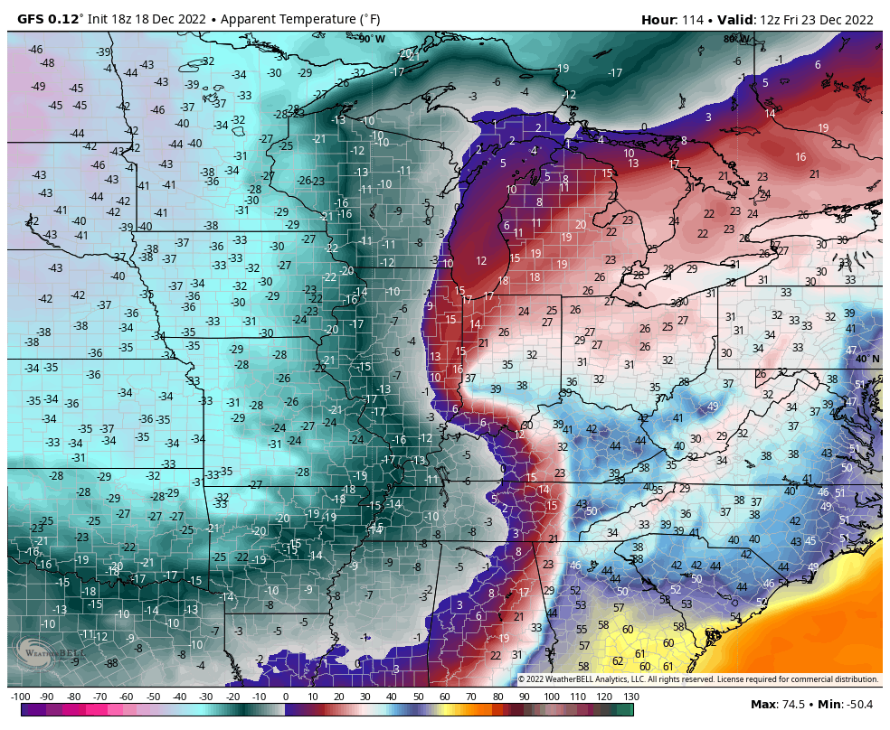
Bitterly cold air gets incorporated into this storm with lows likely heading toward zero or below for Christmas Weekend. Life-threatening wind chills may hit -20 at times. Here are the temps from the GFS with lows going below zero…
Wind chills are beyond brutal…
GFS
EURO
Please start making preparations for the bitterly cold temps. Local and state governments, and utility companies need to start preparing now for what kind of issues come from that kind of prolonged cold.
Back to the storm… It will be interesting to see this system when it gets fully within the 84 hour window on the short range models like the NAM and short range Candian. Those two models go through 1am Thursday and area already showing a stark difference from one another…
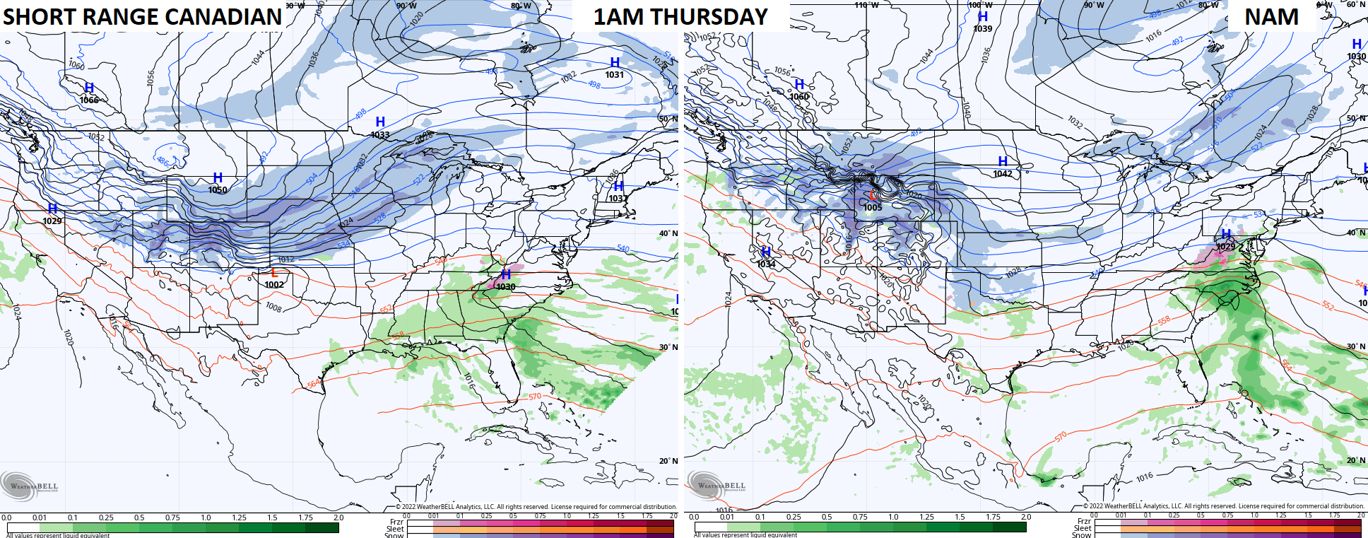
Those aren’t even close!
I will update as needed. Enjoy the rest of your Sunday and take care.

Ugh hope WKY gets the most