Good afternoon, folks. We’ve made it to Christmas week and we have a harsh period of winter weather on the way. This brings snow in here for the end of the week with bitterly cold temps crashing in for the big weekend.
KWC should be good to go, now. I’ve spent more money on it to, hopefully, keep it from crashing. I have my doubts because you snow people are crazy… But I love ya. 😜
Before we get into the models, here’s a breakdown of how things try to play out…
THURSDAY
- Rain develops across much of the region, but it may start as a bit of a mix.
- Winds kick in from the southwest as temps spike ahead of the arctic front.
THURSDAY NIGHT
- The arctic front races eastward as low pressure develops along it. I’m still not sure exactly where this low develops and moves, but that’s critical to the forecast.
- Temps drop 30-40 degrees in an hour or two. Given everything will be wet before this happens, a massive flash freeze will take place. Everything ices up, folks.
- Rain rapidly changes to snow behind the front. A period of moderate to heavy snow is likely. How long of a period is the question.
- Winds gust to 40mph-50mph will be likely.
- Temps go below zero by Friday morning.
- Wind chills may reach -25
FRIDAY
- The period of snow behind the front moves away during the morning.
- Wraparound snow should then kick in during the afternoon and evening as the storm cranks to our north.
- Travel conditions will be ugly during this time.
- Winds will continue to gust to 40mph-50mph at times. Blowing snow may be an issue.
- Temps stay in the teens and may even drop into the single digits at some point.
- Wind chills may drop as low as -20.
FRIDAY NIGHT
- The wraparound snows will pull away, but travel continues to look rather ugly.
- Temps make a run at 0 or below.
- Wind chills will continue to run in the -10 to -20 degree range.
CHRISTMAS EVE
- A few flurries or a snow shower will be around.
- Gusty winds slowly come down.
- Temps stay in the upper single digits to mid teens for highs.
- Wind chills hang in the -5 to -10 range.
CHRISTMAS DAY
- The sky looks dry
- Highs from the middle teens to low 20s.
- Wind chills from -5 to 5.
The trend of the morning models is back to the east and that’s a good thing for snow lovers. The farther east we get this storm to develop and track along the arctic front, the better the opportunity it has crank longer duration snows around here.
The GFS looked odd with the run from last night as it wrapped up the low in Missouri. It’s no longer doing that…
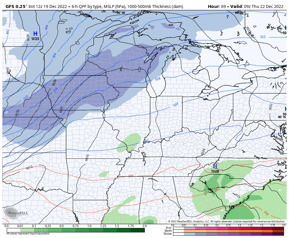
You can see my breakdown playing out on that animation. Those wraparound snows are the key because of the bitterly cold air that moves into. Normal snow ratios are 10 to 1. Those kind of ratios would be 20-1 to 30-1.
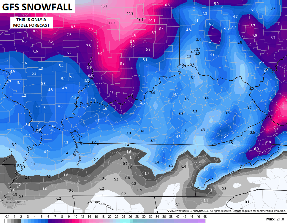
Since we are now just a few days away from this storm impacting us, let’s break out the model snow forecasts. These will change from run to run, but they’re fun to follow. Here’s what this run of the GFS is showing…
I don’t think too many people would complain if that verified.
Winds continue to crank on this run…
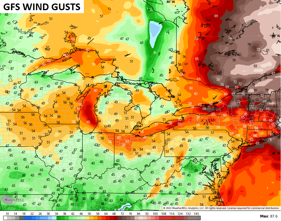
Look at those winds ahead of the blizzard… Hurricane force in New England?
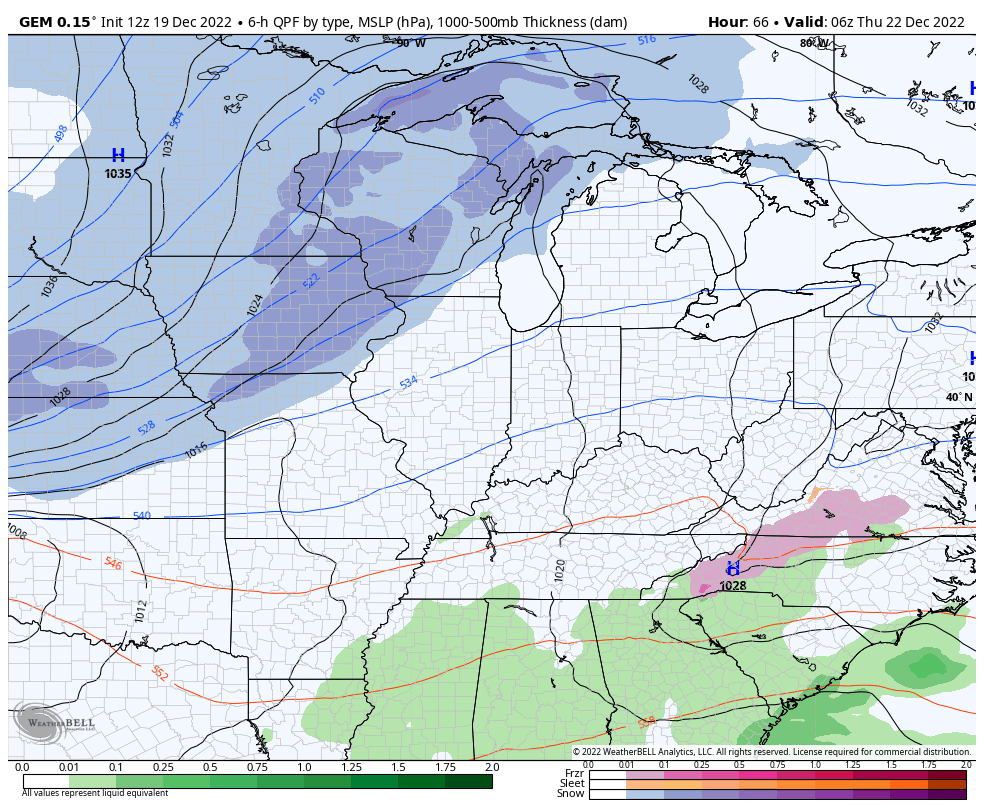
The Canadian Model also took a bit of a run to the east…
For fun, here’s the snow map from this run…
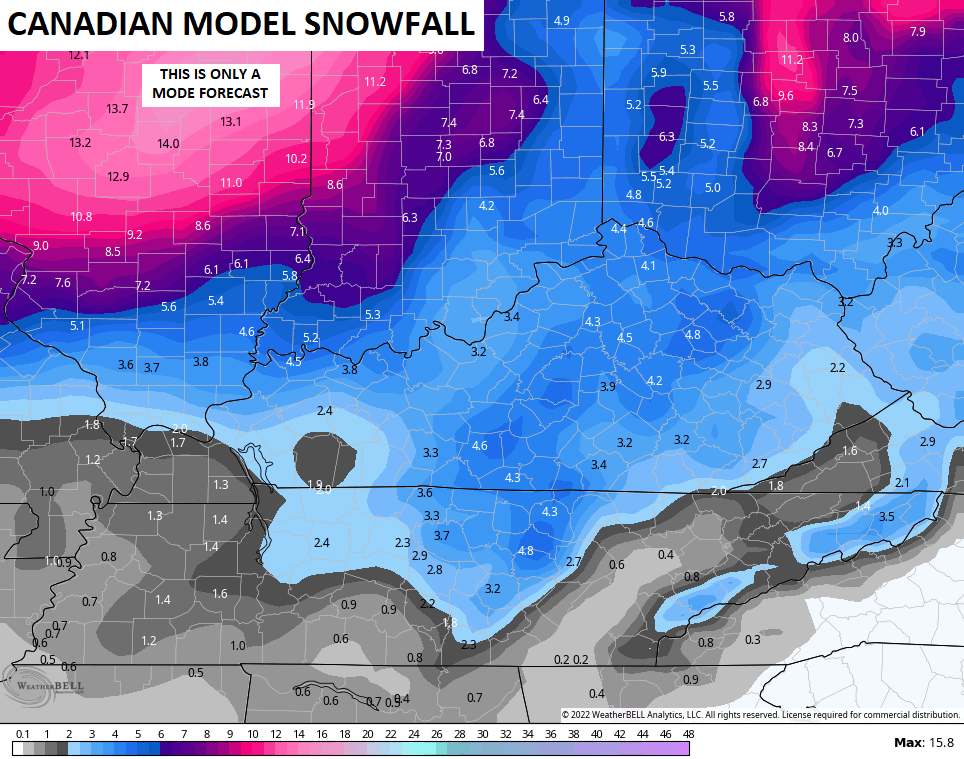
All the snowfall maps are based on the Kuchera ratio instead of the normal 10-1 ratio maps. The Kuchera uses temps to estimate the snowfall ratios. Obviously, the colder the air, the higher those ratios are going to be.
I am still not ready to make a First Call map, but that may come later tonight or Tuesday. I do think most can get a few inches out of this with the potential for several inches if we can keep an eastward trend going.
Regardless, travel will become pretty nasty Thursday night through Saturday.
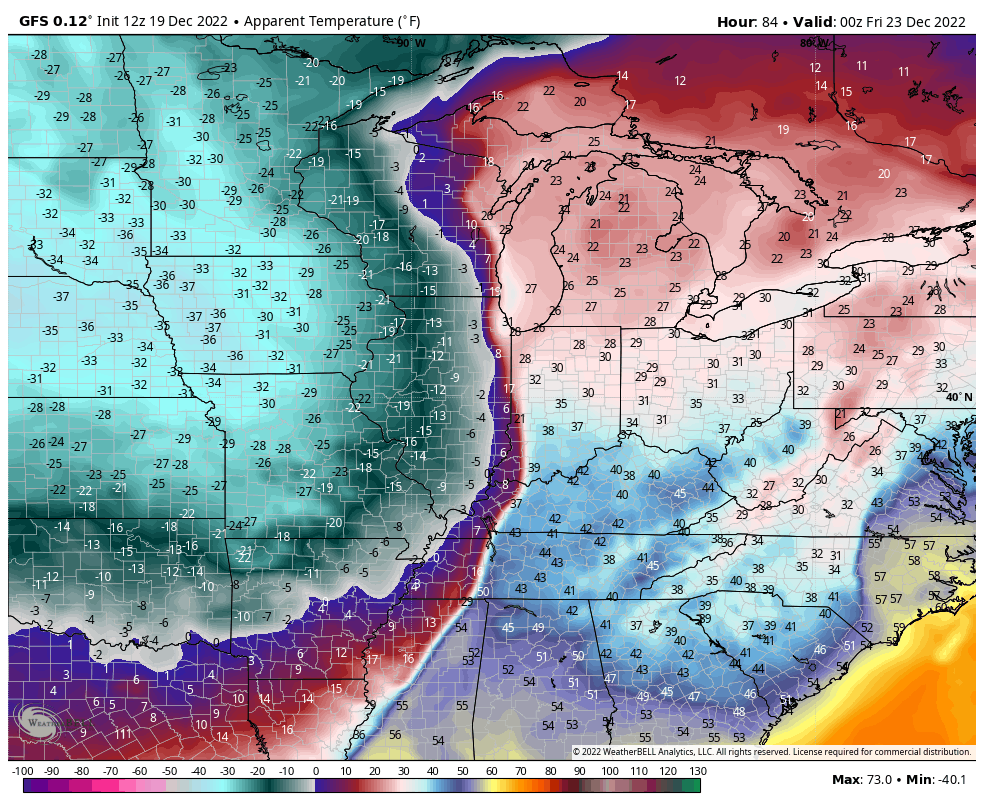
The cold is going to be crazy with wind chills becoming life threatening…
I will have the latest on WKYT starting at 4pm and I’ll drop by with more updates later today.
Have a good one and take care.

From a standpoint of travel hazards, areas that get less snow (1″ to 3″) will be at a much greater risk, because the flash freeze, which will drop temperatures from 30°to 40° in an HOUR, will turn the initial rain that falls into a sheet of solid ice! Sprinkle a layer of snow over that, and you’re looking at surfaces that will make driving and even walking, extremely difficult. We also need to take steps now to ensure that exposed pipes and outdoor faucets are insulated, and garden hoses are drained.
Hopefully the wind kicks in to help dry roads off before freezing. Catch is that only works for roads exposed to the direct wind.
Just wanted to say thank you Chris for all you do here and keeping this site going. This is where I go for KY weather.
Looks like for now we have scenic snow and no shoveling perhaps. Win win
May not be that bad. The extreme cold may be followed by a return to normal and I hope with some more good rains, but I’m concerned of possible Ice Storms in the months ahead following the Arctic cold fronts that may invade in January, February and March ?