Good evening, folks. After almost pulling the trigger earlier today, it’s our first Winter Storm THREAT of the season. Our big storm system targets the Ohio Valley and Great Lakes with high winds, snow, below zero temps and brutally cold wind chills.
Let’s start with a Winter Storm Watch that’s out for areas of western Kentucky. This gets awfully close to Interstate 65…
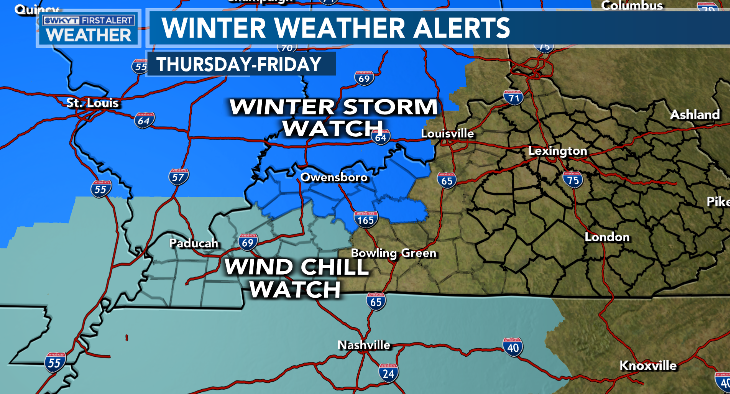
You will also notice the Wind Chill Watch that’s out for the west and for much of Tennessee. I had hoped this would be issued already for all of Kentucky, but it’s not and it should be. I’m sure that comes later tonight.
This arctic front moving in Thursday afternoon and evening looks to arrive a little faster and that likely means better snow chances for the entire region.
Whiteout conditions are likely right behind the front as a band of moderate to heavy snow works through. This may only be a 2–3-hour window of those kinds of snows, but it’s going to be pretty awesome to see, but nasty if you’re caught out in it.
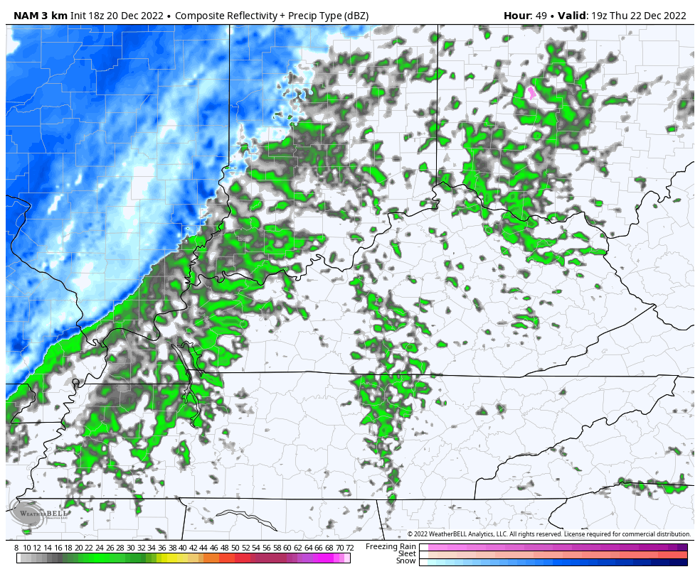
The Future Radar from the Hi Res NAM shows this intense band of snow…
The GFS essentially hasn’t changed much at all…
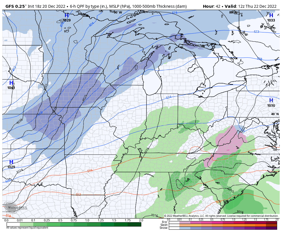
I like the GFS and Canadian more than the EURO because the EURO seems to be too fast with the overall system.
Now… The GFS has quite the wraparound snow event showing up with it and it continues to spit out much more snow than any other model…
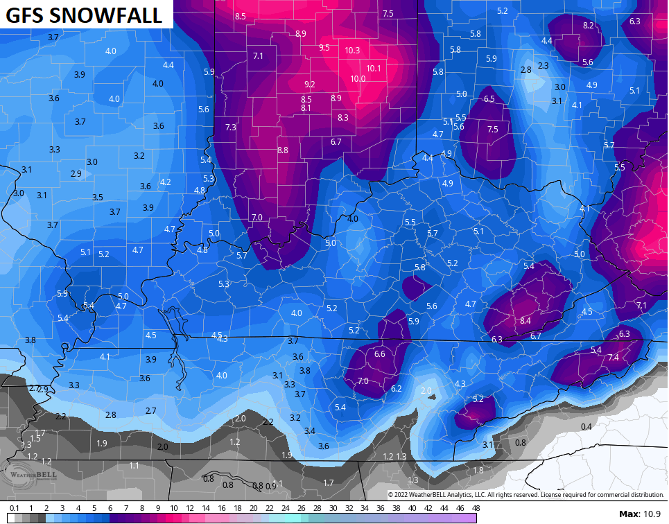
My First Call For Snowfall isn’t running with those totals, but a general 1″-4″ snowfall for many with the chance for a little more in the northwest…
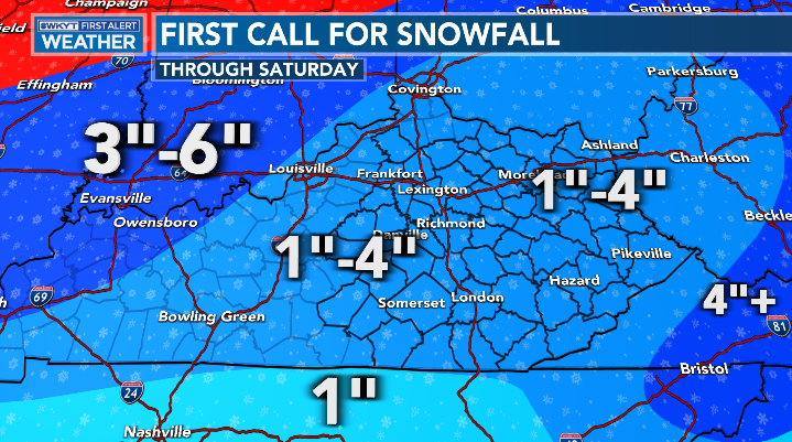
Again, that’s the first call and certainly won’t be the last. 😜❄
Temps are brutally cold with lows going below zero by Friday morning…
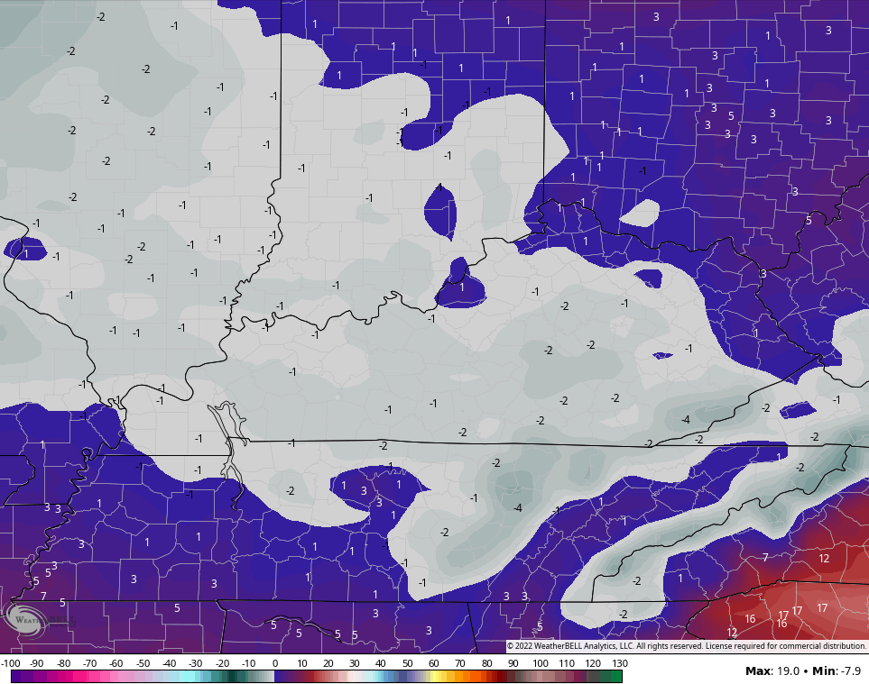
Wind chill numbers of -20 to -25 will be common with a drop to -30 even possible. Highs are single digits with wind chills -10 to -20 all day
Bitterly cold air continues into the weekend with zero or below lows and wind chills well below zero.
I’ll have the latest on WKYT News on the CW at 10 and on WKYT-TV at 11. If need be, I’ll stop back here for another update.
Have a good one and take care.

Thanks CB! My ignorant intuition suggests we might be surprised and it over-performs a bit, but one could argue the exact opposite and probably be just as “logical”. Still seems more eastern and southern expanse, but all of the models currently agree that Kentucky is the floor. Interesting system.