Good Wednesday, folks. A developing winter storm/blizzard targets the Ohio Valley and Great Lakes, bringing snow, high winds and life-threatening wind chills to Kentucky. While we may not get in on the true blizzard part, it may act the part for a few hours behind the arctic front.
The trends continue for a snowier system across the region and our Winter Storm Threat continues from Thursday afternoon through Friday. If my confidence increase, I will upgrade to a Winter Storm ALERT and that’s very possible later today.
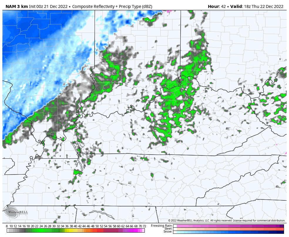
The arrival of our arctic front is speeding up and some of the models are spitting out another wave of low pressure along this as it moves through central and eastern Kentucky. This may produce an increasing band of snow as it moves eastward. This band may also produce a 2-4 hour window of whiteout conditions as it moves through.
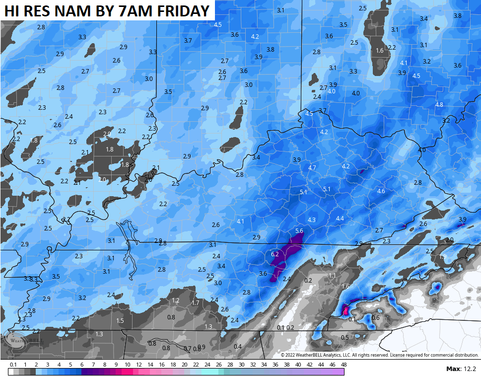
The future radar from the Hi Res NAM shows this well…
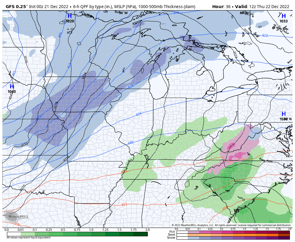
The GFS has been showing this for a while, so it now has the NAM fam on its side…
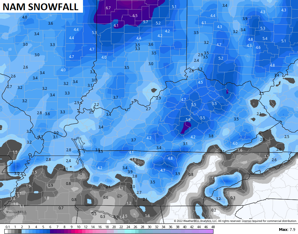
For a while now, the GFS has been showing the highest snowfall numbers and it continues to do so…
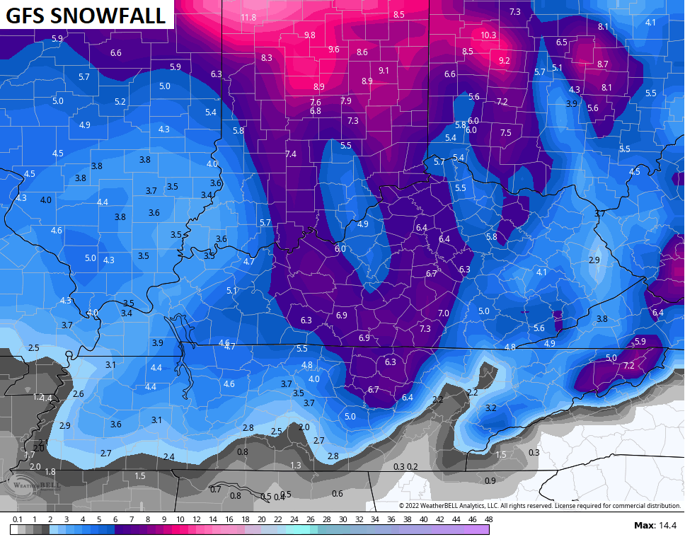
The Hi Res NAM and NAM aren’t too far away…
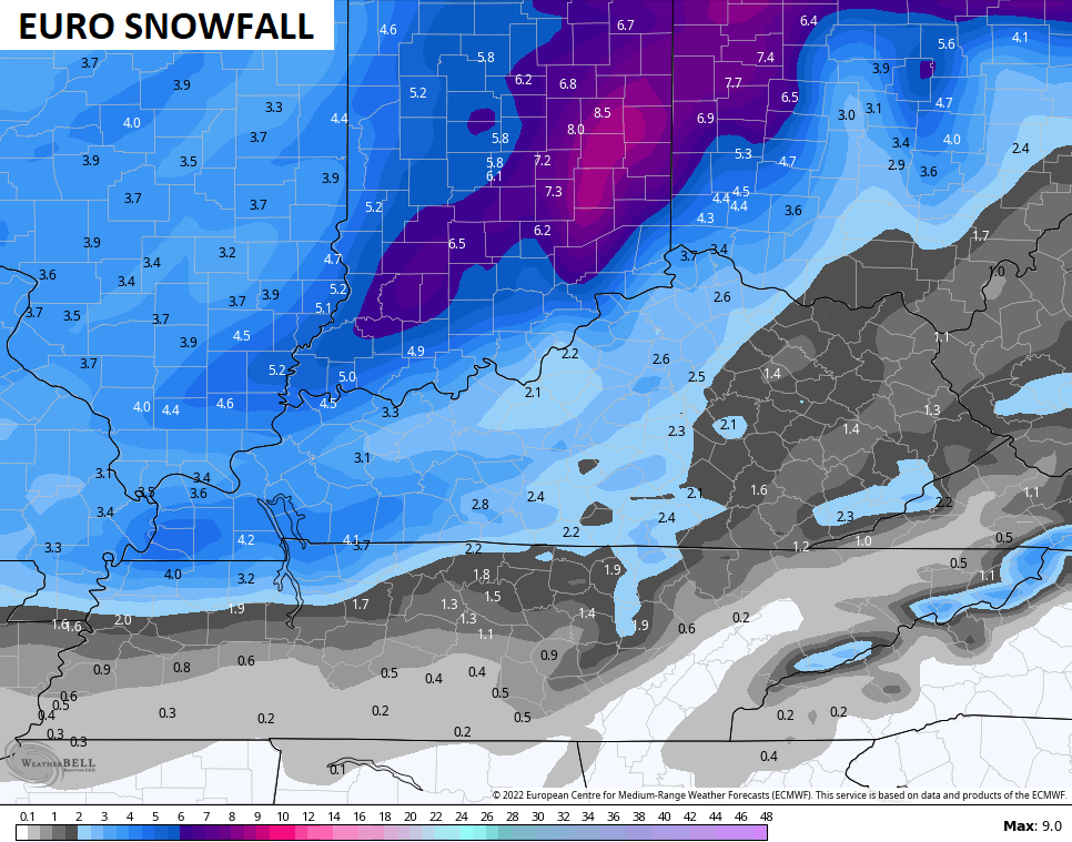
The EURO has been the Grinch with snowfall totals, but the trend of the model is to show higher totals with each passing run…
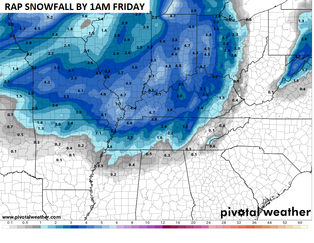
The RAP only goes through 1am Friday, but you can see how it’s marching along with the models above…
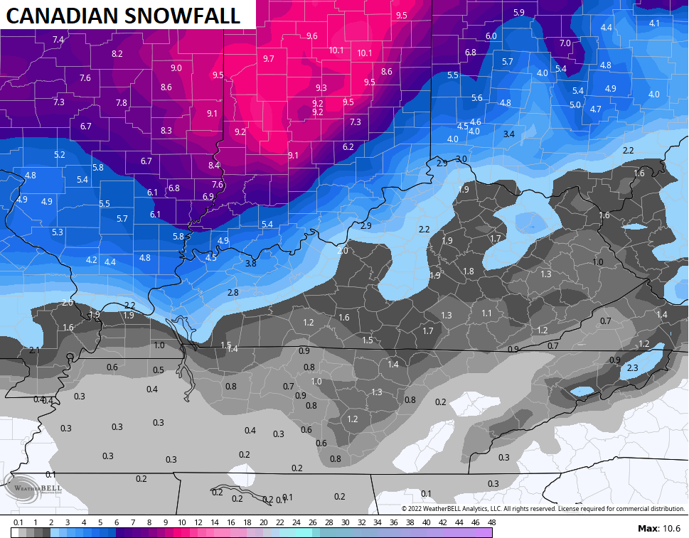
On the flipside, the Canadian has much lower totals…
I will keep my First Call for Snowfall going until I can see some more data later today…
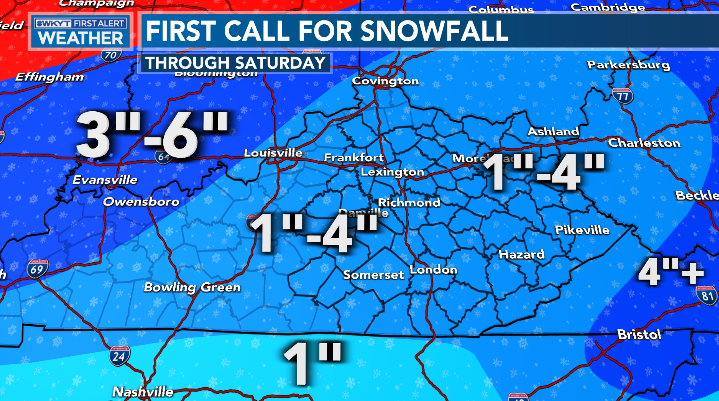
There’s a real chance those numbers could go up just a bit.
Blowing snow is going to become an issue with this setup. Travel conditions will get nasty once the arctic front arrives and that continues into Friday. Please make travel plans accordingly.
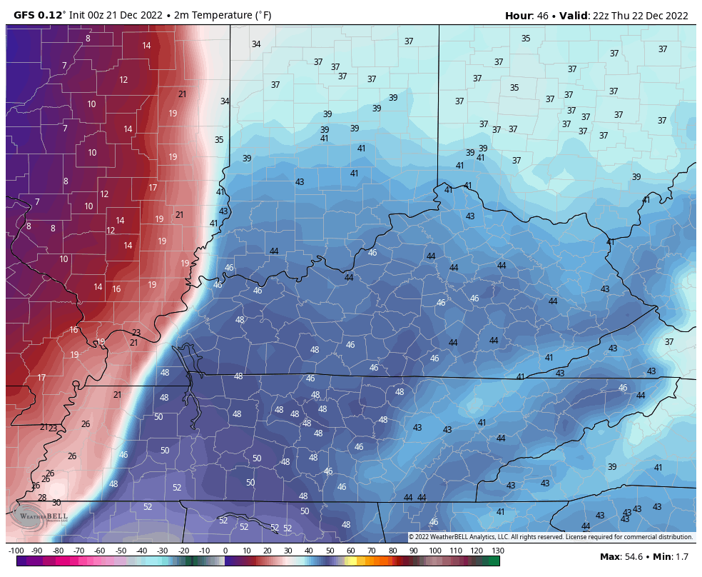
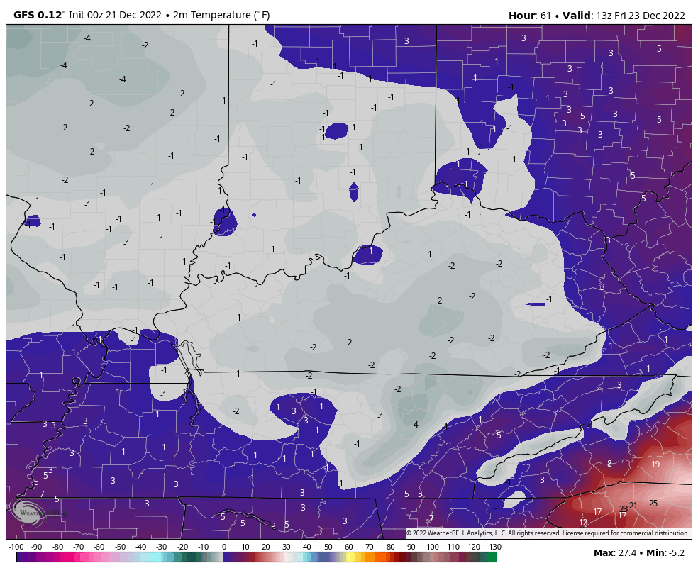
Brutally cold temps are going to cause a lot of issues, folks. This is one of the more prolific drops in temps you will ever see. We may hit 50 Thursday afternoon before dropping well below zero later that night. This temp animation goes from 5pm Thursday through 8am Friday…
That bitter cold remains through Christmas weekend…
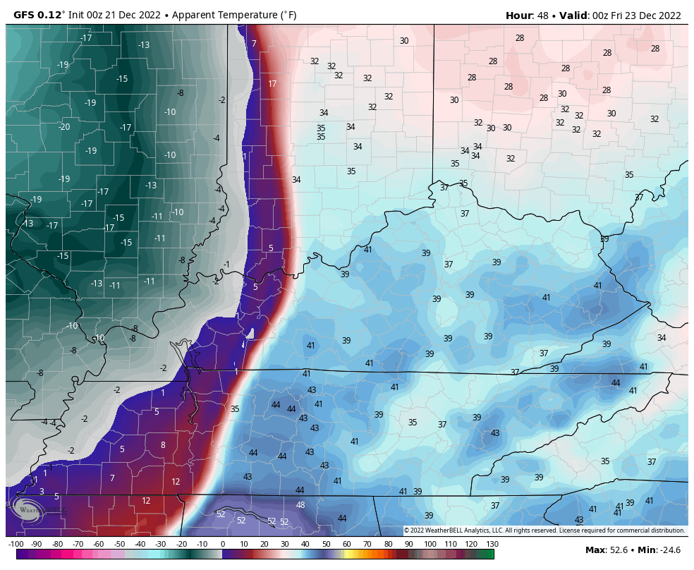
Wind chills are brutal and may flirt with -30 early Friday…
Updates will come your way later today, so check back. Have a good one and take care.

hard livin by kieth whitley,
2nd its 530 and im still the first to post.
Today is first day of winter shortest day and the longest night. Calm before the storm hits
Still tripping me out why the floor of this is not more in Tennessee. That said, the less chance for more shoveling, the better. Will be too cold for snow balls, snowmen, etc. Hopefully not too crazy slick and dangerous.
Thanks Chris, for all your hard work on all the updates. If this storm over preforms and deposits more than six inches of Snow State wide, this will be my first Snowstorm that came out of the Northwest without any phasing with a surface low from the Gulf of Mexico.
The Arctic cold front reminds me of the weather pattern back at the end of the year 1976. As some of you older folks know that January through March 1977 was a very cold and had frequent major Snows, but that Winter occurred in a year that had a weak El Nino. Lots of phasing between the Polar jet and the Subtropical Jet.
This is a rare event. I lived at the firehouse in 1994 for two weeks until roads cleared and the 22 below zero temps. I don’t tolerate the extreme cold like I used to.
It’s interesting to me that NWS Louisville continues to be all in on the Euro due to its run-to-run consistency. Even with that consistency, the Euro is forecasting >2″ for my area while the official NWS forecast is “<1/2 inch." Also, the wind chill at 0900ET on Friday is forecast as around -22F. I would think that should trigger at least a wind chill advisory but so far it's only covered under the SPS. That's dangerous level wind chill for this area.