Good evening, folks. This is a bonus post just to get in my New Call For Snowfall and to offer some very quick thoughts on this dangerous setup ahead. Snow and bitter cold temps are going to cause some big time issues.
This is the New Call for Snowfall…
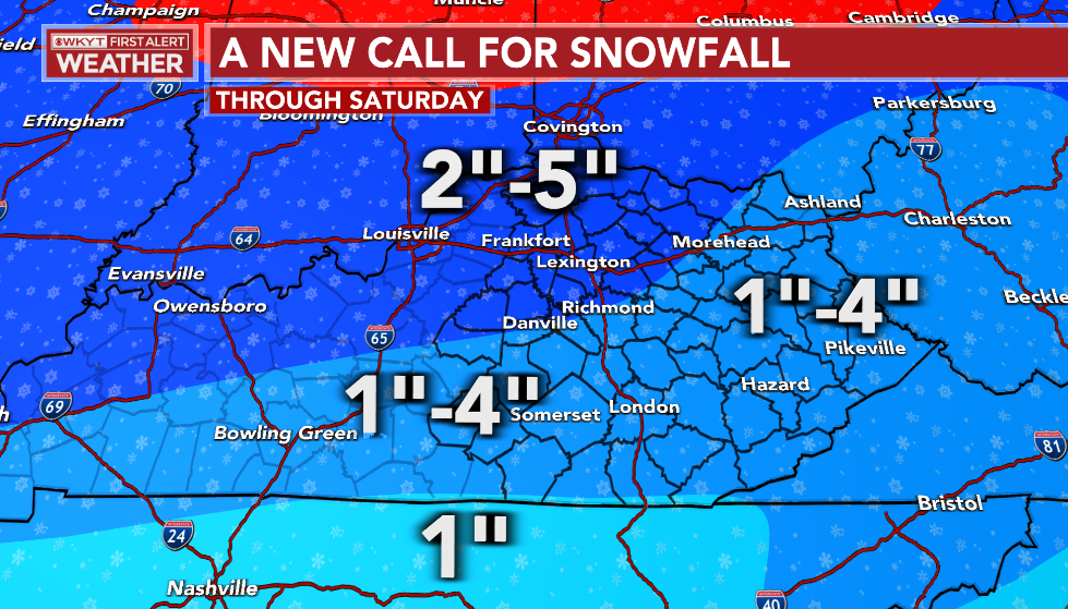
I’ve increased the area of 2″-5″ of snow and I may not be done with that just yet. I will be updating that later tonight with a final call tomorrow.
The NWS continues to play catchup to this storm and they’re doing so at a really bad time. It’s one of the busiest travel periods of the entire year and they’ve spent the past several days downplaying this event.
Don’t surprised if some of this gets upgraded to a Winter Storm Warning…
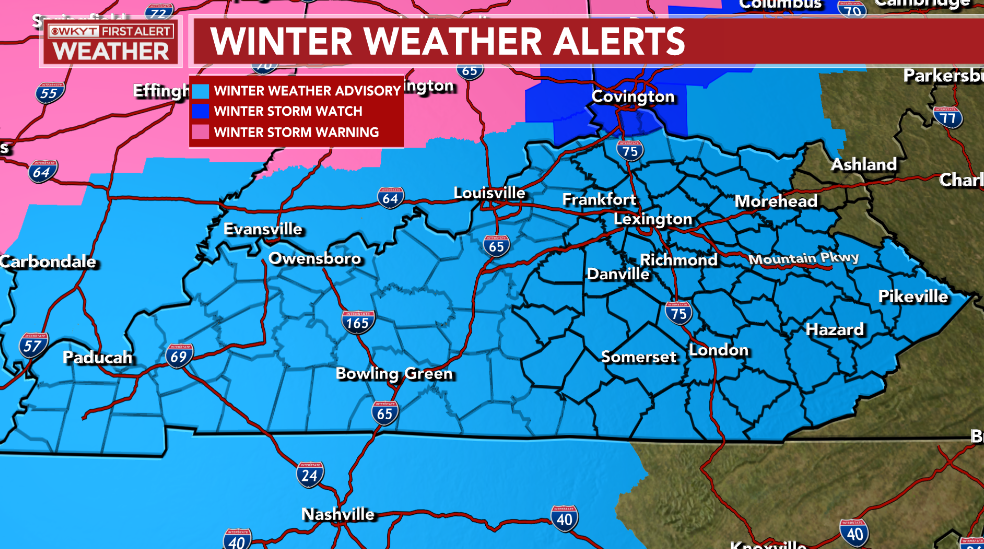
Areas of western Kentucky, southern Indiana, southwestern Virginia and all of Tennessee are under a Wind Chill Warning, but it’s only a Watch for central and eastern Kentucky…

How this isn’t a warning is really, really perplexing. Wind chills are a slam dunk.
I’ll be back with a normal update later this evening. Enjoy and take care.

Man..Just crazy..
https://mobile.twitter.com/NWSCheyenne/status/1605667970667069440/photo/1
Dang.
WOW !!! -70 Wind Chill in Montana. Lowest Wind Chill I’ve never seen in the lower 48.
Seems this sub ice cold storm puppy is going to either under, or over-perform with snow. It seems too unique for any common ground 😉
That said, GOOD LUCK figuring out how much snow actually falls, with the crazy high wind. LOL