Good evening, folks. Our winter storm continues to take aim at the region with snow, blowing snow, and bitterly cold temperatures. We are facing treacherous travel conditions and life-threatening cold temps and wind chill.
I have made no changes to the snow forecast, but I’ll update this later tonight…
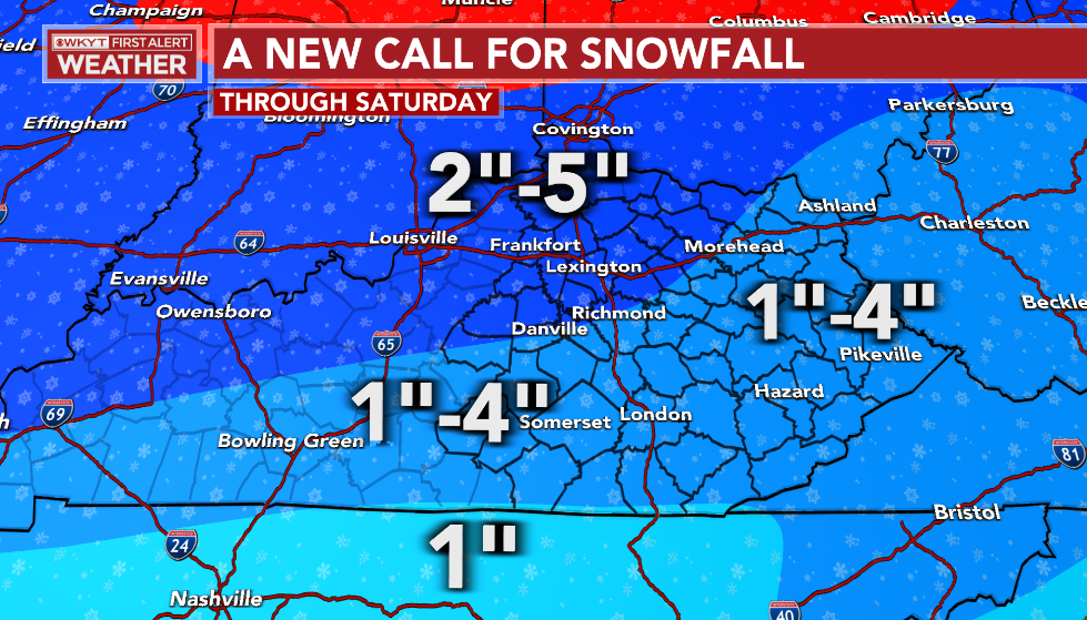
Again, this is through Saturday. We get the s
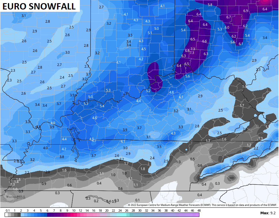
The afternoon run of the EURO made a big jump toward what the American Models have been showing. The EURO now has the heaviest snow along and south of the Ohio River…
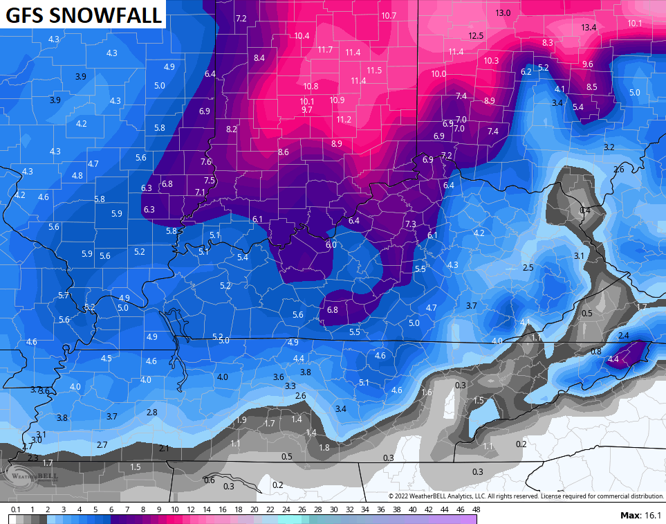
The late afternoon GFS decided to take it’s already high totals and make them a little higher…
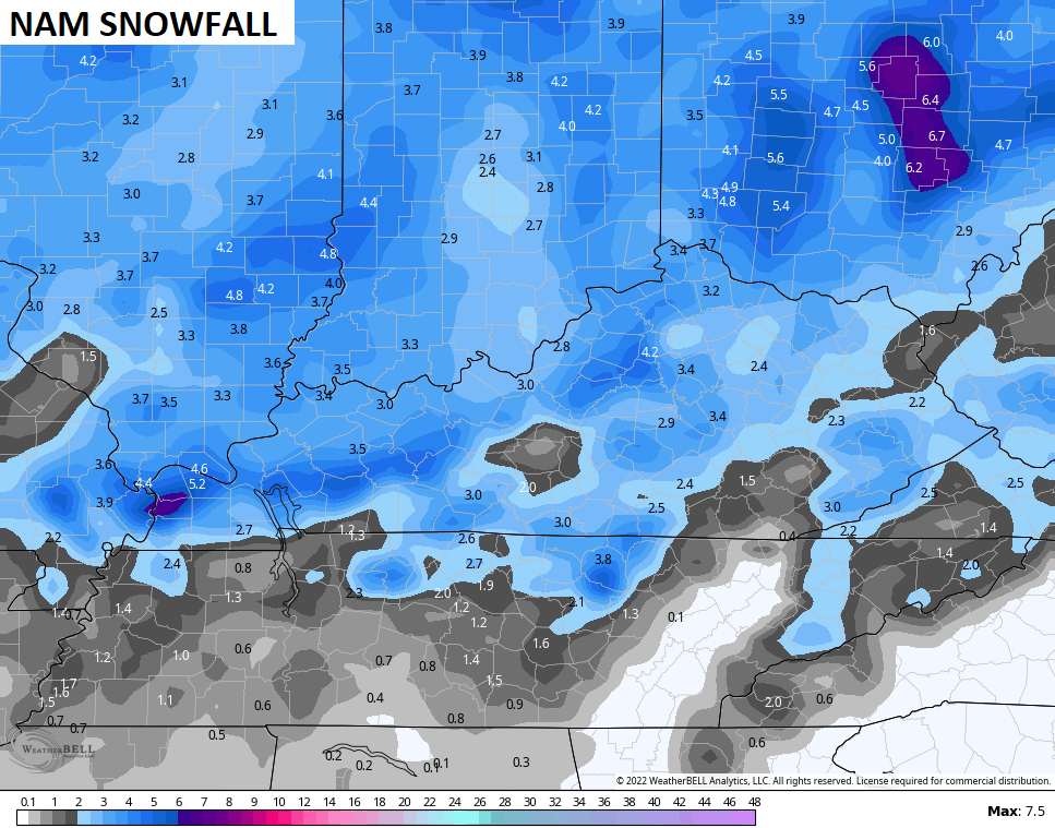
The NAM fam isn’t as beefy as the models above, but still have some nice totals…

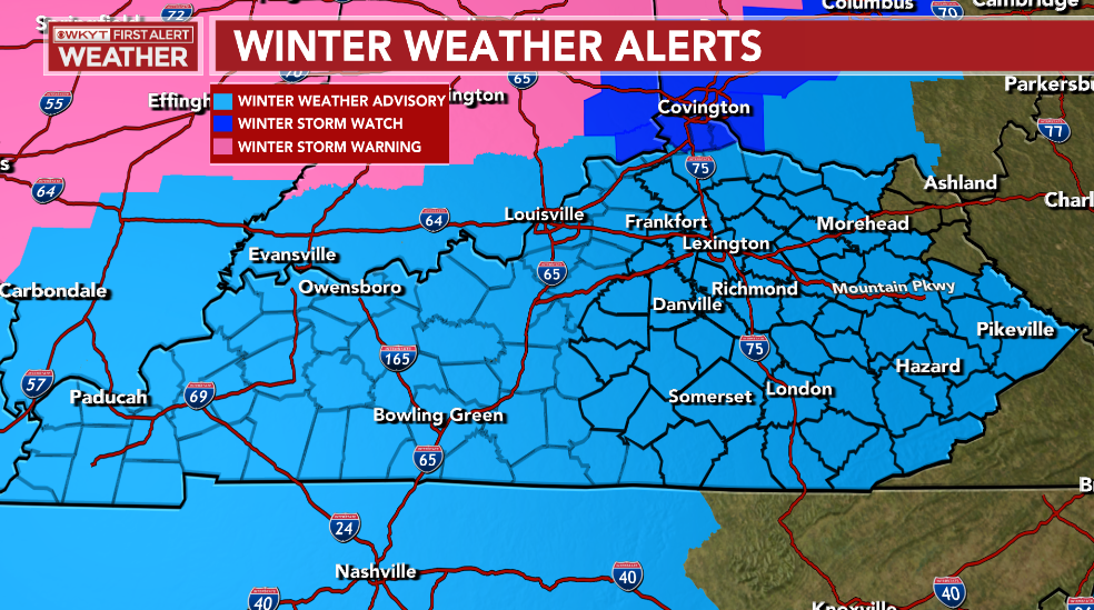
Now you can see why I think why parts of the Winter Weather Advisory should be upgraded…
I still cannot believe the NWS hasn’t issued a Wind Chill Warning…

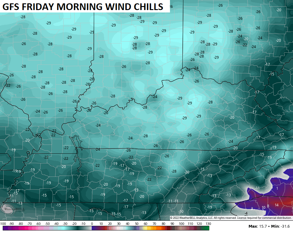
The models are trending colder with Friday morning lows with the GFS now forecasting well below zero lows…

That same model has wind chills nearing -30 Friday morning…
I will have the latest on WKYT News at 10 on the CW then again on WKYT-TV at 11. Enjoy the rest of the evening and take care.
