Good Thursday, folks. It’s a windy and mild day taking shape across our region as we get set for a series of storm systems to impact our region. These will bring a lot of rain over the next week and may even bring some strong storms early in the new year.
Temps today are deep into the 50s for many with a mix of sun and clouds. There’s a small chance for a shower to go up in the west at some point today, but most of the area is dry.
Friday is another mild day that’s going to feel 90 degrees warmer than last Friday for some. What???? Wind chills last Friday were in the -30 range and this Friday will feature temps pushing 60 degrees. That’s a mega change!
This is a strong southwest flow ahead of low pressure moving in here on Saturday. That brings some showers into the region Friday with widespread rain and some thunder coming for the final day of the year on Saturday…
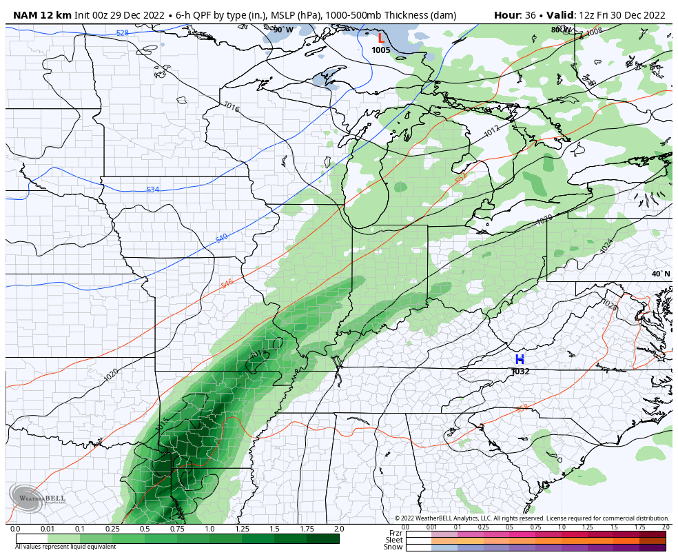
Some thunder is even possible on your New Year’s Eve! Is that a good sign or a bad sign for the year ahead? ⚡🌩
New Year’s Day is a nice one with temps 50s with clouds decreasing.
This sets the stage for a more potent setup early next week. A strong low pressure develops and works through the plains Monday into Tuesday. This drags a cold front toward the region and this may very well have a line of strong to severe storms along and ahead of it.
Another wave of low pressure may follow behind that with colder air by the end of next week. That may have some flakes with it.
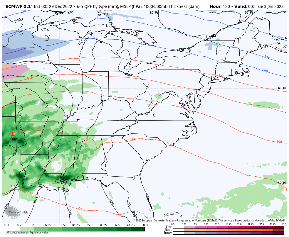
The EURO has the most threatening severe weather look of the models…
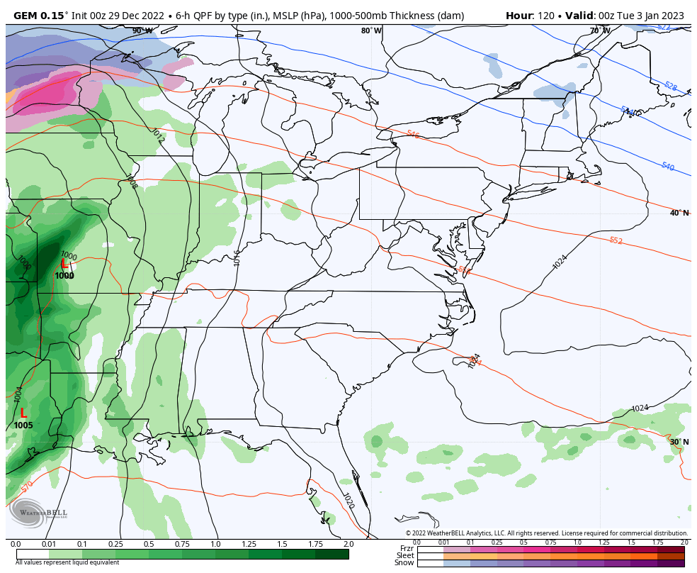
Canadian
The EURO Ensembles continue to show a trough developing during the second week of January…
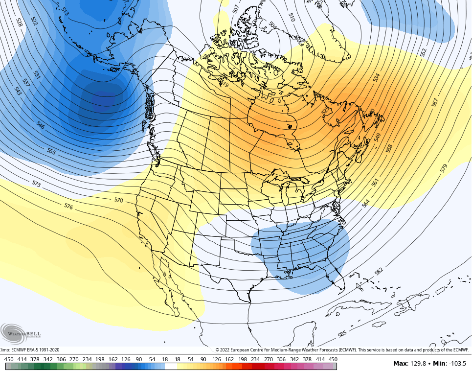
Notice how all the positive height anomalies building across Canada. We’ve seen this setup repeating itself each month since September and it looks like January will continue that streak.
I’ll have your normal updates later today. Make it a good one and take care.

song american pie don mclean, day the basketball died. get rid of calipari. KWC bowl central goes to 2-0, todays play is under 65 oklahoma/fla state. will be 3 str8 total plays.
Get rid of Calipari? No.
Good song to pick out Rolo and yes get rid of Cal!!
No
Thanks Chris, It really looks like a lot of variability in temperatures. Is to be expected in a La Nina Winter with the Southeast Ridge strengthening from time to time. Be glad to observe the demise of La Nina and the phase to ENSO sometime next year ?
Schroeder what will that mean for our weather here when LA Nina ends? What is enso
Crystal, ENSO stands for : El Nino Southern Oscillation which is the warm phase, while La Nina is the cold phase. La Nina gives the Ohio Valley warm and wet Winters and drier Winters along the Gulf coast. The Northern States have the cold and Snowy Winters typically.
An El Nino activates the Subtropical jet stream while diminishing the Southeast Ridge therefore allowing more phasing storms to take place and produce more chances of major Snowstorms in Kentucky.
Thank you
Schroeder, the most recent ENSO discussion said that although we have a high probability of being stuck with La Niña through March, there is a 73% probability the we will have an ENSO Neutral condition this coming Spring. The latest Sea Surface Temperature Anomaly chart shows that the cooler than normal water in the Eastern Pacific is weakening, which is very good news!
https://www.ospo.noaa.gov/Products/ocean/sst/anomaly/
It’s an interesting setup coming up to start the new year. In fact, next week’s severe weather threat resembles conditions that existed on New Years Day 2022, when an EF-0 tornado hit the south side of Bowling Green. It touched down about ¾ of a mile from my house, and was a disturbing bit of déjà vu after the December 11th outbreak! The good news is that next week’s system doesn’t have the upper air support of last year’s storm.
As the Storms move East they have been weakened by the strong Southeast Ridge here lately.
Thanks Joe. I always have that fear of severe weather during a La Nina Winter. This La Nina is definitely showing signs of it’s demise I hope before Spring.
Thanks to both Schroeder and JoeD for the explanations!