Good Saturday and Happy New Year’s Eve! As hard as it is to believe, we’ve made it to the final day of the year and we are tracking rain to close things out. The pattern gets even busier as we head into the first week of 2023 with the threat for strong storms and a few snowflakes.
Let’s begin with today’s rain. It’s coming out us in showers with a few rumbles of thunder possible. This action is scotting quickly through here from southwest to northeast and should wrap up by the evening.
Here are your radars to get you through the day…

Drying skies take over this evening and that makes for a really nice New Year’s Day. Temps are going to be in the 55-60 degree range with a mix of sun and clouds as 2023 starts.
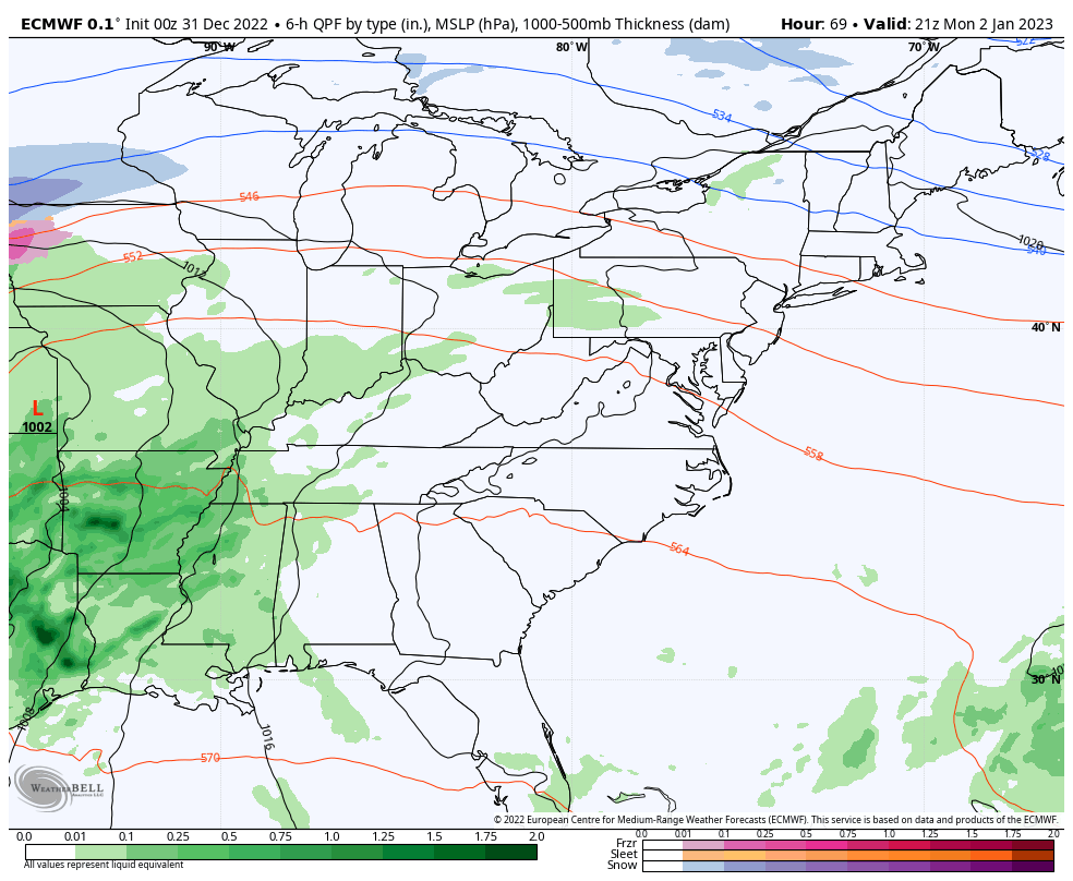
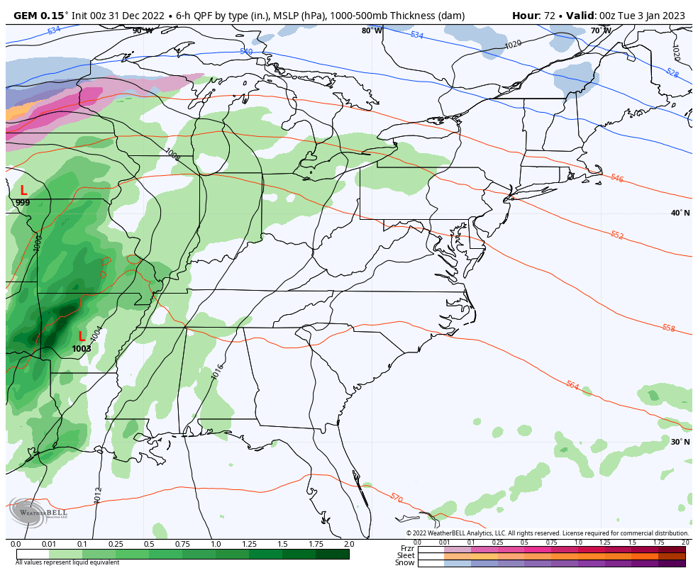
The big storm lifting northward through the Mississippi Valley Monday into Tuesday is likely to bring rounds of rain and thunderstorms to our region. The threat for strong to severe storms is there later Monday and Monday night, especially across the western half of the state.
Here’s the Monday Severe Weather Outlook from the Storm Prediction Center…

Damaging wind would be the primary player with this setup.
The front remains active as it slowly moves across the rest of the state Tuesday into Tuesday night. Additional rounds of showers and storms will be noted during this time and a general 1″-3″ of rain will be possible. That could lead to some local high water issues.
As that system passes through, colder air presses in with the potential for some rain and snow showers as early as Wednesday night and Thursday.
The EURO and Canadian Models have been very consistent with this whole scenario..
EURO
CANADIAN
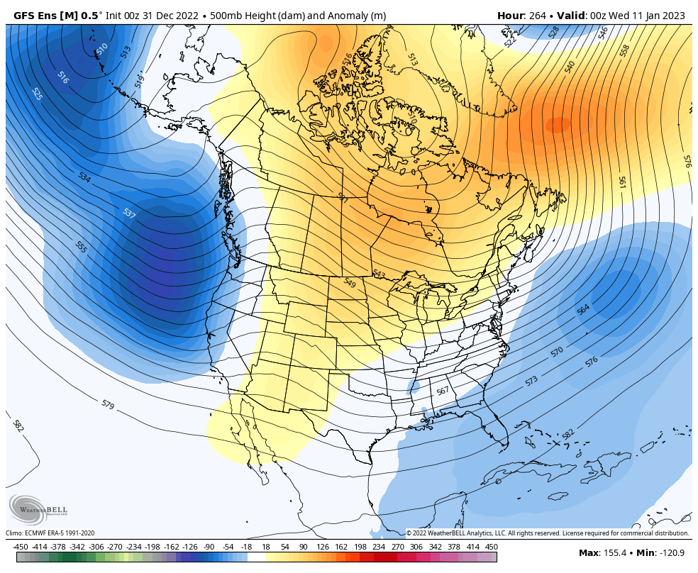
The real change back to winter begins to take place during the second week of January. The GFS Ensembles show our trough developing during this time…
I’ll throw you another update later today, so check back. Make it a great and safe New Year’s Eve. Take care.

Right back at you Chris.Happy New Year’s Eve to Chris and all my fellow weather lovers. Hope you have a safe and happy New Year’s Eve.
Same to you, Crystal!!
Happy NYE and Happy New Year!
2022 sure had a little bit of everything for weather watchers, some of it unique and beautiful, while much of it was flat-out nasty. Here’s wishing the KWC weather watching team a happy, safe and damage-free New Year!
There could be as a spark of hope showing up on the latest Sea Surface Temperature Anomaly chart, where the Central and West-Central Pacific waters are still showing up as considerably colder than normal. But the Eastern Pacific waters, which are what directly affect the La Niña/El Niño oscillations, are showing signs of normalizing. In fact, there’s a patch off the coast of Ecuador that is showing up a warmer than normal.
Hope springs eternal!
https://www.ospo.noaa.gov/Products/ocean/sst/anomaly/
Looks like we may be entering ENSO- neutral which means there isn’t any push between atmospheric entities. The weather pattern could go either way. Lets hope we have Winter weather through mid April so we may enjoy a Spring without freezes, and adequate soil moisture for the planting season ahead. What we have now is a ‘ False Spring ‘ and I hope it doesn’t dominate over the next three month.
HAPPY NEW YEAR TO ALL !!!