Good afternoon and Happy New Year’s Eve. The closing hours of the year are upon us and we have some short-term improvement in our weather. Unfortunately, that doesn’t last long into the new year as our busy pattern cranks back up.
Let’s begin with what’s going on for the rest of today. Temps are mild as showers push away to the east. By midnight, much of the rain is over with and that bodes well for all those big parties.
Here are your radars to follow along…

New Year’s Day is pleasant with a mix of sun and clouds and temps in the 50s for many.
The next system rolling in here for late Monday and Tuesday continues to look like a widespread shower and thunderstorm maker. Some of the storms in the west may be strong, but the greatest instability continues to be to the southwest of the state. This is reflected in the new Monday Severe Weather Outlook from the Storm Prediction Center…

Heavy rain and gusty winds are likely with this setup and we could be looking at some local high water issues through Wednesday. That’s as another wave of low pressure develops and moves along the boundary. That should be followed by colder air and some rain and snow showers by Wednesday night and Thursday.
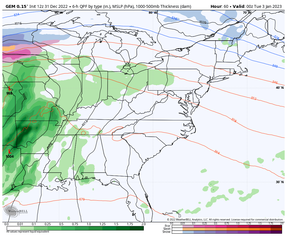
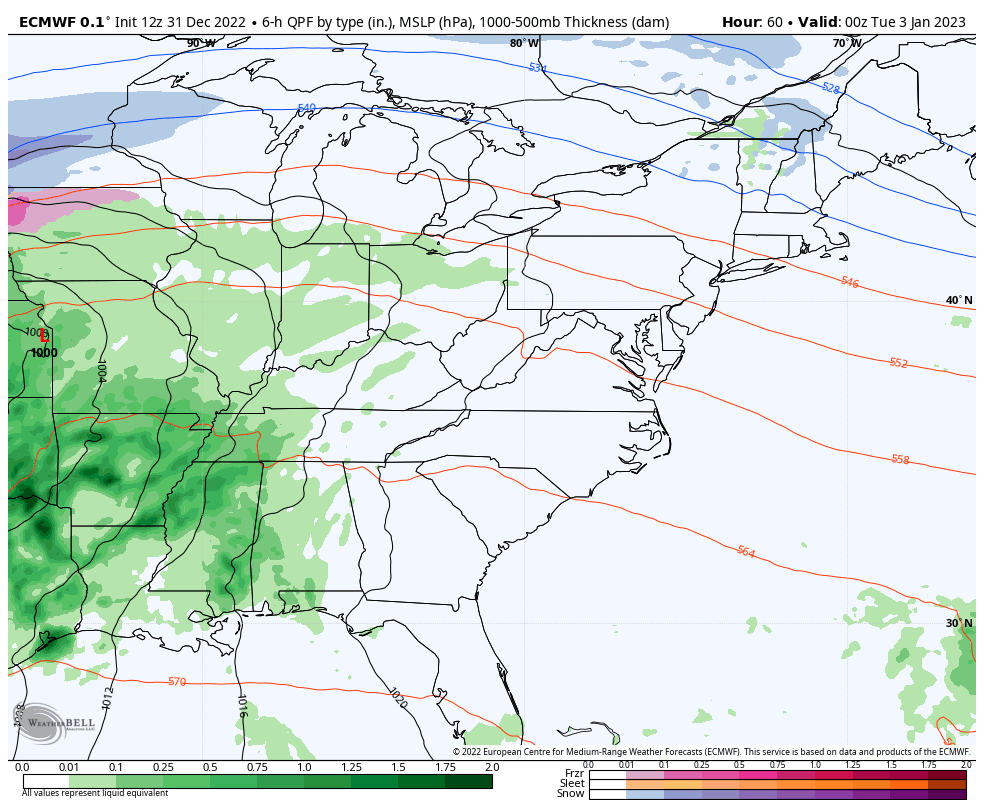
The Canadian and EURO continue to be in lock step with this scenario…
CANADIAN
EURO
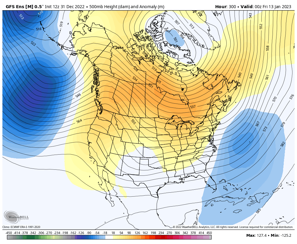
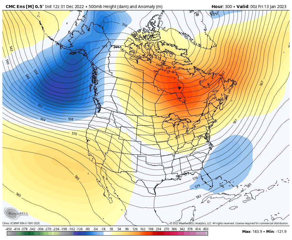
The Ensembles continue the trend back to a winter pattern during the second week of the month, but they disagree on exact timing and how it happens. Still, the trends are solid…
GFS ENSEMBLES
CANADIAN ENSEMBLES
Have a great and safe New Year’s Eve. Take care.

whiskey bent and hell bound song.