Good Sunday and Happy New Year! 2023 is off and running on a pretty nice weather note, but that doesn’t last very long. Heavy rain and storms are on the way to start the upcoming week, with the possibility of a few flakes to end it.
Temps out there today are mainly in the 50s with a mix of sun and clouds.
Clouds thicken ahead of our next storm system on Monday. That’s a low that moves from the Plains states into the western Great Lakes from late Monday into Tuesday. That drags a cold front in here and this front may have a line of strong storms with it into western Kentucky.
The Storm Prediction Center has the greatest severe threat to our southwest on Monday…

As the front moves east, another wave of low pressure rolls across the region with additional rains into Wednesday. A general 1″-3″ of rain will be likely during this time and that may lead to some flooding issues.
Colder air comes in behind this low by Wednesday night and Thursday, bringing rain and snow showers into the area.
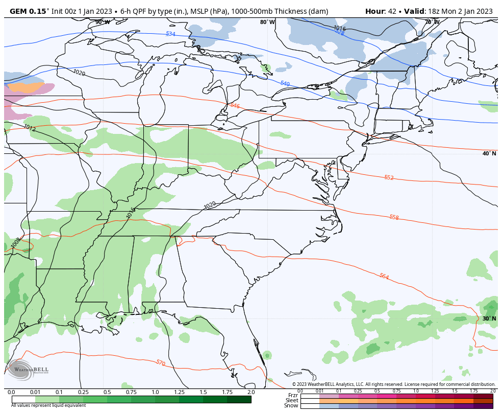
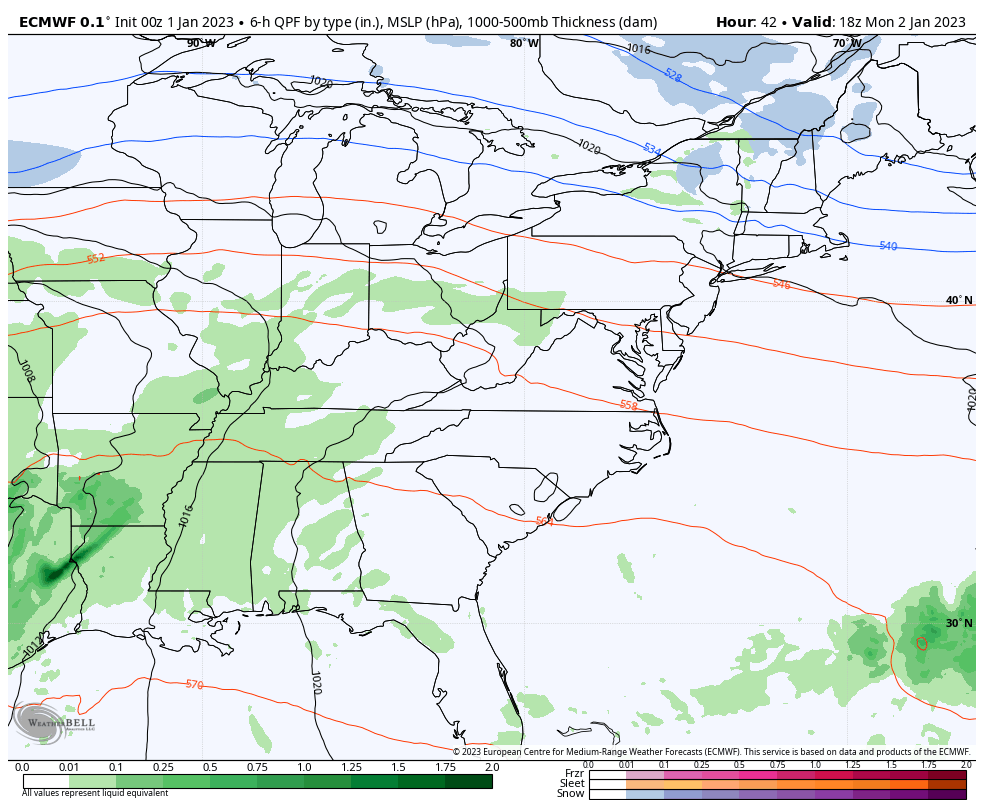
We continue to find the Canadian and EURO in lock step with one another with the whole week…
CANADIAN
EURO
I will update where the pattern goes after this with my updates later today. Make it a good one and Happy New Year. Take care.

My wish to All is a Happy and Healthy 2023. I’m sure we will have a lot of interesting weather to discuss in the coming months.
Ditto Schroeder! Happy new year!
fire and rain.