Good Sunday and Happy New Year! This brand spanking new year is starting off on a decent note out there today, but it’s about to get active. Thunderstorms and snowflakes are likely as we get into the week ahead.
A potent storm system rolls across the plains and into the western Great Lakes over the next few days. Southwest winds ahead of this will boost temps deep into the 60s as we await the arrive of a cold front. This setup is active in terms of showers and thunderstorms from late Monday through Tuesday. The chance is there for some strong or locally severe storms in the west, but the best chance for severe weather is to our southwest.
The Storm Prediction Center shows the Monday bullseye of severe threat across the Ark-La-Tex area…

That focuses farther east on Tuesday and the low end threat may include areas of south central Kentucky…

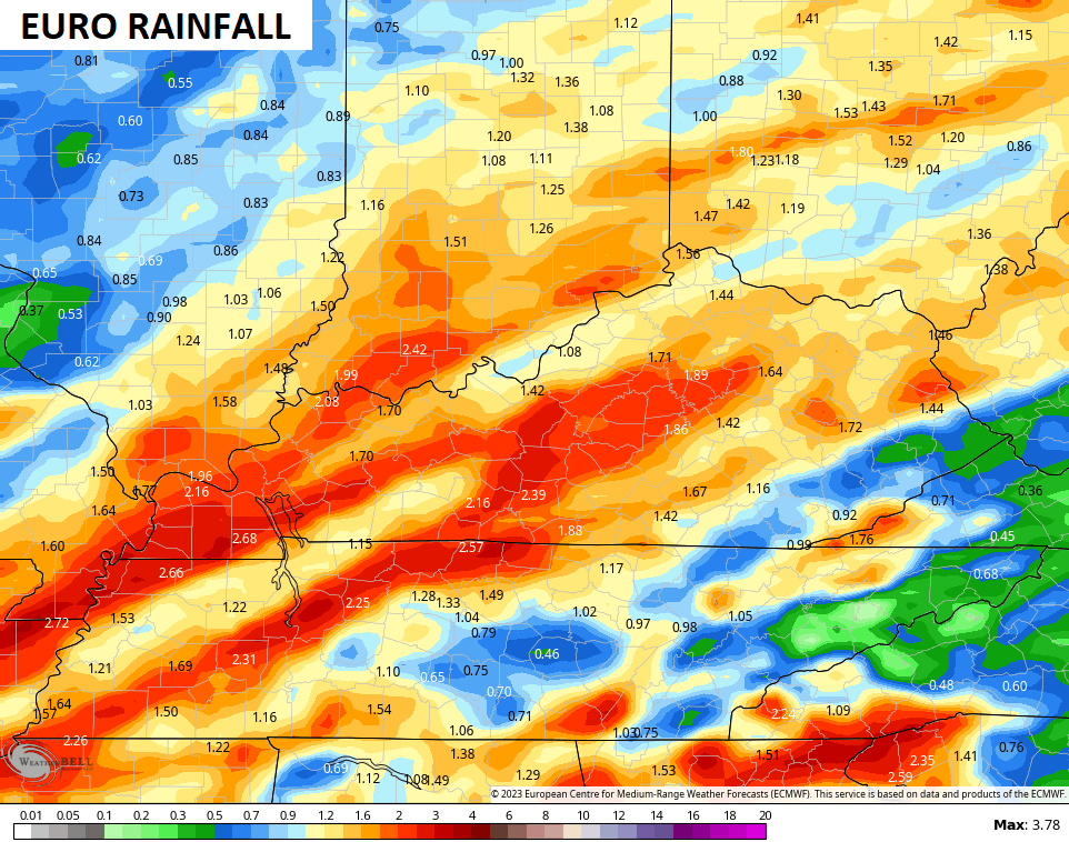
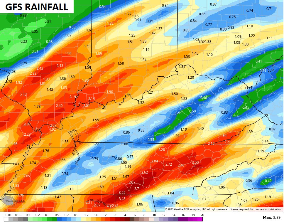
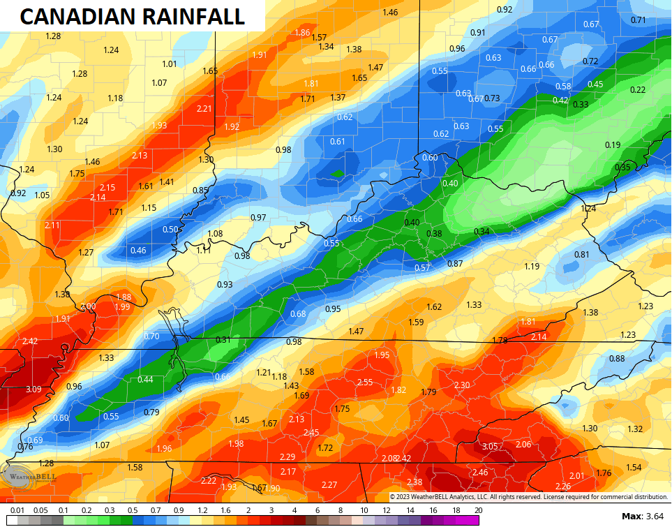
Heavy rains will also be a good bet with this setup. Much of the region should pick up a general 1″-3″ rainfall through Wednesday. The models have their usual disagreements…
As this system moves through on Wednesday, colder air works in for Wednesday night and Thursday. This will bring some rain and snow showers in here and that may linger into Friday.
It took a while, but the GFS is now on board with the flakes…
That’s what the Canadian and EURO have been showing for a while now…
CANADIAN
EURO
There’s the potential for that to wrap up a little more and is something for us to watch closely over the next few days.
Another system will likely follow that up by next weekend and may threaten the region with rain and snow…
CANADIAN
All signs continue to point toward a deep trough getting established in our region later in week two of the month. The EURO Ensembles are becoming much more emphatic with this…
The Old Man is going to flex again, folks! 💪
Have a great rest of the day and take care.

Enjoy the seasonal temps. before the Old Man lays the hammer down again.