Good Monday, everyone. We have a very active setup to start the week as a potent cold front brings rounds of heavy rain and strong storms in here. As the week begins with strong storms, it looks to end with some winter weather blowing through. Would you expect anything else?
Let’s set the scene with our current setup:
- Southwest winds crank today and boost temps deep into the 60s. Near record highs will be possible for some.
- Scattered showers and storms develop and work from southwest to northeast, but a lot of the day is dry.
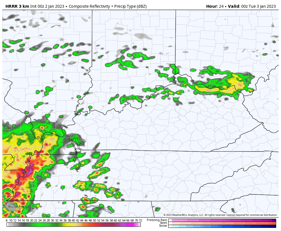
- A squall line of storms develops and pushes into western Kentucky late this evening then progresses across the state tonight into Tuesday morning.
- Damaging winds will be possible with this line as it moves through, especially across the west.
- These lines can sometimes throw a quick tornado spin up at you, so we will watch for that.
- The front is still to our west on Tuesday and we will likely spawn another line of thunderstorms. This one develops across the east and may bring strong storms into central and eastern Kentucky through Tuesday night.
- A general 1″-3″
- Rain diminishes from west to east on Wednesday as colder air sweeps in from the northwest.
In terms of the severe threat today and early Tonight, here’s the Severe Weather Outlook from the Storm Prediction Center…

The Future Radar from the HRRR starts at 7pm today and goes through Noon Tuesday…
The severe threat then moves farther east on Tuesday, with the greatest threat to our south. Still, the Storm Prediction Center has parts of the area in the zone to watch…

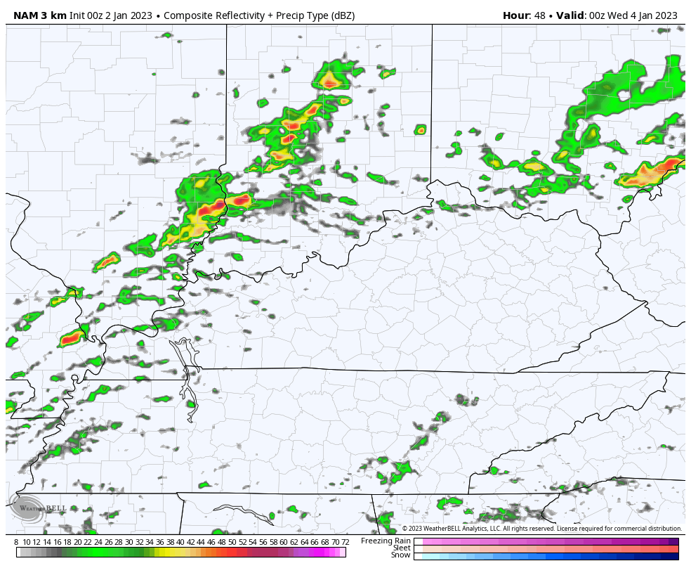
The HRRR doesn’t go all the way through Tuesday night as of this writing, but the Hi Res NAM does. Here’s the Future Radar from 7pm Tuesday through 7am Wednesday…
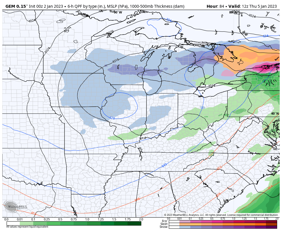
Behind all this comes colder air and a system dropping in from the northwest. This may very well lead to some light snow or snow showers Thursday into early Friday…
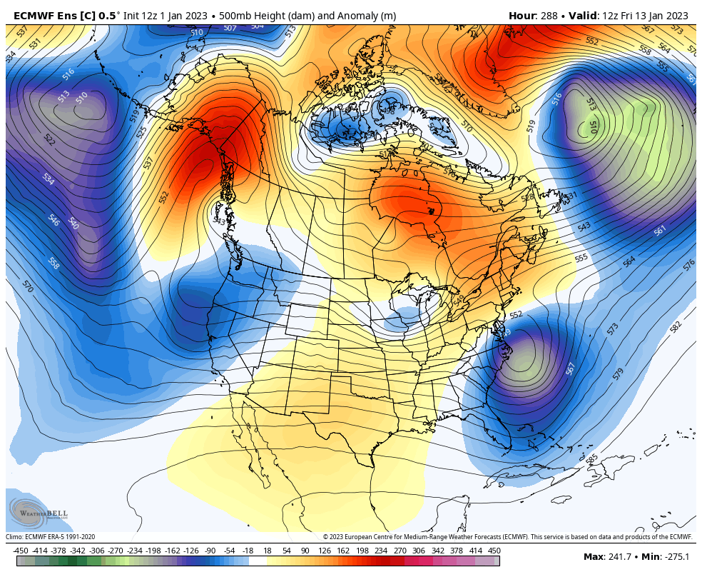
The Euro Ensembles continue to go toward a deep trough developing later next week…
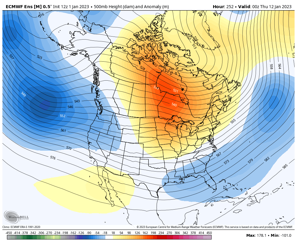
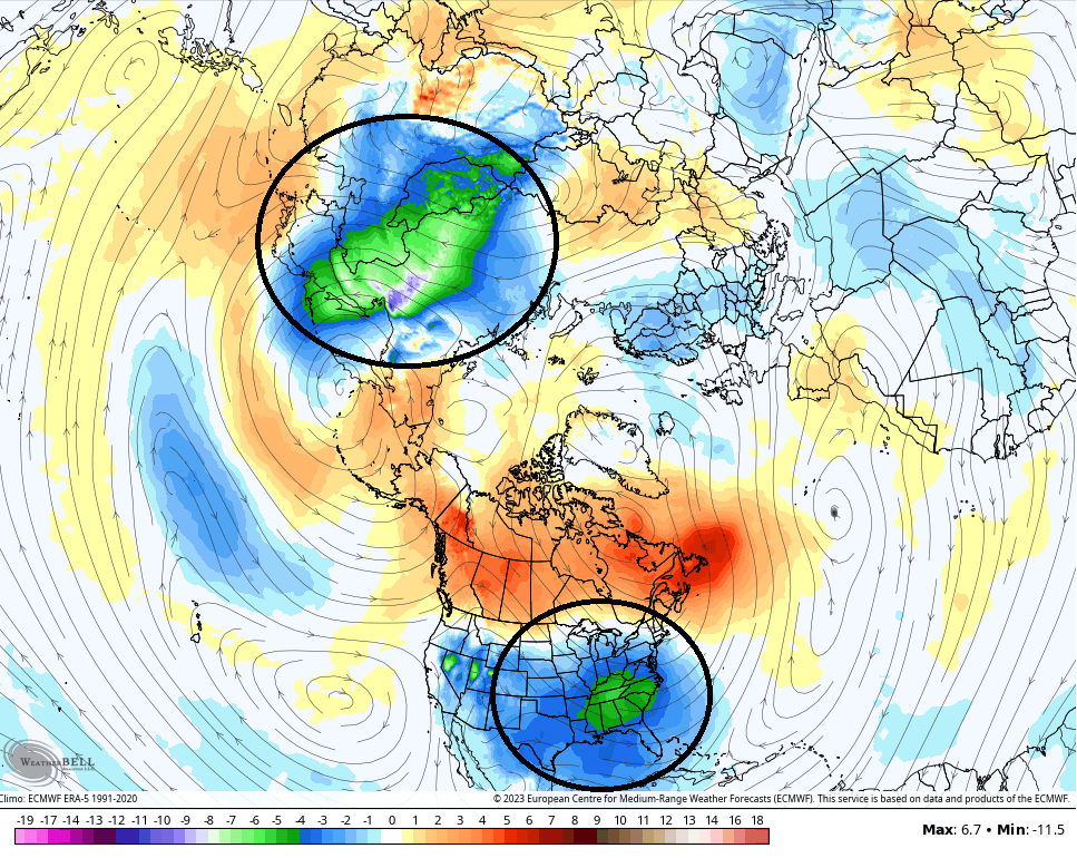
That’s a healthy winter look showing up and trying to lock in. If we take that same run and look at the northern hemisphere, you can see how the coldest air relative to normal has split into two pools across the globe, with one showing up across the US…
If we look at the Control Run of the EURO Ensembles, we see this trough looking more stout…
It should be noted that the GFS Ensembles and Canadian Ensembles aren’t as impressed, but they’re showing some pretty big run to run swings.
I will have your normal updates through the day. Until then, I have all your friendly storm tracking tools…

Current watches

Possible Watch Areas

Have a great Monday and take care.

KWC bowl central USC -2