Good evening, folks. Rounds of heavy rain producing showers and thunderstorms will continue to work in from the west and southwest tonight through Tuesday night. These rounds will bring the threat for flooding and the potential for strong to severe storms.
The greatest severe threat tonight remains across the west. That’s where the Storm Prediction Center has a Marginal to Slight Risk for many, with the Enhanced Risk into the western tip of the state…

The risk area will focus farther east on Tuesday. I think we have an early day risk before another line of strong to severe storms develops by evening. Here’s the latest from the Storm Prediction Center…

Don’t be surprised to see that get bumped up a bit with later updates.
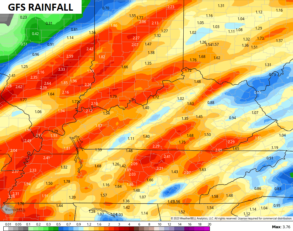
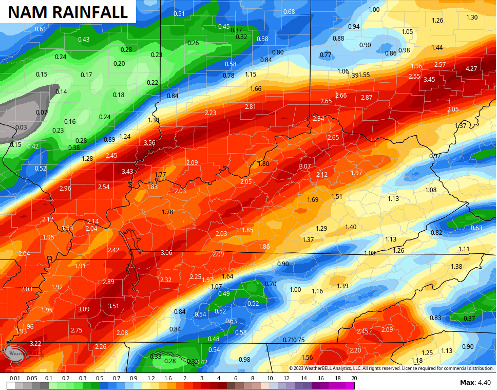
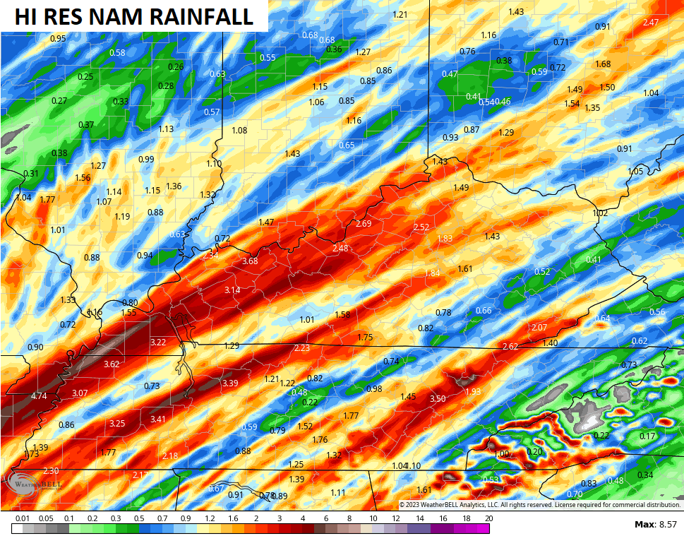
Torrential rains will likely cause flash flooding issues as storms may try to fire up over the same areas. The greatest risk is across western and central Kentucky.
The models have some hefty totals through Wednesday…
We shut the faucet off on Wednesday as a few flakes try to fly by Thursday.
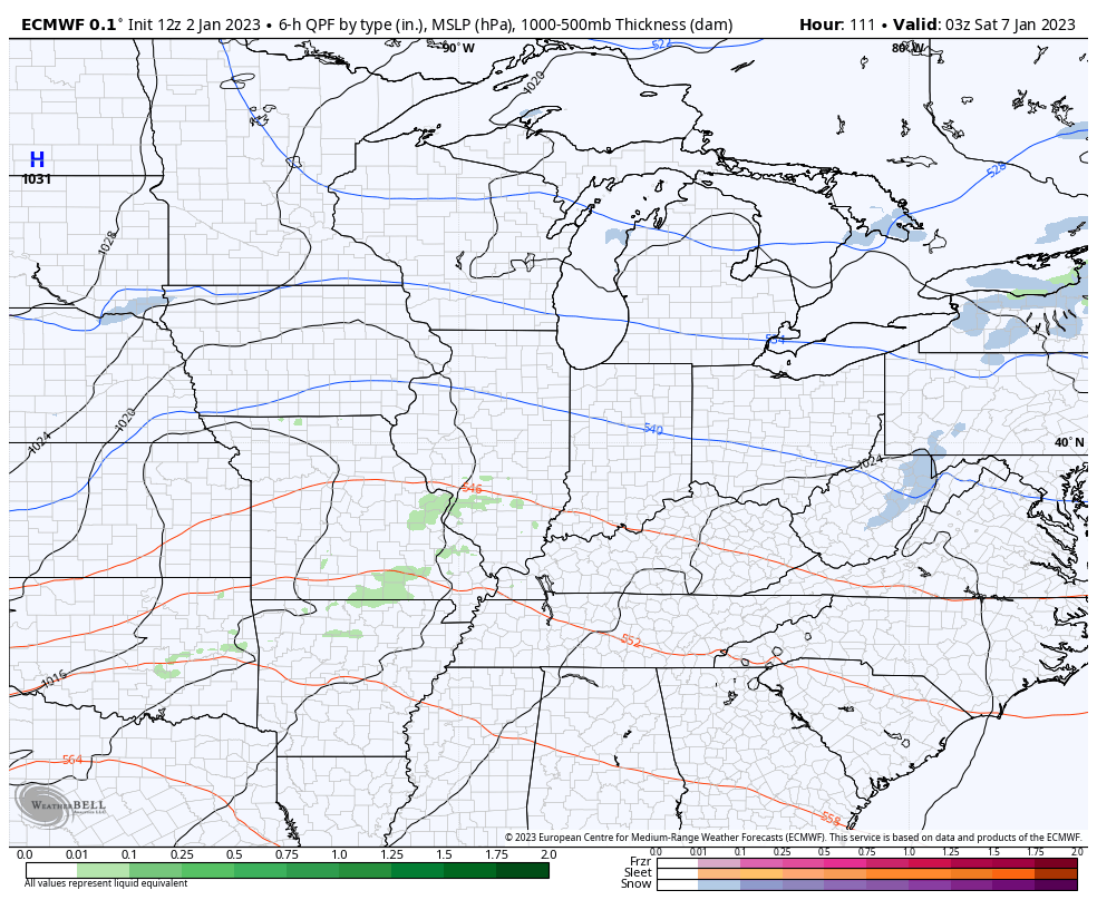
The system coming in behind this for the weekend is showing up a little stronger as we inch closer. Rain and some snow will be possible with this, but the models are still trying to figure this thing out.
Here’s how the EURO sees it…
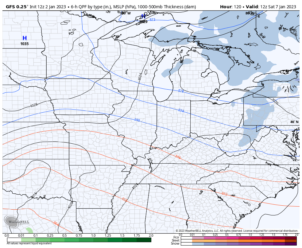
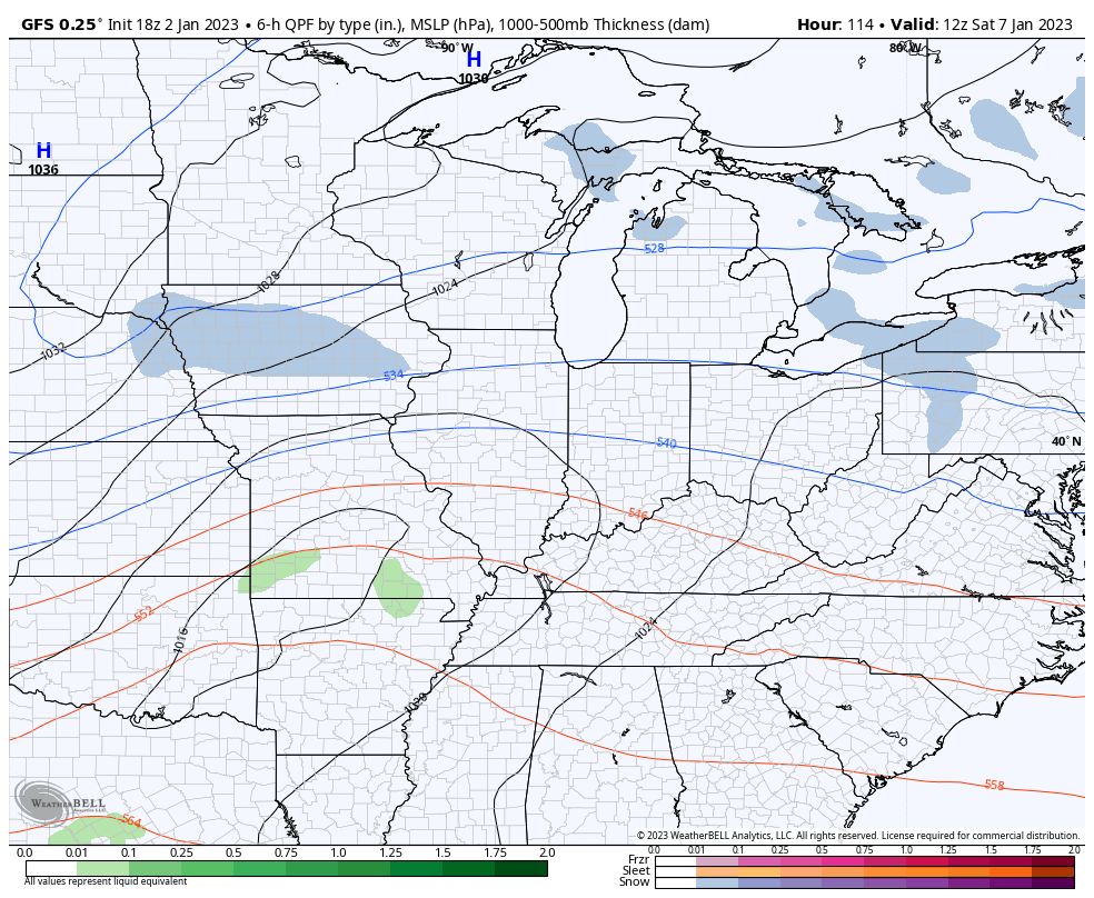
The last two runs of the GFS illustrate the consistency problems with the model…
I leave you with your storm tracking toys for the evening…

Current watches

Possible Watch Areas

Have a great evening and take care.
