Good Tuesday, folks. We continue to track rounds of strong storms and torrential rains through the Bluegrass state. This setup is likely to cause additional issues through early Wednesday before we change up the pattern a bit.
Let’s talk about what’s going on out there today:
- Showers and storms are working eastward and putting down enough rain for local high water concerns through early this afternoon.
- Some of the morning storms may be strong or locally severe.
- The front is still to our west and will likely fire up another line of strong to severe storms this evening. That would continue into the overnight hours in central and eastern Kentucky.
- Once again, damaging wind is the primary player, but a quick tornado spin up will be possible.
- That line will put down additional heavy rains, so we will also be on guard for additional high water issues.
Here’s today’s Severe Weather Outlook from the Storm Prediction Center…

Rain will slow down early Wednesday as colder air comes in from the northwest. This will bring a rain or snow shower with it on Thursday as we get ready for a bigger system to follow that by the weekend.
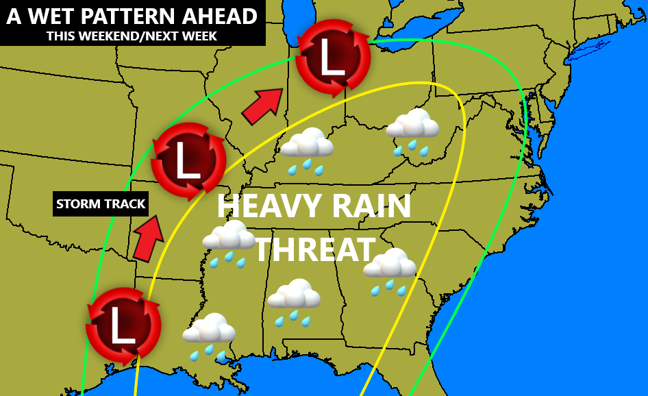
This soggy setup has been yapped about for a while on here. I made this map on Christmas…
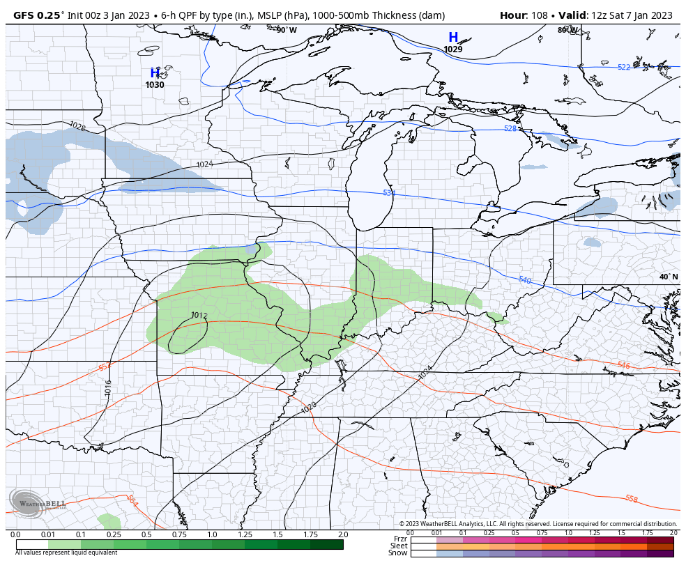
The models are still dancing around with where to put the rain and snow across the Ohio Valley over the weekend…
I will have updates later today. As always, I have you set to track today’s severe threat and heavy rain…

Current watches

Possible Watch Areas

Have a great day and take care.

A soggy week ahead. Sums it up.
Warren County remains under a Tornado Watch for the next 3 hours. We’ve picked up 1.03″ of rain over the past 24 hours, and radar indicates that there is more to come. But the western counties have been deluged, with Muhlenberg County picking up 5.1″ over the past 24 hours, 4.2″ of that falling since midnight!