Good afternoon, folks. Flooding rains and strong storms are slowly winding down out there this afternoon with only one more line to go through tonight. Beyond this, we find a more typical looking January pattern taking shape with another storm system blowing in for the weekend.
Let’s talk about the current system before we get to that.
Storms lined up from southwest to northeast across the state last night and this morning, putting down a tremendous amount of rain. Flash flooding has been fairly extensive across areas of western and central Kentucky. That’s going to happen with rainfall numbers like these from the Kentucky Mesonet…
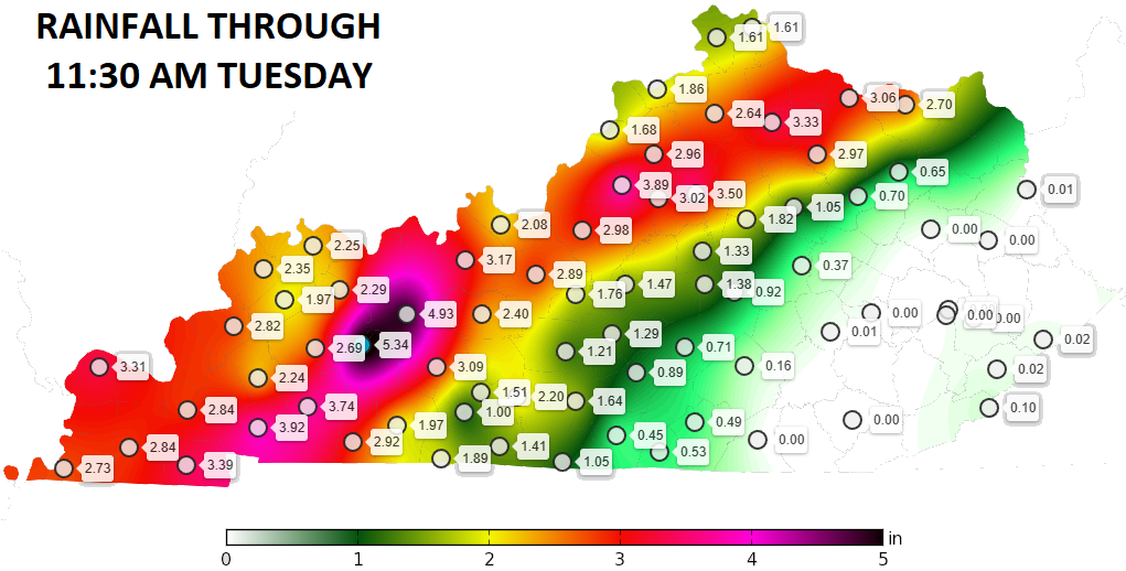
We did all of this without a Flood Watch being issued until well after the heavy rains had already settled in. This simply cannot continue to happen from our local NWS offices. It just can’t. Please change the culture, folks.
The heaviest rain this afternoon will focus on the southeast with a broken line of storms developing across the west and rolling east this evening. There’s a low end risk for a few more strong storms…

Colder air works in behind this for Thursday with some rain and snow showers possible for some.
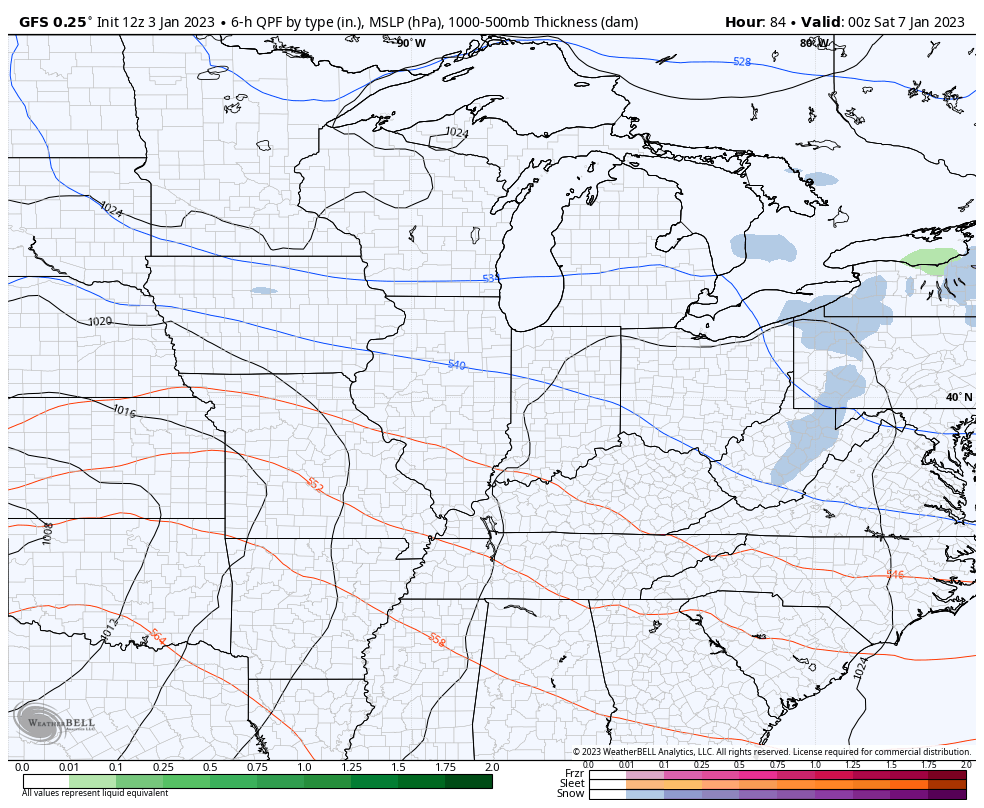
The next system for the weekend continues to show up stronger as we get closer, but the models are still trying to figure out where to put the rain and snow with this. The GFS offers a flatter solution with another system coming in behind it…
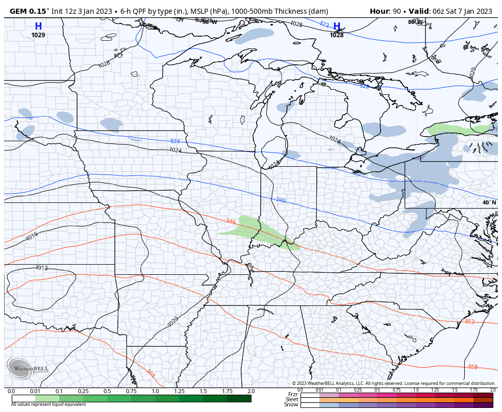
The Candian Model has a more wrapped up storm over the weekend…
I will have the latest on WKYT-TV starting at 4pm and will drop by for another update this evening. Here are your storm tracking tools to keep you company…

Current watches

Possible Watch Areas

Have a great day and take care.

david lee murphy!!! the road you leave behind.