Good Wednesday, folks. Torrential rains caused all kinds of issues across the state over the past few days and we have one more round to go through early Today. While we do get a few days to dry out, I’m watching two more systems that will likely impact our weather this weekend.
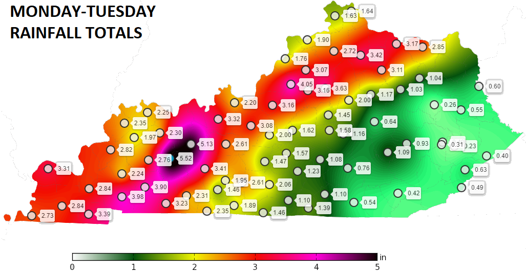
Let’s look back at one of the wettest January systems on record for Kentucky. Much of these numbers from the Kentucky Mesonet fell in a 24 hour period…
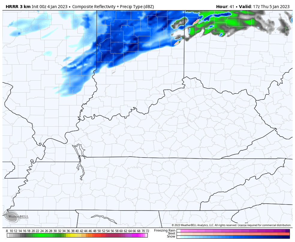
This morning’s showers and storms are likely to be farther east but can cause some local high water concerns for a time. Here are your radars to start the day…

Skies improve quickly this afternoon as our front pushes to the east. Temps begin to slide and there’s another push of colder air due in here late Thursday. That one has a chance to spin up some showers of rain and snow, especially in the north and east.
The Future Radar from the HRRR shows this developing Thursday afternoon and early evening…
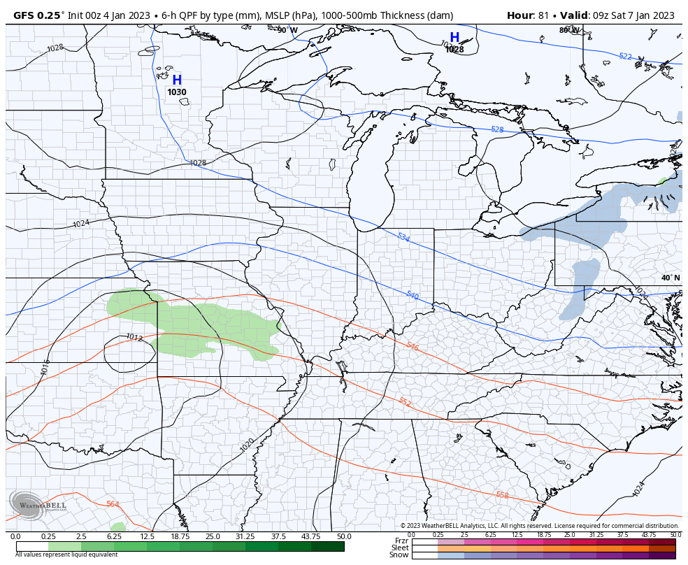
Two systems move in for the weekend, but we still have some question marks with them. The first arrives Saturday with rain and some snow. The best chance for flakes to fly will be across the north as this system moves in.
The next one tries to wrap up a little more with rain on Sunday and the chance for a wraparound flake behind it Monday morning.
Here’s how the GFS is playing this…
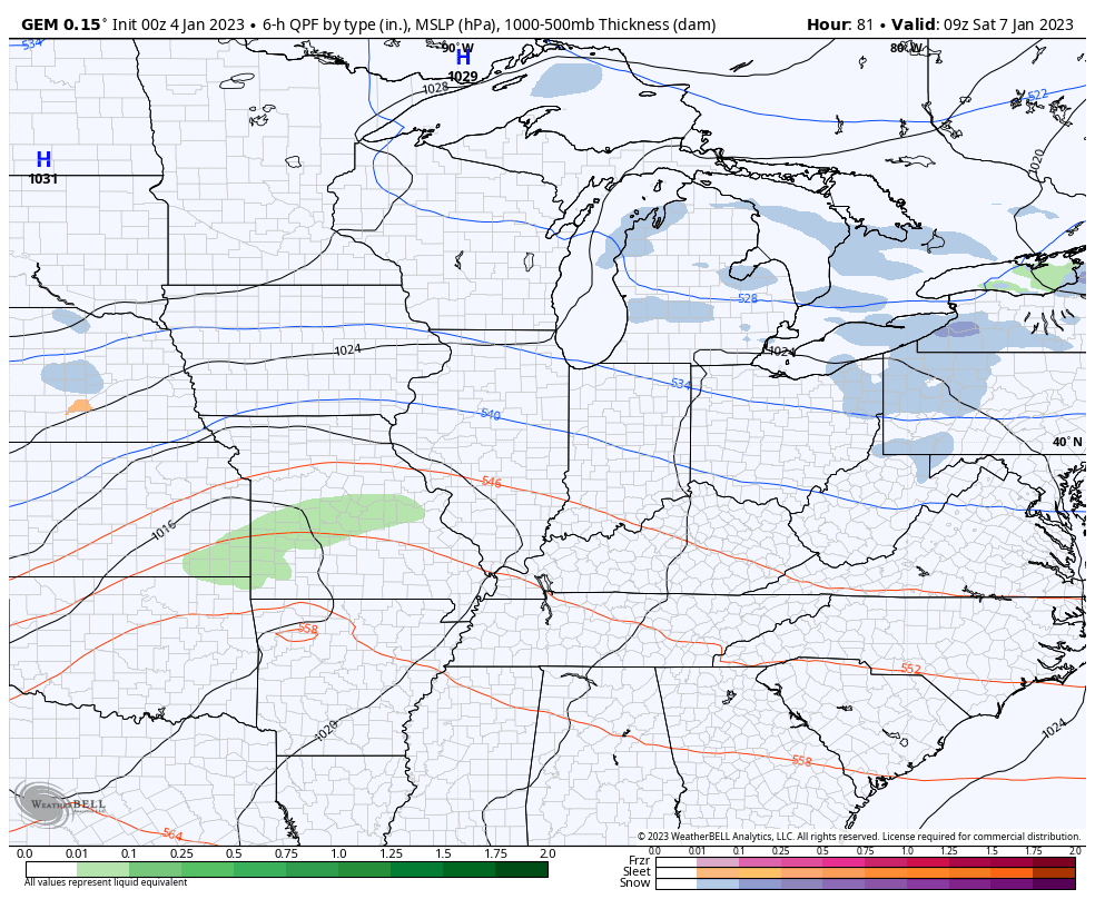
The Canadian…
As I said in my earlier post, we need winter to flex again or we are going to get ourselves into trouble. Very active patterns in warm spells during the winter months can cause more issues in our region.
I will have updates later today. Make it a good one and take care.

This site can be brutal sometimes to leave a comment.
bomb cyclone in california!!!! how high the water momma by cash.